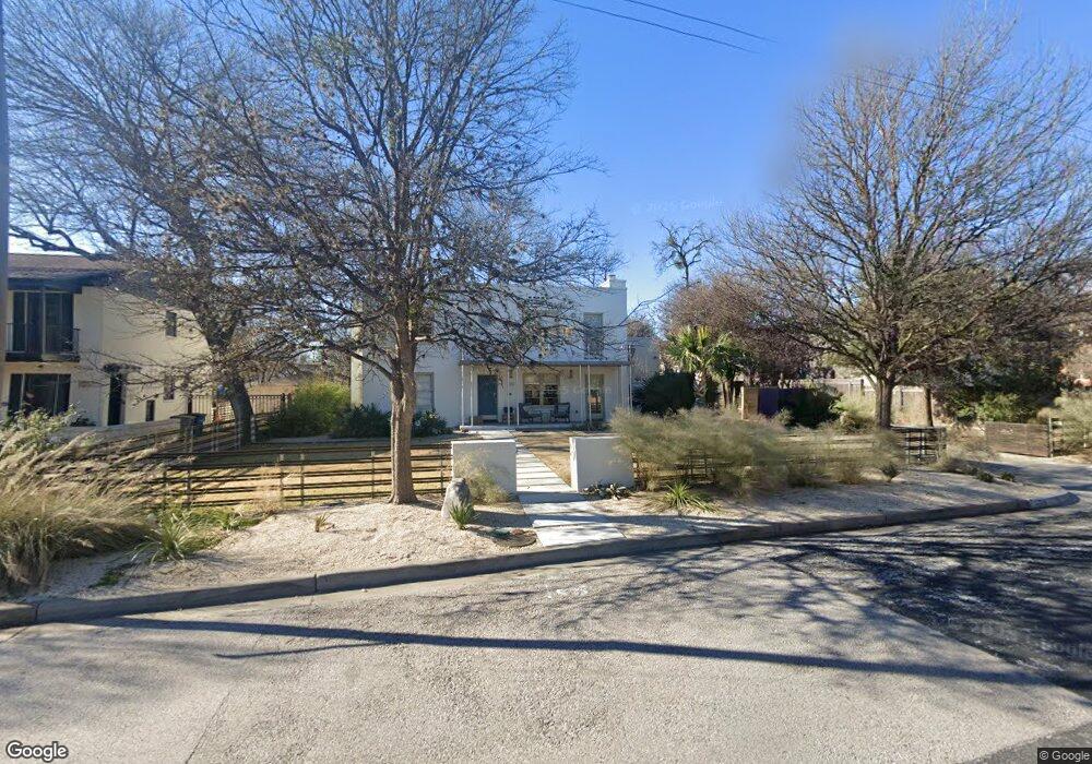
1206 Lorrain St Unit A Austin, TX 78703
Clarksville NeighborhoodEstimated Value: $2,224,000 - $2,962,000
2
Beds
1
Bath
1,436
Sq Ft
$1,783/Sq Ft
Est. Value
About This Home
This home is located at 1206 Lorrain St Unit A, Austin, TX 78703 and is currently estimated at $2,559,752, approximately $1,782 per square foot. 1206 Lorrain St Unit A is a home located in Travis County with nearby schools including Mathews Elementary School, Austin High School, and Headwaters School.
Ownership History
Date
Name
Owned For
Owner Type
Purchase Details
Closed on
Nov 7, 2011
Sold by
Lee Robert N and Lee Emily G
Bought by
Barnhill Ted and Barnhill Katharine
Current Estimated Value
Purchase Details
Closed on
Apr 2, 2007
Sold by
Herrera Orrantia Homero
Bought by
Lee Robert N and Lee Emily G
Home Financials for this Owner
Home Financials are based on the most recent Mortgage that was taken out on this home.
Original Mortgage
$648,750
Interest Rate
6.24%
Mortgage Type
Purchase Money Mortgage
Purchase Details
Closed on
Aug 5, 2004
Sold by
Marsh Charles A and Marsh Jennifer
Bought by
Herrera Orrantia Homero
Create a Home Valuation Report for This Property
The Home Valuation Report is an in-depth analysis detailing your home's value as well as a comparison with similar homes in the area
Home Values in the Area
Average Home Value in this Area
Purchase History
| Date | Buyer | Sale Price | Title Company |
|---|---|---|---|
| Barnhill Ted | -- | North American Title | |
| Lee Robert N | -- | North American Title | |
| Herrera Orrantia Homero | -- | Chicago Title Insurance Comp |
Source: Public Records
Mortgage History
| Date | Status | Borrower | Loan Amount |
|---|---|---|---|
| Previous Owner | Lee Robert N | $648,750 |
Source: Public Records
Tax History
| Year | Tax Paid | Tax Assessment Tax Assessment Total Assessment is a certain percentage of the fair market value that is determined by local assessors to be the total taxable value of land and additions on the property. | Land | Improvement |
|---|---|---|---|---|
| 2025 | $41,137 | $2,303,738 | $977,880 | $1,325,858 |
| 2023 | $41,414 | $2,289,022 | $0 | $0 |
| 2022 | $41,097 | $2,080,929 | $0 | $0 |
| 2021 | $41,177 | $1,891,754 | $650,000 | $1,837,956 |
| 2020 | $36,887 | $1,719,776 | $650,000 | $1,274,700 |
| 2018 | $31,467 | $1,421,303 | $812,500 | $696,500 |
| 2017 | $28,816 | $1,292,094 | $552,500 | $739,594 |
| 2016 | $29,032 | $1,301,788 | $520,000 | $867,575 |
| 2015 | $23,240 | $1,138,919 | $405,000 | $947,641 |
| 2014 | $23,240 | $1,035,381 | $450,000 | $585,381 |
Source: Public Records
Map
Nearby Homes
- 1506 W 13th St Unit 1
- 1506 W 13th St Unit 11
- 1205 Enfield Rd
- 1406 Windsor Rd Unit 305
- 1208 Enfield Rd Unit 204
- 1210 Windsor Rd Unit 216
- 1210 Windsor Rd Unit 122
- 1200 Enfield Rd Unit 205
- 1411 W 10th St
- 1603 Enfield Rd Unit 211
- 1605 W 11th St
- 1408 W 9th St Unit 801
- 1408 W 9th St Unit 301
- 1408 W 9th St Unit 504
- 1111 W 12th St Unit 102
- 1620 W 10th St
- 1003 Blanco St
- 1621 Enfield Rd Unit F
- 1503 W 9th St Unit 204
- 1509 Parkway
- 1206 Lorrain St Unit B
- 1206 Lorrain St
- 1204 Lorrain St
- 1210 Lorrain St
- 1202 Lorrain St
- 1209 Marshall Ln
- 1207 Marshall Ln
- 1404 W 12th St
- 1404 W 12th St Unit C
- 1404 W 12th St Unit D
- 1211 Marshall Ln Unit B
- 1211 Marshall Ln Unit 2D
- 1211 Marshall Ln Unit 2C
- 1211 Marshall Ln Unit 1B
- 1211 Marshall Ln Unit 1A
- 1211 Marshall Ln Unit C
- 1211 Marshall Ln Unit A
- 1205 Marshall Ln
- 1200 Lorrain St
- 1207 Lorrain St Unit 2
Your Personal Tour Guide
Ask me questions while you tour the home.