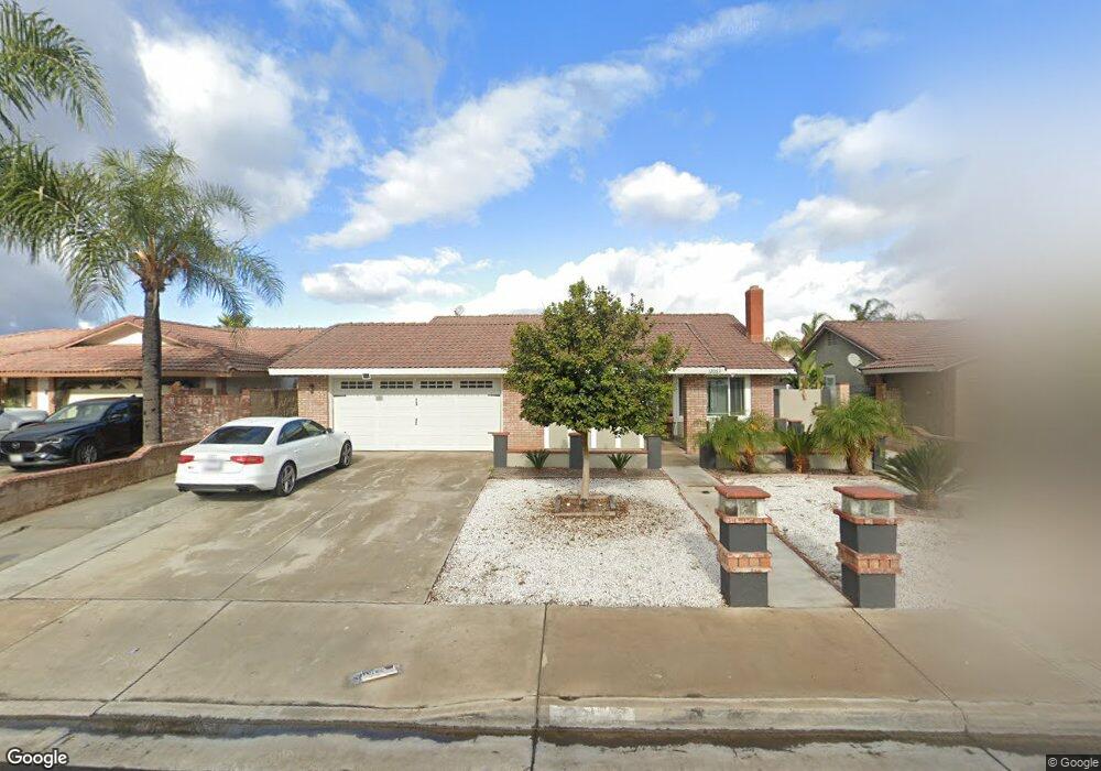
12063 Taylor St Riverside, CA 92503
La Sierra South NeighborhoodEstimated Value: $596,825 - $659,000
4
Beds
2
Baths
1,330
Sq Ft
$477/Sq Ft
Est. Value
About This Home
This home is located at 12063 Taylor St, Riverside, CA 92503 and is currently estimated at $634,456, approximately $477 per square foot. 12063 Taylor St is a home located in Riverside County with nearby schools including Phillip M. Stokoe Elementary School, Ysmael Villegas Middle School, and Hillcrest High School.
Ownership History
Date
Name
Owned For
Owner Type
Purchase Details
Closed on
Aug 17, 2001
Sold by
Guerra Josefa
Bought by
Guerra Felix
Current Estimated Value
Home Financials for this Owner
Home Financials are based on the most recent Mortgage that was taken out on this home.
Original Mortgage
$172,000
Interest Rate
7.21%
Mortgage Type
Stand Alone First
Purchase Details
Closed on
Jul 5, 2001
Sold by
Cao Henry
Bought by
Guerra Felix
Home Financials for this Owner
Home Financials are based on the most recent Mortgage that was taken out on this home.
Original Mortgage
$172,000
Interest Rate
7.21%
Mortgage Type
Stand Alone First
Purchase Details
Closed on
Sep 4, 1998
Sold by
Huynh Hung Quoc and Thai Thao Kim
Bought by
Cao Henry
Home Financials for this Owner
Home Financials are based on the most recent Mortgage that was taken out on this home.
Original Mortgage
$109,250
Interest Rate
6.79%
Create a Home Valuation Report for This Property
The Home Valuation Report is an in-depth analysis detailing your home's value as well as a comparison with similar homes in the area
Home Values in the Area
Average Home Value in this Area
Purchase History
| Date | Buyer | Sale Price | Title Company |
|---|---|---|---|
| Guerra Felix | -- | American Title Co | |
| Guerra Felix | $172,000 | American Title Co | |
| Cao Henry | $115,000 | Benefit Land Title Company |
Source: Public Records
Mortgage History
| Date | Status | Borrower | Loan Amount |
|---|---|---|---|
| Previous Owner | Guerra Felix | $172,000 | |
| Previous Owner | Cao Henry | $109,250 |
Source: Public Records
Tax History Compared to Growth
Tax History
| Year | Tax Paid | Tax Assessment Tax Assessment Total Assessment is a certain percentage of the fair market value that is determined by local assessors to be the total taxable value of land and additions on the property. | Land | Improvement |
|---|---|---|---|---|
| 2025 | $2,996 | $254,068 | $73,852 | $180,216 |
| 2023 | $2,996 | $244,204 | $70,985 | $173,219 |
| 2022 | $2,771 | $239,417 | $69,594 | $169,823 |
| 2021 | $2,733 | $234,724 | $68,230 | $166,494 |
| 2020 | $2,689 | $232,318 | $67,531 | $164,787 |
| 2019 | $2,652 | $227,763 | $66,207 | $161,556 |
| 2018 | $2,614 | $223,298 | $64,909 | $158,389 |
| 2017 | $2,565 | $218,921 | $63,637 | $155,284 |
| 2016 | $2,522 | $214,630 | $62,390 | $152,240 |
| 2015 | $2,484 | $211,407 | $61,453 | $149,954 |
| 2014 | $2,473 | $207,267 | $60,250 | $147,017 |
Source: Public Records
Map
Nearby Homes
- 3663 Buchanan St Unit 110
- 3663 Buchanan St Unit 90
- 12149 Indiana Ave Unit 18
- 12149 Indiana Ave Unit 95
- 3883 Buchanan St Unit 133
- 3883 Buchanan St Unit 3
- 11868 National Dr
- 3700 Buchanan Ave Unit 204
- 3700 Buchanan Ave Unit Spc 131
- 3700 Buchanan St Unit 108
- 3700 Buchanan St Unit 180
- 3700 Buchanan St Unit 189
- 3700 Buchanan St Unit 8
- 3700 Buchanan St Unit 164
- 3700 Buchanan St Unit 98
- 3700 Buchanan St Unit 102
- 3700 Buchanan St Unit 69
- 3700 Buchanan St Unit 121
- 3700 Buchanan St Unit 104
- 3700 Buchanan St Unit 204
- 12069 Taylor St
- 12057 Taylor St
- 12051 Taylor St
- 12075 Taylor St
- 12060 Taylor St
- 12045 Taylor St
- 12066 Taylor St
- 12054 Taylor St
- 12081 Taylor St
- 12048 Taylor St
- 12039 Taylor St
- 12098 Dressage Ln
- 12042 Taylor St
- 12092 Dressage Ln
- 12067 Dressage Ln
- 12049 Dressage Ln
- 12086 Dressage Ln
- 12033 Taylor St
- 12043 Dressage Ln
- 12036 Taylor St