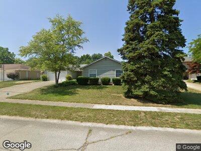
1207 N Lenfesty Ave Marion, IN 46952
Shady Hills NeighborhoodEstimated Value: $172,000 - $234,000
3
Beds
2
Baths
2,160
Sq Ft
$97/Sq Ft
Est. Value
About This Home
This home is located at 1207 N Lenfesty Ave, Marion, IN 46952 and is currently estimated at $208,516, approximately $96 per square foot. 1207 N Lenfesty Ave is a home located in Grant County with nearby schools including John W. Kendall Elementary School, Justice Thurgood Marshall Intermediate School, and John L. McCulloch Junior High School.
Ownership History
Date
Name
Owned For
Owner Type
Purchase Details
Closed on
Jun 20, 2020
Sold by
Wolf Norman F and Wolf Dorothy J
Bought by
Littlefield Barbara L and Wolf Michael J
Current Estimated Value
Purchase Details
Closed on
Mar 28, 2000
Sold by
Not Provided
Bought by
Not Provided
Purchase Details
Closed on
Dec 7, 1998
Sold by
Not Provided
Bought by
Not Provided
Create a Home Valuation Report for This Property
The Home Valuation Report is an in-depth analysis detailing your home's value as well as a comparison with similar homes in the area
Home Values in the Area
Average Home Value in this Area
Purchase History
| Date | Buyer | Sale Price | Title Company |
|---|---|---|---|
| Littlefield Barbara L | -- | None Available | |
| Not Provided | $112,000 | -- | |
| Not Provided | $105,000 | -- |
Source: Public Records
Mortgage History
| Date | Status | Borrower | Loan Amount |
|---|---|---|---|
| Open | Wolf Norman F | $37,847 | |
| Previous Owner | Wolf Norman | $94,000 | |
| Previous Owner | Wolf Norman F | $101,500 | |
| Previous Owner | Wolf Norman F | $119,200 | |
| Previous Owner | Wolf Norman F | $134,100 |
Source: Public Records
Tax History Compared to Growth
Tax History
| Year | Tax Paid | Tax Assessment Tax Assessment Total Assessment is a certain percentage of the fair market value that is determined by local assessors to be the total taxable value of land and additions on the property. | Land | Improvement |
|---|---|---|---|---|
| 2024 | $913 | $192,700 | $21,400 | $171,300 |
| 2023 | $895 | $171,300 | $21,400 | $149,900 |
| 2022 | $877 | $148,500 | $18,600 | $129,900 |
| 2021 | $860 | $125,800 | $18,600 | $107,200 |
| 2020 | $797 | $122,600 | $18,600 | $104,000 |
| 2019 | $827 | $120,600 | $18,600 | $102,000 |
| 2018 | $820 | $118,700 | $18,600 | $100,100 |
| 2017 | $805 | $122,200 | $18,600 | $103,600 |
| 2016 | $779 | $118,700 | $18,600 | $100,100 |
| 2014 | $1,106 | $120,900 | $18,600 | $102,300 |
| 2013 | $1,106 | $120,600 | $18,600 | $102,000 |
Source: Public Records
Map
Nearby Homes
- 2010 W Wilno Dr
- 1509 Hawksview Dr
- 0 W Kem Rd Unit 202512289
- 1525 N Miller Ave
- 1834 W Kem Rd
- 2376 W Kem Rd
- 2311 American Dr
- 1725 W Saxon Dr
- 807 N Knight Cir
- 805 N Knight Cir
- 1425 Fox Trail Unit 46
- 1400 Fox Trail Unit 33
- 2612 W Ticonderoga Dr
- 1419 Fox Trail Unit 43
- 727 N Lancelot Dr
- 1431 Fox Trail Unit 49
- 1402 Fox Trail Unit 32
- 1428 Fox Trail Unit 17
- 1404 Fox Trail Unit 31
- 1417 Fox Trail Unit 42
- 1207 N Lenfesty Ave
- 1209 N Lenfesty Ave
- 1205 N Lenfesty Ave
- 1203 N Lenfesty Ave
- 2007 W Wilno Dr
- 1204 N Lenfesty Ave
- 2008 W Wilno Dr
- 2104 Morrow Rd
- 1202 N Lenfesty Ave
- 2005 W Wilno Dr
- 2106 Morrow Rd
- 2026 Morrow Rd
- 2006 W Wilno Dr
- 2123 W Woodview Dr
- 2129 W Woodview Dr
- 2024 Morrow Rd
- 2131 W Woodview Dr
- 2003 W Wilno Dr
- 2116 Morrow Rd
- 2004 W Wilno Dr