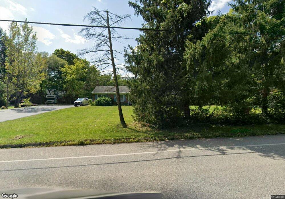
1208 Cowpath Rd Hatfield, PA 19440
Estimated Value: $443,000 - $570,000
4
Beds
2
Baths
1,832
Sq Ft
$282/Sq Ft
Est. Value
About This Home
This home is located at 1208 Cowpath Rd, Hatfield, PA 19440 and is currently estimated at $515,908, approximately $281 per square foot. 1208 Cowpath Rd is a home located in Montgomery County with nearby schools including Oak Park El School, Pennfield Middle School, and North Penn Senior High School.
Ownership History
Date
Name
Owned For
Owner Type
Purchase Details
Closed on
Nov 28, 2005
Sold by
Steinmetz Paul P and Steinmetz Joan A
Bought by
Scatton Sandra L
Current Estimated Value
Home Financials for this Owner
Home Financials are based on the most recent Mortgage that was taken out on this home.
Original Mortgage
$214,800
Outstanding Balance
$119,324
Interest Rate
6.17%
Estimated Equity
$396,584
Create a Home Valuation Report for This Property
The Home Valuation Report is an in-depth analysis detailing your home's value as well as a comparison with similar homes in the area
Home Values in the Area
Average Home Value in this Area
Purchase History
| Date | Buyer | Sale Price | Title Company |
|---|---|---|---|
| Scatton Sandra L | $268,500 | -- |
Source: Public Records
Mortgage History
| Date | Status | Borrower | Loan Amount |
|---|---|---|---|
| Open | Scatton Sandra L | $214,800 |
Source: Public Records
Tax History Compared to Growth
Tax History
| Year | Tax Paid | Tax Assessment Tax Assessment Total Assessment is a certain percentage of the fair market value that is determined by local assessors to be the total taxable value of land and additions on the property. | Land | Improvement |
|---|---|---|---|---|
| 2025 | $7,272 | $181,620 | $63,040 | $118,580 |
| 2024 | $7,272 | $181,620 | $63,040 | $118,580 |
| 2023 | $6,960 | $181,620 | $63,040 | $118,580 |
| 2022 | $6,733 | $181,620 | $63,040 | $118,580 |
| 2021 | $6,541 | $181,620 | $63,040 | $118,580 |
| 2020 | $6,387 | $181,620 | $63,040 | $118,580 |
| 2019 | $6,280 | $181,620 | $63,040 | $118,580 |
| 2018 | $6,280 | $181,620 | $63,040 | $118,580 |
| 2017 | $6,041 | $181,620 | $63,040 | $118,580 |
| 2016 | $5,969 | $181,620 | $63,040 | $118,580 |
| 2015 | $5,730 | $181,620 | $63,040 | $118,580 |
| 2014 | $5,730 | $181,620 | $63,040 | $118,580 |
Source: Public Records
Map
Nearby Homes
- 1206 Cowpath Rd
- 1230 Cowpath Rd
- 1186 Cowpath Rd
- 1240 Cowpath Rd
- 1229 Cowpath Rd
- 1888 Cindy Ln
- 1301 Cowpath Rd
- 1880 Cindy Ln
- 1219 Cowpath Rd
- 1307 Cowpath Rd
- 1306 Cowpath Rd
- 1872 Cindy Ln
- 1225 Cowpath Rd
- 1887 Cindy Ln
- 1269 Cowpath Rd
- 1879 Cindy Ln
- 1221 Cowpath Rd
- 1864 Cindy Ln
- 1871 Cindy Ln
- 1106 Cowpath Rd