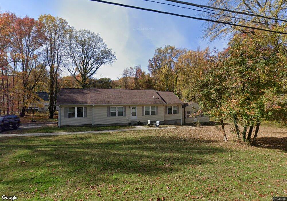
1208 Jones Station Rd Arnold, MD 21012
Estimated Value: $549,000 - $718,000
--
Bed
2
Baths
2,314
Sq Ft
$278/Sq Ft
Est. Value
About This Home
This home is located at 1208 Jones Station Rd, Arnold, MD 21012 and is currently estimated at $642,347, approximately $277 per square foot. 1208 Jones Station Rd is a home located in Anne Arundel County with nearby schools including Arnold Elementary School, Severn River Middle School, and Broadneck High School.
Ownership History
Date
Name
Owned For
Owner Type
Purchase Details
Closed on
Jun 24, 2019
Sold by
Turner Rodel R and The Estate Of Beatriss W Turne
Bought by
A & T Builders Inc
Current Estimated Value
Purchase Details
Closed on
Apr 20, 2015
Sold by
Turner Ralph L
Bought by
Turner Ralph L and Williams Lauryn
Purchase Details
Closed on
Feb 26, 2003
Sold by
Bailey Beatrice
Bought by
Turner Ralph L
Create a Home Valuation Report for This Property
The Home Valuation Report is an in-depth analysis detailing your home's value as well as a comparison with similar homes in the area
Home Values in the Area
Average Home Value in this Area
Purchase History
| Date | Buyer | Sale Price | Title Company |
|---|---|---|---|
| A & T Builders Inc | $135,000 | Northco Title Corporation | |
| Turner Ralph L | -- | None Available | |
| Turner Ralph L | -- | -- |
Source: Public Records
Tax History Compared to Growth
Tax History
| Year | Tax Paid | Tax Assessment Tax Assessment Total Assessment is a certain percentage of the fair market value that is determined by local assessors to be the total taxable value of land and additions on the property. | Land | Improvement |
|---|---|---|---|---|
| 2025 | $5,834 | $548,167 | -- | -- |
| 2024 | $5,834 | $516,700 | $270,000 | $246,700 |
| 2023 | $5,708 | $513,367 | $0 | $0 |
| 2022 | $5,363 | $510,033 | $0 | $0 |
| 2021 | $10,572 | $506,700 | $260,000 | $246,700 |
| 2020 | $5,136 | $482,100 | $0 | $0 |
| 2019 | $5,029 | $457,500 | $0 | $0 |
| 2018 | $4,390 | $432,900 | $210,000 | $222,900 |
| 2017 | $1,010 | $432,900 | $0 | $0 |
| 2016 | -- | $432,900 | $0 | $0 |
| 2015 | -- | $504,900 | $0 | $0 |
| 2014 | -- | $475,333 | $0 | $0 |
Source: Public Records
Map
Nearby Homes
- 1217 Springwood Ct
- 33 Sheridan Rd
- 1231 Summerwood Ct
- 150 Merrimack Way
- 1256 Crowell Ct
- 1224 Hickory Hill Cir
- 1249 Birchcrest Ct
- Severn Plan at Ford's Grant
- Magothy Plan at Ford's Grant
- Newport Plan at Ford's Grant
- 00 Mazie
- 0000 Mazie
- 340 Candle Ridge Dr
- 360 Jones Station Rd
- 000 Mazie Way
- 400 Colonial Ridge Ln
- 1433 Gilbert Rd
- 1426 Silver Oak Ln
- 349 Candle Ridge Ct
- 550 Greenhill Ct
- 1202 Jones Station Rd
- 246 Woodard Rd
- 1209 Jones Station Rd
- 245 Woodard Rd
- 1205 Jones Station Rd
- 1213 Jones Station Rd
- 247 Woodard Rd
- 461 College Pkwy
- 459 College Pkwy
- 1201 Grey Stone Terrace
- 1217 Jones Station Rd
- 285 Locust Ridge Ln
- 250 Woodard Rd
- 1218 Jones Station Rd
- 350 Kimwood Rd
- 1203 Grey Stone Terrace
- 287 Locust Ridge Ln
- 251 Woodard Rd
- 1228 Jones Station Rd
- 283 Locust Ridge Ln