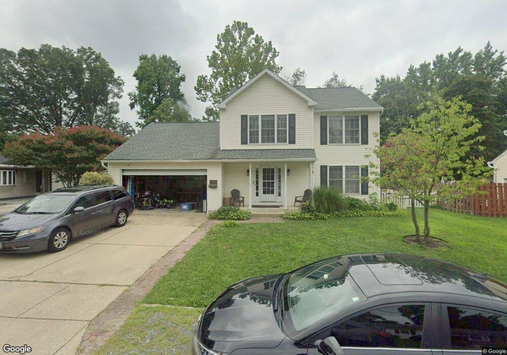
1209 Brietwert Ave Odenton, MD 21113
Estimated Value: $583,253
3
Beds
3
Baths
1,752
Sq Ft
$333/Sq Ft
Est. Value
About This Home
This home is located at 1209 Brietwert Ave, Odenton, MD 21113 and is currently estimated at $583,253, approximately $332 per square foot. 1209 Brietwert Ave is a home located in Anne Arundel County with nearby schools including Odenton Elementary School, Arundel Middle School, and Arundel High School.
Ownership History
Date
Name
Owned For
Owner Type
Purchase Details
Closed on
Nov 27, 2017
Sold by
Madison Stephen D and Madison Frances L
Bought by
Cook Colin Richard and Cook Amanda Katherine Folan
Current Estimated Value
Home Financials for this Owner
Home Financials are based on the most recent Mortgage that was taken out on this home.
Original Mortgage
$320,000
Outstanding Balance
$269,133
Interest Rate
3.9%
Mortgage Type
New Conventional
Estimated Equity
$314,120
Purchase Details
Closed on
Oct 31, 2000
Sold by
Ameri & Star Homes Inc
Bought by
Madison Stephen D and Madison Frances L
Create a Home Valuation Report for This Property
The Home Valuation Report is an in-depth analysis detailing your home's value as well as a comparison with similar homes in the area
Home Values in the Area
Average Home Value in this Area
Purchase History
| Date | Buyer | Sale Price | Title Company |
|---|---|---|---|
| Cook Colin Richard | $400,000 | None Available | |
| Madison Stephen D | $181,000 | -- |
Source: Public Records
Mortgage History
| Date | Status | Borrower | Loan Amount |
|---|---|---|---|
| Open | Cook Colin Richard | $320,000 |
Source: Public Records
Tax History Compared to Growth
Tax History
| Year | Tax Paid | Tax Assessment Tax Assessment Total Assessment is a certain percentage of the fair market value that is determined by local assessors to be the total taxable value of land and additions on the property. | Land | Improvement |
|---|---|---|---|---|
| 2025 | $4,009 | $373,800 | $165,100 | $208,700 |
| 2024 | $4,009 | $350,267 | $0 | $0 |
| 2023 | $3,884 | $326,733 | $0 | $0 |
| 2022 | $3,611 | $303,200 | $165,100 | $138,100 |
| 2021 | $7,222 | $303,200 | $165,100 | $138,100 |
| 2020 | $3,572 | $303,200 | $165,100 | $138,100 |
| 2019 | $3,529 | $315,200 | $177,100 | $138,100 |
| 2018 | $2,952 | $291,167 | $0 | $0 |
| 2017 | $3,102 | $267,133 | $0 | $0 |
| 2016 | -- | $243,100 | $0 | $0 |
| 2015 | -- | $243,100 | $0 | $0 |
| 2014 | -- | $243,100 | $0 | $0 |
Source: Public Records
Map
Nearby Homes
- 1230 Breitwert Ave
- 1250 Breitwert Ave
- 654 Lions Gate Ln
- 606 Moonglow Rd
- 602 Moonglow Rd Unit 202
- 602 Moonglow Rd Unit 304
- 546 Greencrest Ln
- 508 Greencrest Ln
- 488 Bruce Ave
- 604 Rolling Hill Walk Unit 103
- 608 Rolling Hill Walk Unit 304
- 363 Baltimore Ave
- 357 Council Oak Dr
- 328 Council Oak Dr
- 1536 Winfields Ln
- 200 Mccamish Ct
- 208 Branchard Ct
- 521 Realm Ct E Unit 11-68
- 1552 Ringe Dr
- 506 Imperial Square
- 1211 Brietwert Ave
- 1211 Breitwert Ave
- 1207 Brietwert Ave
- 1222 Graycliff Ln
- 1218 Graycliff Ln
- 1216 Graycliff Ln
- 1224 Graycliff Ln
- 1214 Graycliff Ln
- 1205 Breitwert Ave
- 1213 Brietwert Ave
- 1205 Brietwert Ave
- 1212 Graycliff Ln
- 1210 Graycliff Ln
- 1204 Breitwert Ave
- 1204 Breitwert Ave
- 1208 Graycliff Ln
- 1206 Brietwert Ave
- 1210 Brietwert Ave
- 1206 Graycliff Ln
- 1203 Breitwert Ave