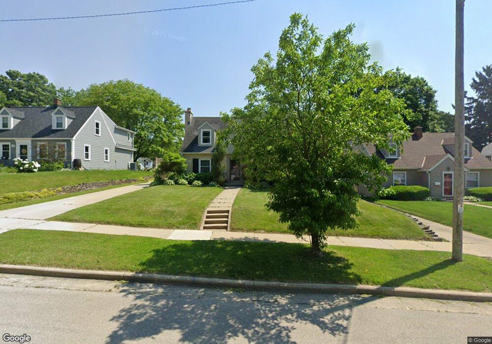
1209 Grant St Waukesha, WI 53186
Estimated Value: $343,000 - $414,357
3
Beds
1
Bath
1,789
Sq Ft
$217/Sq Ft
Est. Value
About This Home
This home is located at 1209 Grant St, Waukesha, WI 53186 and is currently estimated at $388,339, approximately $217 per square foot. 1209 Grant St is a home located in Waukesha County with nearby schools including Hadfield Elementary School, Horning Middle School, and South High School.
Ownership History
Date
Name
Owned For
Owner Type
Purchase Details
Closed on
Jun 6, 2019
Sold by
Langrbck James A
Bought by
Trujillo Katie M and Trujillo Miguel A
Current Estimated Value
Purchase Details
Closed on
Apr 11, 2019
Sold by
Abrahamson Survivors Trust
Bought by
Langreck James A
Purchase Details
Closed on
Oct 1, 2017
Sold by
Abrahamson E Ronald
Bought by
Abrahmson E Ronald and The Of Abrahmson Surivor Revocable Trust
Purchase Details
Closed on
Aug 12, 2003
Sold by
Abrahamson E Ronald and Abrahamson Nancy S
Bought by
E Ronald & Nancy S Abrahamson Revocable
Create a Home Valuation Report for This Property
The Home Valuation Report is an in-depth analysis detailing your home's value as well as a comparison with similar homes in the area
Home Values in the Area
Average Home Value in this Area
Purchase History
| Date | Buyer | Sale Price | Title Company |
|---|---|---|---|
| Trujillo Katie M | $230,000 | None Available | |
| Langreck James A | $230,000 | None Available | |
| Abrahmson E Ronald | -- | None Available | |
| E Ronald & Nancy S Abrahamson Revocable | -- | -- |
Source: Public Records
Tax History Compared to Growth
Tax History
| Year | Tax Paid | Tax Assessment Tax Assessment Total Assessment is a certain percentage of the fair market value that is determined by local assessors to be the total taxable value of land and additions on the property. | Land | Improvement |
|---|---|---|---|---|
| 2024 | $5,691 | $381,600 | $102,500 | $279,100 |
| 2023 | $5,539 | $381,600 | $102,500 | $279,100 |
| 2022 | $4,398 | $230,000 | $62,200 | $167,800 |
| 2021 | $4,501 | $230,000 | $62,200 | $167,800 |
| 2020 | $4,351 | $230,000 | $62,200 | $167,800 |
| 2019 | $4,214 | $230,000 | $62,200 | $167,800 |
| 2018 | $3,833 | $205,400 | $58,800 | $146,600 |
| 2017 | $4,296 | $205,400 | $58,800 | $146,600 |
| 2016 | $3,809 | $192,000 | $58,800 | $133,200 |
| 2015 | $3,787 | $192,000 | $58,800 | $133,200 |
| 2014 | $3,869 | $188,200 | $58,800 | $129,400 |
| 2013 | $3,869 | $188,200 | $58,700 | $129,500 |
Source: Public Records
Map
Nearby Homes
- 125 Tenny Ave
- W230S2425 Morningside Dr
- 1037 Windsor Dr
- 1343 Hillside Dr
- 1422 E Racine Ave
- S21W23079 Hillside Dr
- 403 Midland Ave
- 1535 E Racine Ave
- 715 Cavalier Dr
- 400 Sheffield Rd Unit 5
- 917 E Roberta Ave
- 1164 Downing Dr
- 1103 Arcadian Ave
- 1021 Arcadian Ave
- 309 Stonebrook Dr
- 930 Harding Ave
- 953 Genesee St
- 131 Wisconsin Ave
- 1219 National Ave
- 137 Wisconsin Ave
- 1213 Grant St
- 1205 Grant St
- 1203 Grant St
- 1212 Grant St
- 1208 Grant St
- 1202 Grant St
- 1225 Grant St
- 57 Columbia Ave
- 65 Columbia Ave
- 61 Columbia Ave
- 69 Columbia Ave
- 1108 Grant St
- 53 Columbia Ave
- 1100 Grant St
- 136 S Porter Ave
- 140 S Porter Ave
- 135 S Porter Ave
- 150 S Porter Ave
- 160 S Porter Ave
- 125 S Porter Ave