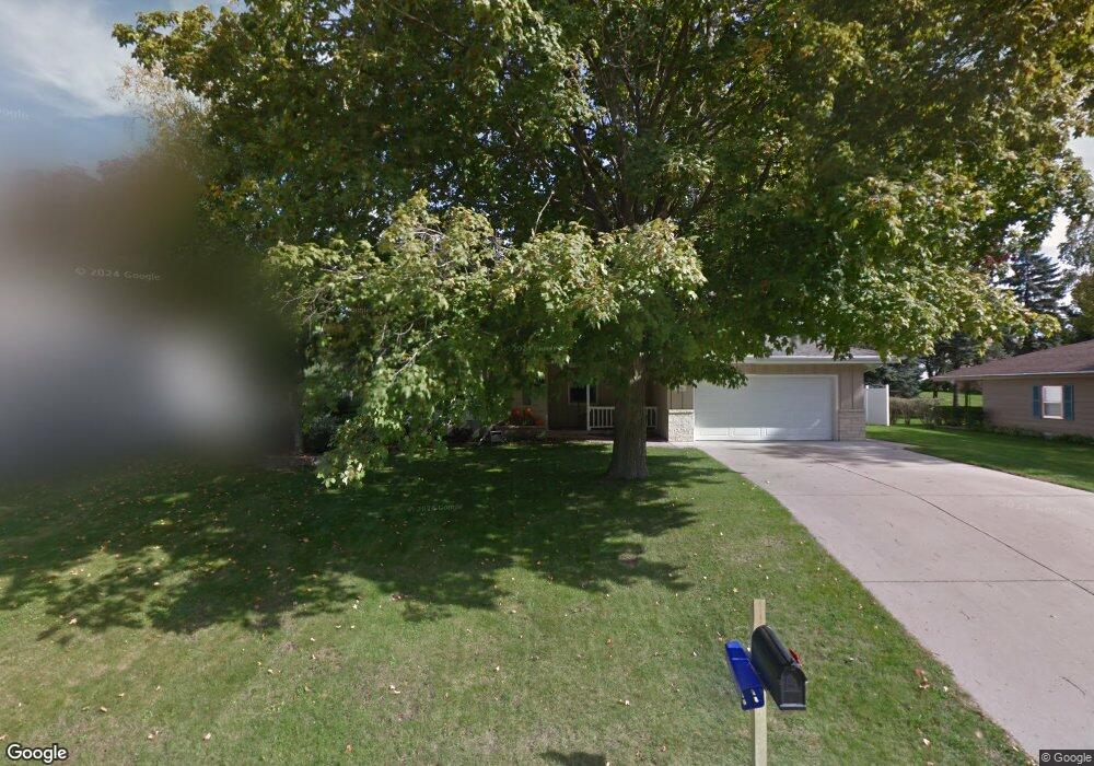
1209 Homestead Rd Beaver Dam, WI 53916
Estimated Value: $344,447 - $443,000
--
Bed
--
Bath
--
Sq Ft
0.3
Acres
About This Home
This home is located at 1209 Homestead Rd, Beaver Dam, WI 53916 and is currently estimated at $391,112. 1209 Homestead Rd is a home located in Dodge County with nearby schools including Beaver Dam High School, St. Katharine Drexel School, and St. Stephen's Lutheran School.
Ownership History
Date
Name
Owned For
Owner Type
Purchase Details
Closed on
Aug 1, 2019
Sold by
Sitter Thomas J
Bought by
Dehn Colin J and Dehn Brook R
Current Estimated Value
Home Financials for this Owner
Home Financials are based on the most recent Mortgage that was taken out on this home.
Original Mortgage
$222,323
Outstanding Balance
$197,421
Interest Rate
4.4%
Mortgage Type
FHA
Estimated Equity
$193,691
Purchase Details
Closed on
Aug 1, 2015
Sold by
Sizer Scott A and Sizer Daine S
Bought by
Sitter Thomas J
Home Financials for this Owner
Home Financials are based on the most recent Mortgage that was taken out on this home.
Original Mortgage
$178,500
Interest Rate
4.01%
Mortgage Type
New Conventional
Create a Home Valuation Report for This Property
The Home Valuation Report is an in-depth analysis detailing your home's value as well as a comparison with similar homes in the area
Home Values in the Area
Average Home Value in this Area
Purchase History
| Date | Buyer | Sale Price | Title Company |
|---|---|---|---|
| Dehn Colin J | $230,000 | None Available | |
| Sitter Thomas J | $188,100 | None Available |
Source: Public Records
Mortgage History
| Date | Status | Borrower | Loan Amount |
|---|---|---|---|
| Open | Dehn Colin J | $222,323 | |
| Previous Owner | Sitter Thomas J | $178,500 |
Source: Public Records
Tax History Compared to Growth
Tax History
| Year | Tax Paid | Tax Assessment Tax Assessment Total Assessment is a certain percentage of the fair market value that is determined by local assessors to be the total taxable value of land and additions on the property. | Land | Improvement |
|---|---|---|---|---|
| 2024 | $5,768 | $345,200 | $57,600 | $287,600 |
| 2023 | $5,985 | $317,500 | $29,900 | $287,600 |
| 2022 | $6,216 | $284,200 | $29,900 | $254,300 |
| 2021 | $5,227 | $247,700 | $29,900 | $217,800 |
| 2020 | $5,160 | $230,000 | $29,900 | $200,100 |
| 2019 | $4,876 | $219,000 | $29,900 | $189,100 |
| 2018 | $4,731 | $206,400 | $29,900 | $176,500 |
| 2017 | $4,733 | $197,900 | $29,900 | $168,000 |
| 2016 | $4,142 | $188,100 | $29,900 | $158,200 |
| 2015 | $3,303 | $148,100 | $29,900 | $118,200 |
| 2014 | $3,336 | $139,200 | $29,900 | $109,300 |
Source: Public Records
Map
Nearby Homes
- 1117 W Circle Dr
- 1234 W Circle Dr
- 1120 Lake Shore Dr
- 718 Mac Arthur Dr
- 509 Grove St
- 701 N Center St
- 300 Declark St
- 106 W Burnett St
- 208 W 3rd St
- 600 Monarch Ln Unit 101
- 216 Lakeview Ln
- 218 Lakeview Ln
- 208 Mary St
- 206 Lakeview Ln
- 204 Lakeview Ln
- 325 W Maple Ave
- 206 West St
- 305 N Lincoln Ave
- 1518 N Spring St
- 144 Wisconsin St
- 1205 Homestead Rd
- 1215 Homestead Rd
- 1208 Hiawatha Dr
- 1204 Hiawatha Dr
- 1214 Hiawatha Dr
- 1201 Homestead Rd
- 1219 Homestead Rd
- 1200 Hiawatha Dr
- 1208 Homestead Rd
- 1204 Homestead Rd
- 1214 Homestead Rd
- 1129 Homestead Rd
- 1220 Hiawatha Dr
- 1200 Homestead Rd
- 1223 Homestead Rd
- 1118 Hiawatha Dr
- 1128 Homestead Rd
- 1211 Hiawatha Dr
- 1207 Hiawatha Dr
- 1221 Lake Shore Dr