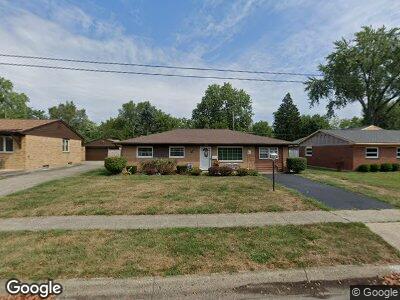
1209 Norman Dr Columbus, OH 43227
Shady Lane NeighborhoodEstimated Value: $203,127 - $243,000
4
Beds
2
Baths
1,410
Sq Ft
$159/Sq Ft
Est. Value
About This Home
This home is located at 1209 Norman Dr, Columbus, OH 43227 and is currently estimated at $224,532, approximately $159 per square foot. 1209 Norman Dr is a home located in Franklin County with nearby schools including Shady Lane Elementary School, Sherwood Middle School, and Walnut Ridge High School.
Ownership History
Date
Name
Owned For
Owner Type
Purchase Details
Closed on
Apr 6, 2023
Sold by
Nuzzo Patricia A
Bought by
Clark Shannon and Clark Peter J
Current Estimated Value
Home Financials for this Owner
Home Financials are based on the most recent Mortgage that was taken out on this home.
Original Mortgage
$100,000
Interest Rate
6.6%
Mortgage Type
Credit Line Revolving
Purchase Details
Closed on
Oct 7, 2016
Sold by
Nuzzo Patricia A and Nuzzo Lewis E
Bought by
Nuzzo Patricia A
Purchase Details
Closed on
Jan 21, 2000
Sold by
Nuzzo Lewis E
Bought by
Nuzzo Lewis E and Nuzzo Patricia A
Purchase Details
Closed on
Aug 25, 1998
Sold by
Estate Of Jean Kathryn Nuzzo
Bought by
Nuzzo Lewis E
Create a Home Valuation Report for This Property
The Home Valuation Report is an in-depth analysis detailing your home's value as well as a comparison with similar homes in the area
Home Values in the Area
Average Home Value in this Area
Purchase History
| Date | Buyer | Sale Price | Title Company |
|---|---|---|---|
| Clark Shannon | $125,000 | Pm Title | |
| Nuzzo Patricia A | -- | None Available | |
| Nuzzo Lewis E | -- | -- | |
| Nuzzo Lewis E | -- | -- |
Source: Public Records
Mortgage History
| Date | Status | Borrower | Loan Amount |
|---|---|---|---|
| Open | Clark Shannon D | $172,500 | |
| Closed | Clark Shannon | $100,000 | |
| Previous Owner | Nuzzo Patrcia A | $75,000 | |
| Previous Owner | Nuzzo Lewis E | $60,000 | |
| Previous Owner | Nuzzo Lewis E | $80,000 | |
| Previous Owner | Nuzzo Lewis E | $75,000 | |
| Previous Owner | Nuzzo Lewis E | $50,000 |
Source: Public Records
Tax History Compared to Growth
Tax History
| Year | Tax Paid | Tax Assessment Tax Assessment Total Assessment is a certain percentage of the fair market value that is determined by local assessors to be the total taxable value of land and additions on the property. | Land | Improvement |
|---|---|---|---|---|
| 2024 | $3,314 | $69,310 | $16,280 | $53,030 |
| 2023 | $2,506 | $65,740 | $16,280 | $49,460 |
| 2022 | $1,298 | $33,780 | $6,270 | $27,510 |
| 2021 | $1,301 | $33,780 | $6,270 | $27,510 |
| 2020 | $1,302 | $33,780 | $6,270 | $27,510 |
| 2019 | $1,039 | $25,870 | $5,010 | $20,860 |
| 2018 | $974 | $25,870 | $5,010 | $20,860 |
| 2017 | $1,021 | $25,870 | $5,010 | $20,860 |
| 2016 | $1,004 | $23,910 | $5,180 | $18,730 |
| 2015 | $912 | $23,910 | $5,180 | $18,730 |
| 2014 | $914 | $23,910 | $5,180 | $18,730 |
| 2013 | $576 | $28,105 | $6,090 | $22,015 |
Source: Public Records
Map
Nearby Homes
- 5072 Teddy Dr
- 4991 Justin Rd
- 1359 Gertrude Dr
- 0 E Main St
- 4838 Calvin Dr
- 1294 Lancelot Rd
- 1308 Lancelot Rd
- 1494 Country Club Rd
- 898 Bucknell Rd
- 4814 E Livingston Ave
- 1519 Country Club Rd
- 4620 Boynton Place
- 1627 Coppertree Ln
- 1624 Coppertree Ln
- 1477 Shady Lane Rd
- 4685 E Livingston Ave
- 4530 Amesbury Rd
- 4538 Grimsby Rd
- 4999 Doral Ave
- 4656 Dundee Ave
- 1209 Norman Dr
- 1211 Norman Dr
- 1207 Norman Dr
- 5037 Connie Ct
- 1213 Norman Dr
- 1205 Norman Dr
- 5050 Connie Ct
- 1218 Norman Dr
- 1220 Norman Dr
- 1216 Norman Dr
- 1215 Norman Dr
- 1222 Norman Dr
- 1214 Norman Dr
- 1176 Manfeld Dr
- 1224 Norman Dr
- 1201 Norman Dr
- 1217 Norman Dr
- 5048 Connie Ct
- 1178 Manfeld Dr
- 5033 Connie Ct