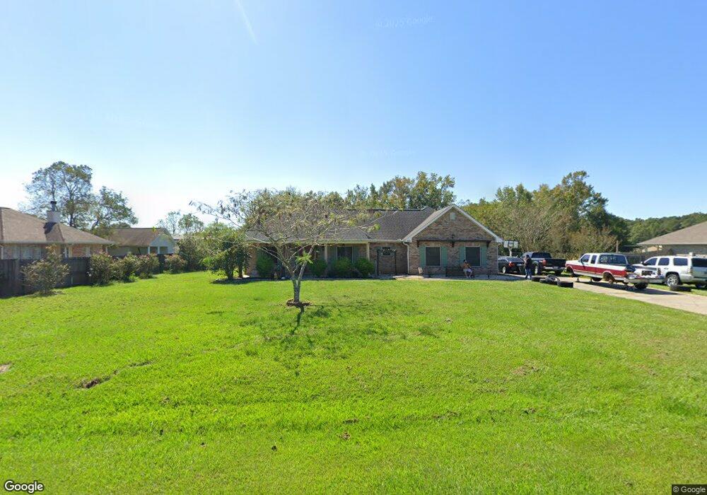
121 Apache Dr Picayune, MS 39466
Estimated Value: $242,140 - $262,000
Studio
1
Bath
1,642
Sq Ft
$156/Sq Ft
Est. Value
About This Home
This home is located at 121 Apache Dr, Picayune, MS 39466 and is currently estimated at $255,535, approximately $155 per square foot. 121 Apache Dr is a home located in Pearl River County with nearby schools including Pearl River Central Upper Elementary School, Pearl River Central Lower Elementary School, and Pearl River Central Middle School.
Ownership History
Date
Name
Owned For
Owner Type
Purchase Details
Closed on
Jan 31, 2022
Sold by
Baham Bryan K
Bought by
Mistretta Mark
Current Estimated Value
Home Financials for this Owner
Home Financials are based on the most recent Mortgage that was taken out on this home.
Original Mortgage
$200,305
Outstanding Balance
$183,963
Interest Rate
3.45%
Mortgage Type
Construction
Estimated Equity
$71,572
Purchase Details
Closed on
Jan 20, 2017
Sold by
Raimey Christopher Earl
Bought by
Baham Julius M
Purchase Details
Closed on
Apr 3, 2012
Sold by
Dominio Gregory Wayne and Dominio Debra Reynolds
Bought by
Raimey Christopher Earl and Raimey Donna R
Purchase Details
Closed on
Jun 16, 2006
Sold by
Dominio Gregory W and Dominio Debra R
Bought by
Stonehill Land Holdings Llc
Create a Home Valuation Report for This Property
The Home Valuation Report is an in-depth analysis detailing your home's value as well as a comparison with similar homes in the area
Purchase History
| Date | Buyer | Sale Price | Title Company |
|---|---|---|---|
| Mistretta Mark | $202,308 | Pilger Title Co | |
| Baham Julius M | -- | -- | |
| Raimey Christopher Earl | -- | -- | |
| Stonehill Land Holdings Llc | -- | -- |
Source: Public Records
Mortgage History
| Date | Status | Borrower | Loan Amount |
|---|---|---|---|
| Open | Mistretta Mark | $200,305 |
Source: Public Records
Tax History
| Year | Tax Paid | Tax Assessment Tax Assessment Total Assessment is a certain percentage of the fair market value that is determined by local assessors to be the total taxable value of land and additions on the property. | Land | Improvement |
|---|---|---|---|---|
| 2025 | $1,917 | $17,425 | $0 | $0 |
| 2024 | $1,917 | $17,503 | $0 | $0 |
| 2023 | $1,919 | $16,140 | $0 | $0 |
| 2022 | $3,077 | $24,210 | $0 | $0 |
| 2021 | $1,084 | $16,140 | $0 | $0 |
| 2020 | $1,088 | $16,140 | $0 | $0 |
| 2019 | $1,061 | $16,075 | $0 | $0 |
| 2018 | $1,054 | $16,075 | $0 | $0 |
| 2017 | $1,563 | $16,075 | $0 | $0 |
| 2016 | $1,563 | $16,075 | $0 | $0 |
| 2015 | $1,438 | $14,397 | $0 | $0 |
| 2014 | $1,436 | $14,382 | $0 | $0 |
Source: Public Records
Map
Nearby Homes
- 49 Mojave Ln
- 52 Oak Dr
- 2 Arbor Ln
- 9 Timaquana Dr
- 34 Leo Eaves Rd
- 15 Miami Ln
- 27 Spice St
- 24 Bear Path
- 17 Pointer Trail
- 34 Hidden Hills Dr E
- 730 Sycamore Rd
- 1274 W Union Rd
- 33 Longbow Dr
- 131 Monk Mitchell Rd
- 97 Rayburn Rd
- 1290 W Union Rd
- 1298 W Union Rd
- 116 Monk Mitchell Rd
- 27 Hartman Rd
- 845 W Union Rd
- 102 Apache Dr
- 108 Apache Dr
- 112 Apache Dr
- 116 Apache Dr
- 132 Apache Dr
- 104 Apache Dr
- 106 Apache Dr
- 4 Pueblo Ln
- 49 Shelton Pearson Rd
- 0 Shelton Pearson Rd
- 76 Shelton Pearson Rd
- 37 Chippewa Dr
- 35 Chippewa Dr
- 31 Chippewa Dr
- 29 Chippewa Dr
- 19 Chippewa Dr
- 15 Chippewa Dr
- 5 Chippewa Dr
- 3 Chippewa Dr
- 11 Mojave Dr
Your Personal Tour Guide
Ask me questions while you tour the home.