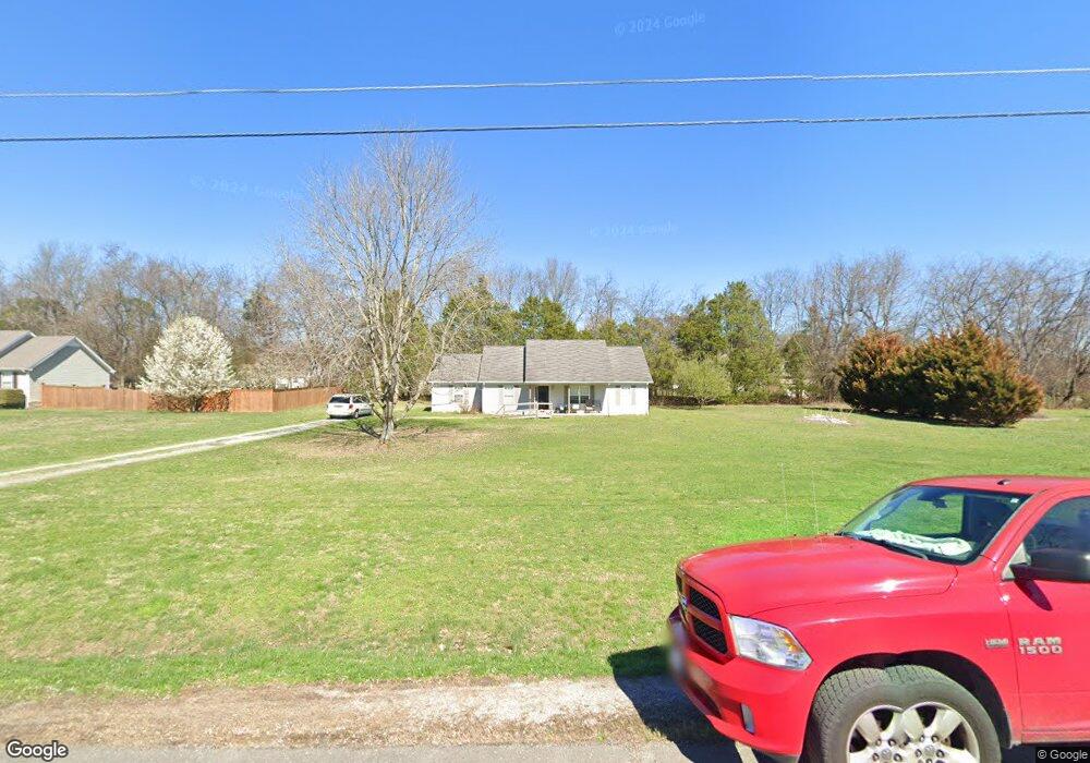
121 Langston Ct Murfreesboro, TN 37128
Estimated Value: $324,000 - $340,000
Studio
2
Baths
1,204
Sq Ft
$277/Sq Ft
Est. Value
About This Home
This home is located at 121 Langston Ct, Murfreesboro, TN 37128 and is currently estimated at $333,550, approximately $277 per square foot. 121 Langston Ct is a home located in Rutherford County with nearby schools including Christiana Elementary School, Christiana Middle School, and Rockvale High School.
Ownership History
Date
Name
Owned For
Owner Type
Purchase Details
Closed on
Dec 19, 2022
Sold by
Hills Kim
Bought by
Land Trust
Current Estimated Value
Purchase Details
Closed on
May 22, 2012
Sold by
Cole Charles E
Bought by
Hills Everett Jacob Ki
Home Financials for this Owner
Home Financials are based on the most recent Mortgage that was taken out on this home.
Original Mortgage
$60,000
Interest Rate
3.88%
Mortgage Type
Commercial
Purchase Details
Closed on
May 9, 1997
Sold by
Chris Markos
Bought by
Cole Charles E and Dee D
Home Financials for this Owner
Home Financials are based on the most recent Mortgage that was taken out on this home.
Original Mortgage
$84,900
Interest Rate
8.17%
Create a Home Valuation Report for This Property
The Home Valuation Report is an in-depth analysis detailing your home's value as well as a comparison with similar homes in the area
Home Values in the Area
Average Home Value in this Area
Purchase History
| Date | Buyer | Sale Price | Title Company |
|---|---|---|---|
| Land Trust | -- | -- | |
| Land Trust | -- | None Listed On Document | |
| Hills Everett Jacob Ki | $100,000 | -- | |
| Cole Charles E | $84,900 | -- |
Source: Public Records
Mortgage History
| Date | Status | Borrower | Loan Amount |
|---|---|---|---|
| Previous Owner | Hills Everett Jacob Ki | $60,000 | |
| Previous Owner | Cole Charles E | $84,900 |
Source: Public Records
Tax History
| Year | Tax Paid | Tax Assessment Tax Assessment Total Assessment is a certain percentage of the fair market value that is determined by local assessors to be the total taxable value of land and additions on the property. | Land | Improvement |
|---|---|---|---|---|
| 2025 | $1,146 | $61,100 | $13,750 | $47,350 |
| 2024 | $1,146 | $61,100 | $13,750 | $47,350 |
| 2023 | $1,146 | $61,100 | $13,750 | $47,350 |
| 2022 | $987 | $61,100 | $13,750 | $47,350 |
| 2021 | $938 | $42,250 | $8,625 | $33,625 |
| 2020 | $938 | $42,250 | $8,625 | $33,625 |
| 2019 | $938 | $42,250 | $8,625 | $33,625 |
| 2018 | $887 | $43,925 | $0 | $0 |
| 2017 | $829 | $30,925 | $0 | $0 |
| 2016 | $829 | $30,925 | $0 | $0 |
| 2015 | $829 | $30,925 | $0 | $0 |
| 2014 | $769 | $30,925 | $0 | $0 |
| 2013 | -- | $30,525 | $0 | $0 |
Source: Public Records
Map
Nearby Homes
- 5401 Vermillion Ct
- 5409 Walnut Farms Blvd
- 5414 Walnut Farms Blvd
- 209 Wears Dr
- 5727 Clarity Way
- 5351 Clarity Way
- 5213 Clarity Way
- 5571 Compass Way
- 113 Copper Leaf Rd
- 1008 Glenda Dr
- 5722 Red Cypress Dr
- 4505 Nickel Trace
- 110 Copper Leaf Rd
- 5303 Clarity Way
- 5201 Clarity Way
- 5209 Clarity Way
- 1800 Clarity Way
- 277 S Meribeth Ln
- 1904 Rhonda Dr
- 434 Meadowview Dr
- 117 Langston Ct
- 125 Langston Ct
- 7519 Lone Eagle Dr
- 7515 Lone Eagle Dr
- 122 Langston Ct
- 7523 Lone Eagle Dr
- 118 Langston Ct
- 127 Langston Ct
- 7527 Lone Eagle Dr
- 124 Langston Ct
- 114 Langston Ct
- 7518 Lone Eagle Dr
- 7512 Lone Eagle Dr
- 7522 Lone Eagle Dr
- 7509 Lone Eagle Dr
- 7531 Lone Eagle Dr
- 129 Langston Ct
- 7526 Lone Eagle Dr
- 128 Langston Ct
- 7530 Lone Eagle Dr
Your Personal Tour Guide
Ask me questions while you tour the home.