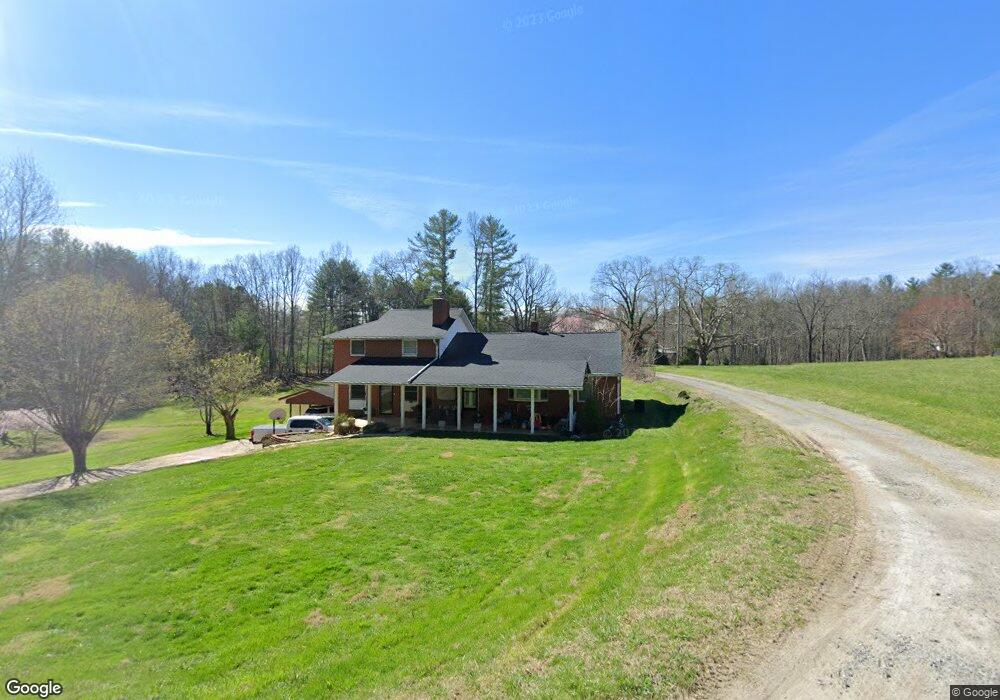
121 Number Nine Rd Fairview, NC 28730
Estimated Value: $483,000 - $627,000
4
Beds
2
Baths
2,281
Sq Ft
$244/Sq Ft
Est. Value
About This Home
This home is located at 121 Number Nine Rd, Fairview, NC 28730 and is currently estimated at $557,507, approximately $244 per square foot. 121 Number Nine Rd is a home located in Buncombe County with nearby schools including A.C. Reynolds High School, Fairview Elementary School, and Cane Creek Middle.
Ownership History
Date
Name
Owned For
Owner Type
Purchase Details
Closed on
Dec 9, 2010
Sold by
West Beverly L
Bought by
West Beverly L and West Stephen G
Current Estimated Value
Home Financials for this Owner
Home Financials are based on the most recent Mortgage that was taken out on this home.
Original Mortgage
$14,500
Outstanding Balance
$9,560
Interest Rate
4.18%
Mortgage Type
Credit Line Revolving
Estimated Equity
$547,947
Create a Home Valuation Report for This Property
The Home Valuation Report is an in-depth analysis detailing your home's value as well as a comparison with similar homes in the area
Home Values in the Area
Average Home Value in this Area
Purchase History
| Date | Buyer | Sale Price | Title Company |
|---|---|---|---|
| West Beverly L | -- | None Available | |
| West Beverly L | -- | None Available |
Source: Public Records
Mortgage History
| Date | Status | Borrower | Loan Amount |
|---|---|---|---|
| Open | West Beverly L | $14,500 | |
| Open | West Beverly L | $60,500 |
Source: Public Records
Tax History
| Year | Tax Paid | Tax Assessment Tax Assessment Total Assessment is a certain percentage of the fair market value that is determined by local assessors to be the total taxable value of land and additions on the property. | Land | Improvement |
|---|---|---|---|---|
| 2025 | $1,642 | $242,300 | $65,800 | $176,500 |
| 2024 | $1,642 | $242,300 | $80,800 | $161,500 |
| 2023 | $1,642 | $242,300 | $80,800 | $161,500 |
| 2022 | $1,534 | $242,300 | $0 | $0 |
| 2021 | $1,534 | $242,300 | $0 | $0 |
| 2020 | $1,408 | $208,900 | $0 | $0 |
| 2019 | $1,408 | $208,900 | $0 | $0 |
| 2018 | $1,345 | $208,900 | $0 | $0 |
| 2017 | $1,345 | $228,100 | $0 | $0 |
| 2016 | $1,617 | $228,100 | $0 | $0 |
| 2015 | $1,617 | $228,100 | $0 | $0 |
| 2014 | $1,617 | $228,100 | $0 | $0 |
Source: Public Records
Map
Nearby Homes
- 9 Meadow Wood Trail
- 15 Madelyn Ln
- 17 Old Gap Creek Rd
- 25 Madelyn Ln
- 139 Clay St
- 206 Cascade Ridge Rd
- Bob Barnwell Rd
- 20 Luckenbach Dr
- 204 Cascade Ridge Rd
- 169 Cascade Ridge Rd
- 165 Cascade Ridge Rd
- 99999 Churchill Downs Dr
- 170 Cascade Ridge Rd
- 38 Mountainberry Ln
- 428 Emmas Grove Rd
- 841B Charlotte Hwy
- 99999 Bob Barnwell Rd
- 1287 Charlotte Hwy
- 84 Joe Jenkins Rd
- 90 Joe Jenkins Rd
- 130 Number Nine Rd
- 6 Lanning Dr
- 14 Lanning Dr
- 94 Number Nine Rd
- 103 Number Nine Rd
- 8 Lanning Dr
- 105 Number Nine Rd
- 142 Number Nine Rd
- 31 Sedgewood Ct
- 69 Number Nine Rd
- 65 Number Nine Rd
- 156 Number Nine Rd
- 36 Sedgewood Ct
- 86 Number Nine Rd
- 68 Number Nine Rd
- 62 Number Nine Rd
- Tract C Sedgewood Ct
- 9999 Sedgewood Ct Unit C
- 9999 Sedgewood Ct
- 28 Sedgewood Ct
Your Personal Tour Guide
Ask me questions while you tour the home.