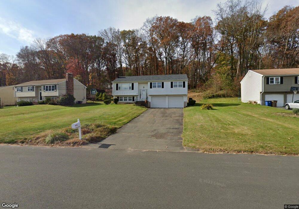
121 Overbrook Dr Vernon Rockville, CT 06066
North Vernon NeighborhoodEstimated Value: $353,000 - $370,000
3
Beds
2
Baths
1,208
Sq Ft
$297/Sq Ft
Est. Value
About This Home
This home is located at 121 Overbrook Dr, Vernon Rockville, CT 06066 and is currently estimated at $358,962, approximately $297 per square foot. 121 Overbrook Dr is a home located in Tolland County with nearby schools including Skinner Road School, Vernon Center Middle School, and Rockville High School.
Ownership History
Date
Name
Owned For
Owner Type
Purchase Details
Closed on
Sep 14, 2007
Sold by
Sadauskas Karen
Bought by
Churchill Richard and Churchill Jennifer
Current Estimated Value
Home Financials for this Owner
Home Financials are based on the most recent Mortgage that was taken out on this home.
Original Mortgage
$248,106
Interest Rate
6.7%
Purchase Details
Closed on
May 1, 2003
Sold by
Tremblay Edward and Tremblay Dorci
Bought by
Sadauskas Kaeren
Create a Home Valuation Report for This Property
The Home Valuation Report is an in-depth analysis detailing your home's value as well as a comparison with similar homes in the area
Home Values in the Area
Average Home Value in this Area
Purchase History
| Date | Buyer | Sale Price | Title Company |
|---|---|---|---|
| Churchill Richard | $252,000 | -- | |
| Sadauskas Kaeren | $183,000 | -- |
Source: Public Records
Mortgage History
| Date | Status | Borrower | Loan Amount |
|---|---|---|---|
| Open | Sadauskas Kaeren | $236,978 | |
| Closed | Sadauskas Kaeren | $250,480 | |
| Closed | Sadauskas Kaeren | $248,106 |
Source: Public Records
Tax History
| Year | Tax Paid | Tax Assessment Tax Assessment Total Assessment is a certain percentage of the fair market value that is determined by local assessors to be the total taxable value of land and additions on the property. | Land | Improvement |
|---|---|---|---|---|
| 2025 | $5,720 | $158,480 | $45,190 | $113,290 |
| 2024 | $5,561 | $158,480 | $45,190 | $113,290 |
| 2023 | $5,292 | $158,480 | $45,190 | $113,290 |
| 2022 | $5,292 | $158,480 | $45,190 | $113,290 |
| 2021 | $5,396 | $136,150 | $46,240 | $89,910 |
| 2020 | $5,396 | $136,150 | $46,240 | $89,910 |
| 2019 | $5,396 | $136,150 | $46,240 | $89,910 |
| 2018 | $5,396 | $136,150 | $46,240 | $89,910 |
| 2017 | $5,270 | $136,150 | $46,240 | $89,910 |
| 2016 | $5,160 | $135,690 | $47,990 | $87,700 |
| 2015 | $5,008 | $135,690 | $47,990 | $87,700 |
| 2014 | $4,900 | $135,690 | $47,990 | $87,700 |
Source: Public Records
Map
Nearby Homes
- 325 Kelly Rd Unit TRLR R19
- 37 Vista View Ln Unit 37
- 413 Lady Bug Ln Unit 413
- 343 Merline Rd
- 61 Tankerhoosen Rd
- 183 Phoenix St
- 169 Avery St
- 295 Phoenix St
- 28 Tracy Dr
- 12 Elizabeth Ln
- 35 Shares Ln Unit 35
- 39 W Vernon St
- 989 Hartford Turnpike
- 6 Whitman Ln Unit 6
- 75 Tracy Dr
- 20 Whitney Ferguson Rd Unit 18
- 655 Talcottville Rd Unit 45
- 51 Carriage Dr
- 1 Laurelwood Ln Unit LOT 18
- 14 Wilson Ln
- 3 Riverside Dr
- 117 Overbrook Dr
- 7 Riverside Dr
- 113 Overbrook Dr
- 120 Overbrook Dr
- 6 Riverside Dr
- 208 Dogwood Ln
- 11 Riverside Dr
- 194 Dogwood Ln
- 2 Ahern Dr
- 46 Kenwood Dr
- 10 Riverside Dr
- 107 Overbrook Dr
- 12 Ahern Dr
- 17 Riverside Dr
- 45 Kenwood Dr
- 186 Dogwood Ln
- 108 Overbrook Dr
- 39 Kenwood Dr
- 16 Riverside Dr
Your Personal Tour Guide
Ask me questions while you tour the home.