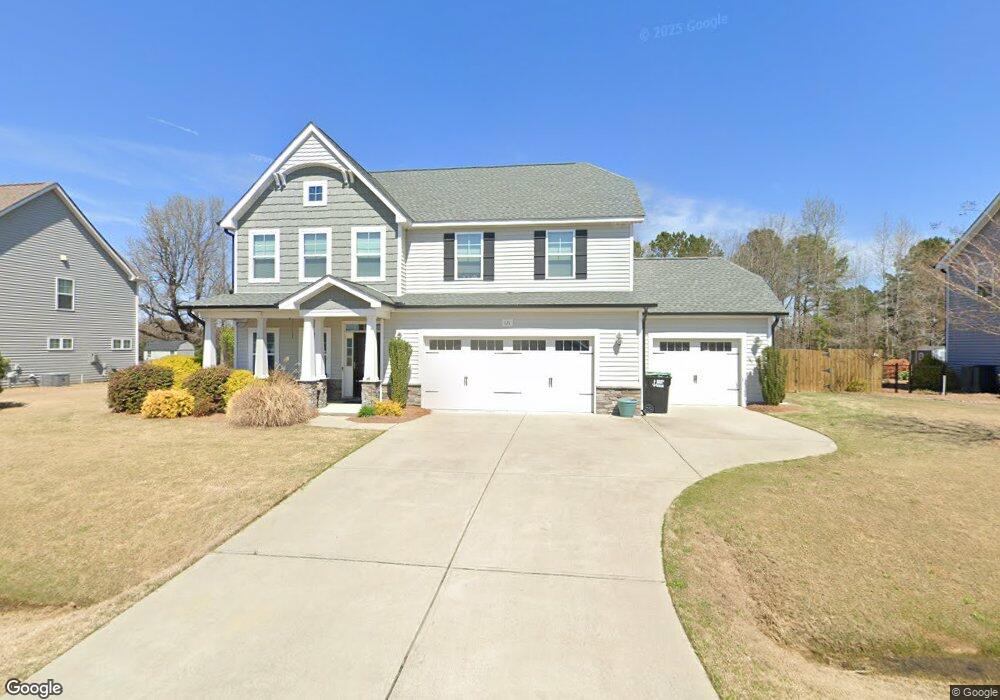
121 Red Angus Dr Smithfield, NC 27577
Estimated Value: $516,688 - $535,000
4
Beds
4
Baths
2,995
Sq Ft
$176/Sq Ft
Est. Value
About This Home
This home is located at 121 Red Angus Dr, Smithfield, NC 27577 and is currently estimated at $527,422, approximately $176 per square foot. 121 Red Angus Dr is a home located in Johnston County with nearby schools including Polenta Elementary School, Swift Creek Middle, and Cleveland High School.
Ownership History
Date
Name
Owned For
Owner Type
Purchase Details
Closed on
Feb 28, 2017
Sold by
Cates Building Inc
Bought by
Crenshaw Jader Keith and Crenshaw Melissa Fisher
Current Estimated Value
Home Financials for this Owner
Home Financials are based on the most recent Mortgage that was taken out on this home.
Original Mortgage
$289,136
Outstanding Balance
$239,900
Interest Rate
4.19%
Mortgage Type
VA
Estimated Equity
$287,522
Create a Home Valuation Report for This Property
The Home Valuation Report is an in-depth analysis detailing your home's value as well as a comparison with similar homes in the area
Home Values in the Area
Average Home Value in this Area
Purchase History
| Date | Buyer | Sale Price | Title Company |
|---|---|---|---|
| Crenshaw Jader Keith | $280,000 | -- |
Source: Public Records
Mortgage History
| Date | Status | Borrower | Loan Amount |
|---|---|---|---|
| Open | Crenshaw Jader Keith | $289,136 |
Source: Public Records
Tax History
| Year | Tax Paid | Tax Assessment Tax Assessment Total Assessment is a certain percentage of the fair market value that is determined by local assessors to be the total taxable value of land and additions on the property. | Land | Improvement |
|---|---|---|---|---|
| 2025 | $3,142 | $494,800 | $75,000 | $419,800 |
| 2024 | $2,404 | $296,740 | $50,000 | $246,740 |
| 2023 | $2,322 | $296,740 | $50,000 | $246,740 |
| 2022 | $2,441 | $296,740 | $50,000 | $246,740 |
| 2021 | $2,441 | $296,740 | $50,000 | $246,740 |
| 2020 | $2,470 | $296,740 | $50,000 | $246,740 |
| 2019 | $2,470 | $296,740 | $50,000 | $246,740 |
| 2018 | $2,334 | $273,740 | $30,000 | $243,740 |
| 2017 | $2,334 | $273,740 | $30,000 | $243,740 |
| 2016 | $256 | $30,000 | $30,000 | $0 |
Source: Public Records
Map
Nearby Homes
- 199 Red Angus Dr
- 2411 Freedom Rd
- 80 Independence Dr
- 15 Independence Dr
- 107 Smithsanders Ct
- 79 Quail Point Cir
- 250 Rising Star Dr
- 100 Brodie Rose Landing Way
- 338 Pedernales Dr
- 447 Rising Star Dr
- 91 Kitty Branch Way
- 386 Rising Star Dr
- 1605 Freedom Rd
- 0 Monroe Rd
- 0 Monroe Rd Unit 100532087
- 141 Pony Gallop Ln
- 452 Brodie Rose Landing Way
- 111 Pony Gallop Ln
- 55 Pony Gallop Ln
- 35 Pony Gallop Ln
- 101 Red Angus Dr
- 128 Red Angus Dr
- 96 Red Angus Dr
- 146 Red Angus Dr
- 159 Red Angus Dr
- 78 Red Angus Dr
- 178 Red Angus Dr
- 65 Red Angus Dr
- 185 Red Angus Dr
- 194 Red Angus Dr
- 54 Black Horse Way
- 54 Black Horse Way
- 45 Red Angus Dr
- 63 Black Horse Way
- 200 Red Angus Dr
- 205 Red Angus Dr
- 25 Red Angus Dr
- 204 Red Angus Dr
- 588 Polenta Rd
- 96 Polenta Fields Dr
Your Personal Tour Guide
Ask me questions while you tour the home.