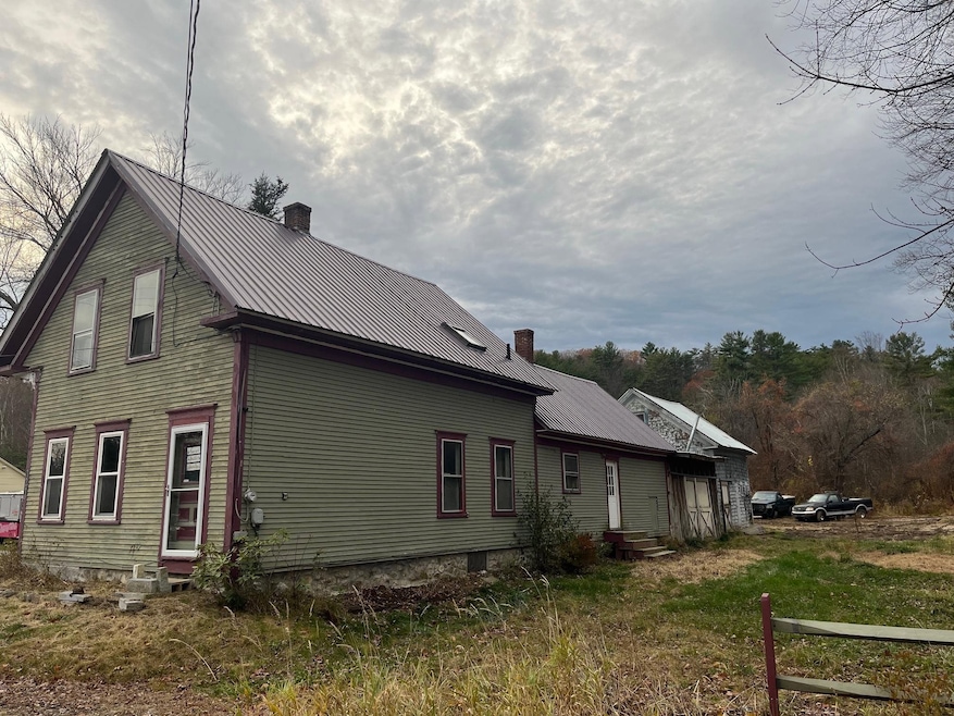
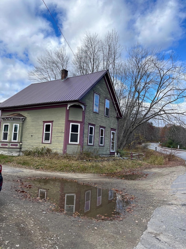
121 Riverside Dr Ashland, NH 03217
Estimated payment $1,585/month
Highlights
- Access To Lake
- New Englander Architecture
- Natural Light
- Wood Flooring
- Snowmobile Trail
- Property near a hospital
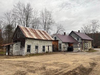
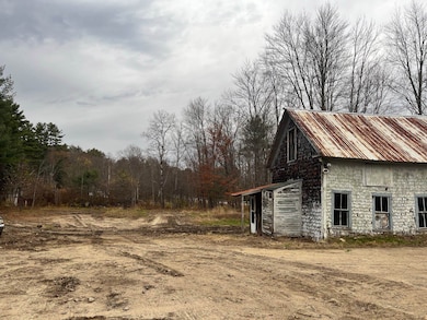
About This Home
Significant price reduction. This New England home has the potential to shine again. With your sweat equity you can live in this home while making improvements. Large kitchen area with attached dining room. Family room offers open concept to dining area along with 3 bedrooms on the 2nd floor. The location is ideal, with easy access to the highway yet walking distance to the town beach, 10 minutes to Plymouth, near multiple ski resorts, snowmobiling, and endless hiking opportunities.
Home Details
Home Type
- Single Family
Est. Annual Taxes
- $4,182
Year Built
- Built in 1900
Parking
- Gravel Driveway
Home Design
- New Englander Architecture
- Metal Roof
- Clapboard
Interior Spaces
- 1,568 Sq Ft Home
- Property has 1.75 Levels
- Natural Light
- Family Room
- Combination Dining and Living Room
- Wood Flooring
Bedrooms and Bathrooms
- 3 Bedrooms
- 1 Full Bathroom
Basement
- Interior Basement Entry
- Dirt Floor
Location
- Property near a hospital
- Property is near golf course, schools, and shops
Schools
- Ashland Elementary School
- Ashland Elementary Middle School
- Plymouth Regional High School
Utilities
- No Cooling
- Pellet Stove burns compressed wood to generate heat
- Baseboard Heating
- Hot Water Heating System
- Heating System Uses Oil
- 200+ Amp Service
- Cable TV Available
Additional Features
- Access To Lake
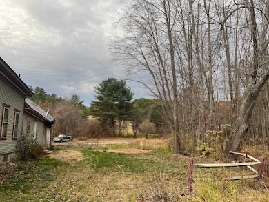
- 0.86 Acre Lot
Community Details
- Snowmobile Trail
Listing and Financial Details
- Tax Block 013
- Assessor Parcel Number 108
Map
Tax History
| Year | Tax Paid | Tax Assessment Tax Assessment Total Assessment is a certain percentage of the fair market value that is determined by local assessors to be the total taxable value of land and additions on the property. | Land | Improvement |
|---|---|---|---|---|
| 2024 | $4,289 | $233,240 | $103,300 | $129,940 |
| 2023 | $4,035 | $233,240 | $103,300 | $129,940 |
| 2022 | $3,827 | $137,330 | $47,100 | $90,230 |
| 2021 | $3,772 | $137,330 | $47,100 | $90,230 |
| 2020 | $3,904 | $137,330 | $47,100 | $90,230 |
| 2019 | $3,838 | $137,330 | $47,100 | $90,230 |
| 2018 | $3,679 | $137,330 | $47,100 | $90,230 |
| 2016 | $3,406 | $139,750 | $41,850 | $97,900 |
| 2015 | $3,490 | $139,750 | $41,850 | $97,900 |
| 2013 | $3,511 | $139,750 | $41,850 | $97,900 |
Property History
| Date | Event | Price | List to Sale | Price per Sq Ft |
|---|---|---|---|---|
| 01/03/2026 01/03/26 | Price Changed | $240,000 | -4.0% | $153 / Sq Ft |
| 11/20/2025 11/20/25 | Price Changed | $250,000 | -13.8% | $159 / Sq Ft |
| 11/05/2025 11/05/25 | For Sale | $290,000 | -- | $185 / Sq Ft |
Purchase History
| Date | Type | Sale Price | Title Company |
|---|---|---|---|
| Deed | $40,000 | -- | |
| Deed | $26,500 | -- | |
| Foreclosure Deed | $148,700 | -- |
Source: PrimeMLS
MLS Number: 5068521
APN: ASHN-000015-000001-000019
Disclaimer: Certain information contained herein is derived from information provided by parties other than Homes.com. All information provided is deemed reliable, but is not guaranteed to be accurate and should be independently verified.
![]() Copyright 2026 PrimeMLS, Inc. All rights reserved. This information is deemed reliable, but not guaranteed. The data relating to real estate displayed on this display comes in part from the IDX Program of PrimeMLS. The information being provided is for consumers’ personal, non-commercial use and may not be used for any purpose other than to identify prospective properties consumers may be interested in purchasing.
Copyright 2026 PrimeMLS, Inc. All rights reserved. This information is deemed reliable, but not guaranteed. The data relating to real estate displayed on this display comes in part from the IDX Program of PrimeMLS. The information being provided is for consumers’ personal, non-commercial use and may not be used for any purpose other than to identify prospective properties consumers may be interested in purchasing.
- 12 Peaked Hill Rd
- 283 River St
- 11 Sebec Rd
- 14 Overlook Rd Unit 3
- 7 Hollows Rd Unit (aka Unit 59)
- 3A N Ashland Rd
- 206 High Country Way Unit (aka Unit 100)
- 13 Pine Arden Dr Unit 70
- 64 Fairway Dr
- 15-B Wildflower Ln
- 373 New Hampshire Route 175
- 88 Perch Pond Rd
- 793 Texas Hill Rd
- 0 Texas Hill Rd Unit 2
- 00 Texas Hill Rd Unit 59
- 0 Texas Hill Rd Unit 1
- 148 Sargent Rd
- 20 Circle Dr Unit 43
- 000 Smith Rd Unit 2
- 0 Oak Ridge Rd Unit 27
- 34 Highland St Unit Apartment #3
- 48 Main St
- 19 Hill Ave Unit A
- 33 Marden Point Rd
- 24 Alvord Rd
- 378 New Hampshire 113
- 550 Texas Hill Rd Unit B
- 46 Russell St
- 46 Russell St
- 46 Russell St
- 4 Bayley Ave
- 55 Paradise Rd Unit 7
- 11 Laurel Glen Ln
- 41 Village Dr
- 48 Old Clubhouse Ln
- 94 Mandi Ln
- 246 Whittemore Point Rd N
- 0 Village Dr
- 1279 New Hampshire 113
- 152 S Mayhew Turnpike

Ask me questions while you tour the home.