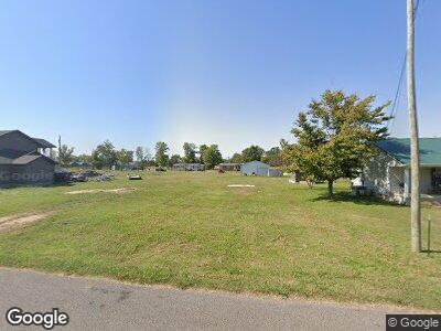
121 S Reelfoot Ave Unit S of Hwy 22 in Sambu Hornbeak, TN 38232
Estimated Value: $16,101 - $106,000
3
Beds
1
Bath
1,320
Sq Ft
$56/Sq Ft
Est. Value
About This Home
This home is located at 121 S Reelfoot Ave Unit S of Hwy 22 in Sambu, Hornbeak, TN 38232 and is currently estimated at $73,525, approximately $55 per square foot. 121 S Reelfoot Ave Unit S of Hwy 22 in Sambu is a home located in Obion County.
Ownership History
Date
Name
Owned For
Owner Type
Purchase Details
Closed on
Apr 30, 2024
Sold by
Pierce Mark and Castellaw Rayce
Bought by
James William A
Current Estimated Value
Purchase Details
Closed on
Mar 31, 2023
Sold by
Parker Doreen Le
Bought by
Pierce Mark and Castellaw Rayce
Purchase Details
Closed on
Jul 7, 2021
Sold by
Campbell Barbara Green and Green Family Revocable Trust
Bought by
Parker Doreen
Home Financials for this Owner
Home Financials are based on the most recent Mortgage that was taken out on this home.
Original Mortgage
$68,732
Interest Rate
2.9%
Mortgage Type
FHA
Purchase Details
Closed on
Mar 12, 2008
Sold by
Chris Ford
Bought by
Barbara Green
Purchase Details
Closed on
Oct 23, 2007
Bought by
Gant Clara %Waynette Ford
Purchase Details
Closed on
Jan 6, 2006
Bought by
Gant Clara
Purchase Details
Closed on
Jul 16, 2004
Bought by
Ford Waynette Etvir Chris
Purchase Details
Closed on
Aug 5, 1977
Purchase Details
Closed on
Jul 20, 1965
Bought by
Gant John F and Gant Clara
Create a Home Valuation Report for This Property
The Home Valuation Report is an in-depth analysis detailing your home's value as well as a comparison with similar homes in the area
Home Values in the Area
Average Home Value in this Area
Purchase History
| Date | Buyer | Sale Price | Title Company |
|---|---|---|---|
| James William A | $40,000 | None Listed On Document | |
| Pierce Mark | $15,000 | -- | |
| Parker Doreen | $70,000 | None Available | |
| Barbara Green | $50,000 | -- | |
| Gant Clara %Waynette Ford | -- | -- | |
| Gant Clara | -- | -- | |
| Ford Waynette Etvir Chris | -- | -- | |
| -- | -- | -- | |
| Gant John F | -- | -- |
Source: Public Records
Mortgage History
| Date | Status | Borrower | Loan Amount |
|---|---|---|---|
| Previous Owner | Parker Doreen | $68,732 |
Source: Public Records
Tax History Compared to Growth
Tax History
| Year | Tax Paid | Tax Assessment Tax Assessment Total Assessment is a certain percentage of the fair market value that is determined by local assessors to be the total taxable value of land and additions on the property. | Land | Improvement |
|---|---|---|---|---|
| 2024 | -- | $2,375 | $2,375 | $0 |
| 2023 | $33 | $2,375 | $2,375 | $0 |
| 2022 | $38 | $2,025 | $2,025 | $0 |
| 2021 | $37 | $10,300 | $2,025 | $8,275 |
| 2020 | $198 | $10,300 | $2,025 | $8,275 |
| 2019 | $310 | $10,400 | $2,025 | $8,375 |
| 2018 | $310 | $10,400 | $2,025 | $8,375 |
| 2017 | $316 | $10,200 | $2,025 | $8,175 |
| 2016 | $316 | $10,200 | $2,025 | $8,175 |
| 2015 | $317 | $10,200 | $2,025 | $8,175 |
| 2014 | $317 | $10,200 | $2,025 | $8,175 |
Source: Public Records
Map
Nearby Homes
- 232 2nd Ave
- 0 Lakeview Dr Unit RRA45037
- 257 2nd Ave
- 240 Vine St
- 354 E Lakeview Dr
- 5674 W Highway 22
- 605 E Lakeview Dr
- 891 Dean Hill Rd
- 1360 Lake Dr
- 1233 Lake Dr
- 4211 Old Samburg Rd
- 000 Old Samburg Rd
- 00 Lakeview Dr
- 5079 Tennessee 21
- 926 Lake Dr
- 860 Lake Dr
- 56 N Bluff Rd
- 4815 Webb Store Rd
- 3454 Treece Rd
- 204 N Main St
