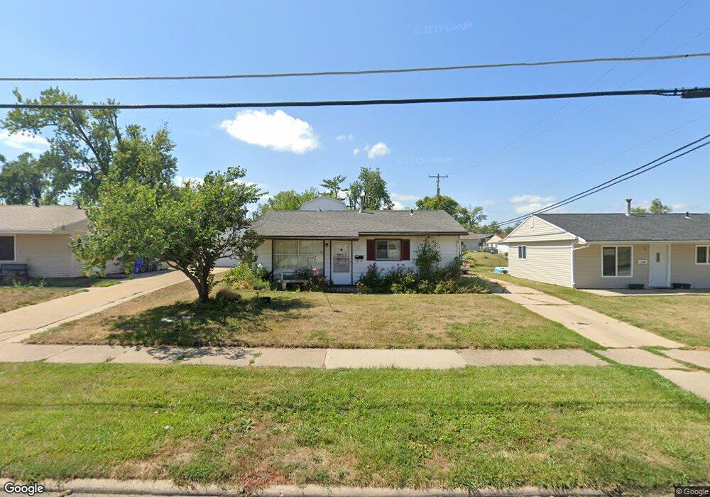
1210 15th St SW Cedar Rapids, IA 52404
Cleveland Area NeighborhoodEstimated Value: $127,000 - $142,000
3
Beds
1
Bath
768
Sq Ft
$173/Sq Ft
Est. Value
About This Home
This home is located at 1210 15th St SW, Cedar Rapids, IA 52404 and is currently estimated at $132,651, approximately $172 per square foot. 1210 15th St SW is a home located in Linn County with nearby schools including Junction City Elementary School, Cleveland Elementary School, and Kentucky Tech - Ashland Reg Tech Center.
Ownership History
Date
Name
Owned For
Owner Type
Purchase Details
Closed on
Apr 21, 2022
Sold by
Pearson Mary Etta C
Bought by
Pearson Jean M
Current Estimated Value
Home Financials for this Owner
Home Financials are based on the most recent Mortgage that was taken out on this home.
Original Mortgage
$74,000
Interest Rate
2.99%
Mortgage Type
New Conventional
Purchase Details
Closed on
Oct 29, 2007
Sold by
Pearson Willard V
Bought by
Pearson Willard V and Pearson Mary Etta C
Home Financials for this Owner
Home Financials are based on the most recent Mortgage that was taken out on this home.
Original Mortgage
$73,000
Interest Rate
6.44%
Mortgage Type
Unknown
Create a Home Valuation Report for This Property
The Home Valuation Report is an in-depth analysis detailing your home's value as well as a comparison with similar homes in the area
Home Values in the Area
Average Home Value in this Area
Purchase History
| Date | Buyer | Sale Price | Title Company |
|---|---|---|---|
| Pearson Jean M | $90,000 | None Listed On Document | |
| Pearson Willard V | $72,500 | Security First Title Co |
Source: Public Records
Mortgage History
| Date | Status | Borrower | Loan Amount |
|---|---|---|---|
| Previous Owner | Pearson Jean M | $74,000 | |
| Previous Owner | Pearson Willard V | $73,000 |
Source: Public Records
Tax History Compared to Growth
Tax History
| Year | Tax Paid | Tax Assessment Tax Assessment Total Assessment is a certain percentage of the fair market value that is determined by local assessors to be the total taxable value of land and additions on the property. | Land | Improvement |
|---|---|---|---|---|
| 2025 | $1,838 | $123,800 | $25,900 | $97,900 |
| 2024 | $1,840 | $116,300 | $23,500 | $92,800 |
| 2023 | $1,840 | $114,300 | $23,500 | $90,800 |
| 2022 | $1,644 | $96,100 | $20,000 | $76,100 |
| 2021 | $1,708 | $91,700 | $20,000 | $71,700 |
| 2020 | $1,708 | $89,300 | $18,800 | $70,500 |
| 2019 | $1,516 | $82,100 | $18,800 | $63,300 |
| 2018 | $1,468 | $82,100 | $18,800 | $63,300 |
| 2017 | $1,536 | $82,300 | $18,800 | $63,500 |
| 2016 | $1,637 | $80,400 | $18,800 | $61,600 |
| 2015 | $1,649 | $80,801 | $18,800 | $62,001 |
| 2014 | $1,464 | $83,411 | $18,800 | $64,611 |
| 2013 | $1,480 | $83,411 | $18,800 | $64,611 |
Source: Public Records
Map
Nearby Homes
- 1206 18th St SW
- 1807 9th Ave SW
- 1812 Holly Meadow Ave SW
- 1806 Holly Meadow Ave SW
- 1400 7th Ave SW
- 1818 Holly Meadow Ave SW
- 1824 Holly Meadow Ave SW
- 1253 20th St SW
- 1121 15th Ave SW
- 1801 Shady Grove Rd SW
- 1602 1st Ave NW
- 1832 8th Ave SW
- 1424 11th St SW
- 1960 Rockford Rd SW Unit 45
- 1913 Holly Meadow Ave SW
- 1227 19th Ave SW
- 2025 18th St SW
- 1005 10th St SW
- 835 10th St SW
- 1118 2nd Ave SW
- 1208 15th St SW
- 1220 15th St SW
- 1206 15th St SW
- 1211 16th St SW
- 1209 16th St SW
- 1204 15th St SW
- 1510 13th Ave SW
- 1207 16th St SW
- 1205 16th St SW
- 1202 15th St SW
- 1501 13th Ave SW
- 1505 13th Ave SW
- 1203 16th St SW
- 1507 13th Ave SW
- 1304 15th St SW
- 1200 15th St SW
- 1511 13th Ave SW
- 1212 16th St SW
- 73 16th St SW
- 1210 16th St SW