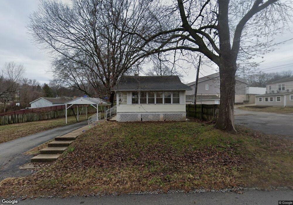
1210 S Emery Ave Independence, MO 64055
Hanthorn NeighborhoodEstimated Value: $116,000 - $141,000
2
Beds
1
Bath
792
Sq Ft
$161/Sq Ft
Est. Value
About This Home
This home is located at 1210 S Emery Ave, Independence, MO 64055 and is currently estimated at $127,589, approximately $161 per square foot. 1210 S Emery Ave is a home located in Jackson County with nearby schools including Sycamore Hills Elementary School, Bridger Middle School, and Pioneer Ridge Middle School.
Ownership History
Date
Name
Owned For
Owner Type
Purchase Details
Closed on
Aug 10, 2009
Sold by
Secretary Of Housing & Urban Development
Bought by
Twelfth Street Oak Grove Properties Llc
Current Estimated Value
Purchase Details
Closed on
Oct 14, 2008
Sold by
Mortgage Electronic Registration Systems
Bought by
Secretary Of Housing & Urban Development
Purchase Details
Closed on
Oct 7, 2008
Sold by
Long Claude J and Long Donna Sue
Bought by
Mortgage Electronic Registration Systems and Gmac Mortgage Llc
Purchase Details
Closed on
Jun 30, 2006
Sold by
Azbill Diane M and Azbill Dianna M
Bought by
Long Claude J and Long Donna Sue
Home Financials for this Owner
Home Financials are based on the most recent Mortgage that was taken out on this home.
Original Mortgage
$68,280
Interest Rate
6.63%
Mortgage Type
FHA
Create a Home Valuation Report for This Property
The Home Valuation Report is an in-depth analysis detailing your home's value as well as a comparison with similar homes in the area
Home Values in the Area
Average Home Value in this Area
Purchase History
| Date | Buyer | Sale Price | Title Company |
|---|---|---|---|
| Twelfth Street Oak Grove Properties Llc | -- | First American Title Ins Co | |
| Secretary Of Housing & Urban Development | -- | Continental Title Company | |
| Mortgage Electronic Registration Systems | $75,622 | Continental Title Company | |
| Long Claude J | $68,820 | Heart Of America Title & Esc |
Source: Public Records
Mortgage History
| Date | Status | Borrower | Loan Amount |
|---|---|---|---|
| Previous Owner | Long Claude J | $68,280 |
Source: Public Records
Tax History Compared to Growth
Tax History
| Year | Tax Paid | Tax Assessment Tax Assessment Total Assessment is a certain percentage of the fair market value that is determined by local assessors to be the total taxable value of land and additions on the property. | Land | Improvement |
|---|---|---|---|---|
| 2025 | $658 | $9,548 | $5,590 | $3,958 |
| 2024 | $643 | $9,500 | $3,800 | $5,700 |
| 2023 | $643 | $15,618 | $1,455 | $14,163 |
| 2022 | $533 | $7,220 | $3,952 | $3,268 |
| 2021 | $533 | $7,220 | $3,952 | $3,268 |
| 2020 | $549 | $7,220 | $3,952 | $3,268 |
| 2019 | $654 | $8,746 | $3,952 | $4,794 |
| 2018 | $521 | $6,650 | $1,213 | $5,437 |
| 2017 | $480 | $6,976 | $1,213 | $5,763 |
| 2016 | $480 | $6,067 | $2,544 | $3,523 |
| 2014 | $456 | $5,890 | $2,470 | $3,420 |
Source: Public Records
Map
Nearby Homes
- 610 E Fair St
- 1312 S Emery St
- 1324 S Emery Ave
- 1340 S Emery Ave
- 1122 S Pearl St
- 1126 S Logan Ave
- 301 E Fair St
- 1410 S Logan Ave
- 913 S Hocker Ave
- 916 S Hocker Ave
- 929 S Pope Ave
- 421 E Angus St
- 1217 S Crane St
- 1423 S Dodgion Ave
- 1100 S Noland Rd
- 522 E Devon St
- 1016 E Stone St
- 1122 S Main St
- 823 S Raymond St
- 1040 E Stone St
- 608 E Albert Ave
- 519 E 23rd St S
- 600 E Albert Ave
- 603 E 23rd St S
- 601 E Albert Ave
- 615 E 23rd St S
- 1221 S Hocker Ave
- 1209 S Hocker Ave
- 606 E Albert Ave
- 605 E Albert Ave
- 609 E Albert Ave
- 610 E Albert Ave
- 518 E Fair St
- 520 E Fair St
- 1224 S Hocker Ave
- 613 E Albert Ave
- 602 E Fair St
- 504 E Fair St
- 1226 S Hocker Ave
- 604 E Fair St