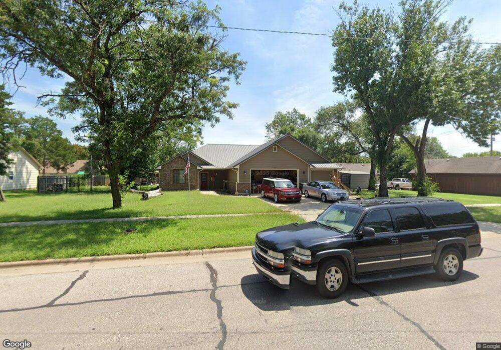
1210 State St Augusta, KS 67010
Estimated Value: $174,000 - $391,324
2
Beds
2
Baths
1,815
Sq Ft
$170/Sq Ft
Est. Value
About This Home
This home is located at 1210 State St, Augusta, KS 67010 and is currently estimated at $309,331, approximately $170 per square foot. 1210 State St is a home located in Butler County with nearby schools including Augusta Senior High School and St. James Catholic School.
Ownership History
Date
Name
Owned For
Owner Type
Purchase Details
Closed on
Oct 31, 2018
Sold by
Mccollom Construction Inc
Bought by
Farmer Michael D and Farmer Randee R
Current Estimated Value
Home Financials for this Owner
Home Financials are based on the most recent Mortgage that was taken out on this home.
Original Mortgage
$200,985
Outstanding Balance
$176,000
Interest Rate
4.6%
Mortgage Type
New Conventional
Estimated Equity
$133,331
Purchase Details
Closed on
Apr 12, 2018
Sold by
Sideline Properties Llc
Bought by
Mccollom Construction Inc
Home Financials for this Owner
Home Financials are based on the most recent Mortgage that was taken out on this home.
Original Mortgage
$224,000
Interest Rate
4.43%
Mortgage Type
Construction
Create a Home Valuation Report for This Property
The Home Valuation Report is an in-depth analysis detailing your home's value as well as a comparison with similar homes in the area
Home Values in the Area
Average Home Value in this Area
Purchase History
| Date | Buyer | Sale Price | Title Company |
|---|---|---|---|
| Farmer Michael D | -- | Kansas Secured Title | |
| Mccollom Construction Inc | -- | Kans Secured Title |
Source: Public Records
Mortgage History
| Date | Status | Borrower | Loan Amount |
|---|---|---|---|
| Open | Farmer Michael D | $200,985 | |
| Previous Owner | Mccollom Construction Inc | $224,000 |
Source: Public Records
Tax History Compared to Growth
Tax History
| Year | Tax Paid | Tax Assessment Tax Assessment Total Assessment is a certain percentage of the fair market value that is determined by local assessors to be the total taxable value of land and additions on the property. | Land | Improvement |
|---|---|---|---|---|
| 2025 | $5,947 | $48,001 | $2,558 | $45,443 |
| 2024 | $5,947 | $46,156 | $2,237 | $43,919 |
| 2023 | $5,947 | $42,631 | $2,059 | $40,572 |
| 2022 | $5,947 | $40,052 | $2,059 | $37,993 |
| 2021 | $5,947 | $36,446 | $2,059 | $34,387 |
| 2020 | $5,947 | $35,837 | $2,059 | $33,778 |
| 2019 | $5,947 | $34,317 | $2,059 | $32,258 |
Source: Public Records
Map
Nearby Homes
- 1224 State St
- 1211 Bobbie St
- 1214 Helen St
- 1110 State St
- 1311 Bobbie St
- 1148 N Osage St
- 1209 N Helen
- 1311 Pauline St
- 1207 Leckliter Dr
- 118 E Broadway Ave
- 1238 Dearborn St
- 1600 Cron St
- 241 Columbia St
- 1606 Sunset Dr
- 1120 Euclid St
- 1209 Ohio St
- 1507 Moyle St
- 935 Wirth St
- 333 E Kelly Ave
- 291 Westwood Ave