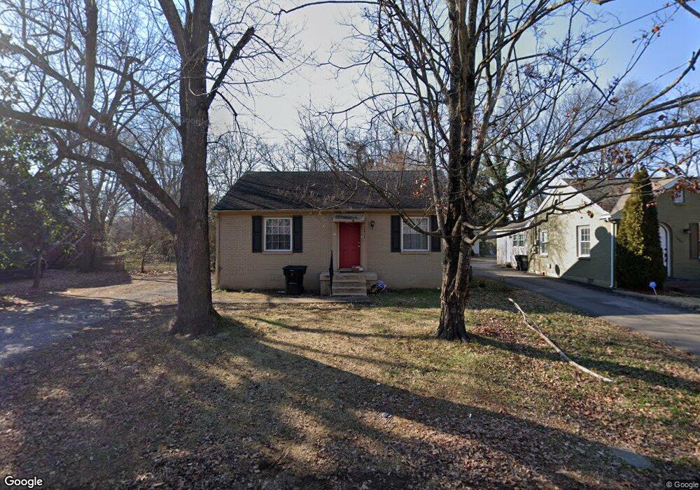
1211 Allen Ave Murfreesboro, TN 37129
Estimated Value: $221,500 - $256,000
--
Bed
1
Bath
832
Sq Ft
$285/Sq Ft
Est. Value
About This Home
This home is located at 1211 Allen Ave, Murfreesboro, TN 37129 and is currently estimated at $237,125, approximately $285 per square foot. 1211 Allen Ave is a home located in Rutherford County with nearby schools including Mitchell-Neilson Elementary, Siegel Middle School, and Siegel High School.
Ownership History
Date
Name
Owned For
Owner Type
Purchase Details
Closed on
Jul 10, 2024
Sold by
Reed James Arlin and Reed Belinda Wyatt
Bought by
Arlin & Belinda Reed Living Trust and Reed James
Current Estimated Value
Purchase Details
Closed on
May 13, 1998
Sold by
Bond Robbie A
Bought by
Reed James A and Reed Belinda W
Purchase Details
Closed on
Aug 24, 1994
Sold by
Lewis Tammy A
Bought by
Bond Robbie A
Create a Home Valuation Report for This Property
The Home Valuation Report is an in-depth analysis detailing your home's value as well as a comparison with similar homes in the area
Home Values in the Area
Average Home Value in this Area
Purchase History
| Date | Buyer | Sale Price | Title Company |
|---|---|---|---|
| Arlin & Belinda Reed Living Trust | -- | None Listed On Document | |
| Reed James A | $64,000 | -- | |
| Bond Robbie A | -- | -- |
Source: Public Records
Tax History Compared to Growth
Tax History
| Year | Tax Paid | Tax Assessment Tax Assessment Total Assessment is a certain percentage of the fair market value that is determined by local assessors to be the total taxable value of land and additions on the property. | Land | Improvement |
|---|---|---|---|---|
| 2025 | $1,214 | $42,900 | $13,750 | $29,150 |
| 2024 | $1,214 | $42,900 | $13,750 | $29,150 |
| 2023 | $805 | $42,900 | $13,750 | $29,150 |
| 2022 | $693 | $42,900 | $13,750 | $29,150 |
| 2021 | $596 | $26,850 | $8,750 | $18,100 |
| 2020 | $596 | $26,850 | $8,750 | $18,100 |
| 2019 | $596 | $26,850 | $8,750 | $18,100 |
| 2018 | $819 | $26,850 | $0 | $0 |
| 2017 | $738 | $18,975 | $0 | $0 |
| 2016 | $738 | $18,975 | $0 | $0 |
| 2015 | $738 | $18,975 | $0 | $0 |
| 2014 | $472 | $18,975 | $0 | $0 |
| 2013 | -- | $17,025 | $0 | $0 |
Source: Public Records
Map
Nearby Homes
- 1107 Owen Layne Dr
- 1116 Owen Layne Dr
- 608 Lynn St
- 1007 Grantland Ave
- 301 Kingwood Dr
- 1120 White Blvd
- 1019 N Maple St Unit 2D
- 1006 Jones Blvd
- 1620 Idlewood Dr
- 1610 Jones Blvd
- 623 Spencer Dr
- 906 N Maple St
- 1006 W Clark Blvd
- 904 N Maple St
- 607 Staley St
- 0 Lebanon Pike Unit RTC2818012
- 710 Spencer Dr
- 1619 Grigg Ave
- 1807 Graybar Ln
- 814 N Church St
- 1301 Allen Ave
- 1207 Allen Ave
- 1303 Allen Ave
- 1208 Grantland Ave
- 1302 Grantland Ave
- 1206 Grantland Ave
- 1304 Grantland Ave
- 1210 Allen Ave
- 1208 Allen Ave
- 1204 Grantland Ave
- 1201 Allen Ave
- 506 W Mcknight Dr Unit 508
- 1204 Allen Ave
- 1304 Allen Ave
- 1306 Grantland Ave
- 1202 Grantland Ave
- 1306 Allen Ave
- 1200 Allen Ave
- 503 W Clark Blvd
- 503 W Clark Blvd