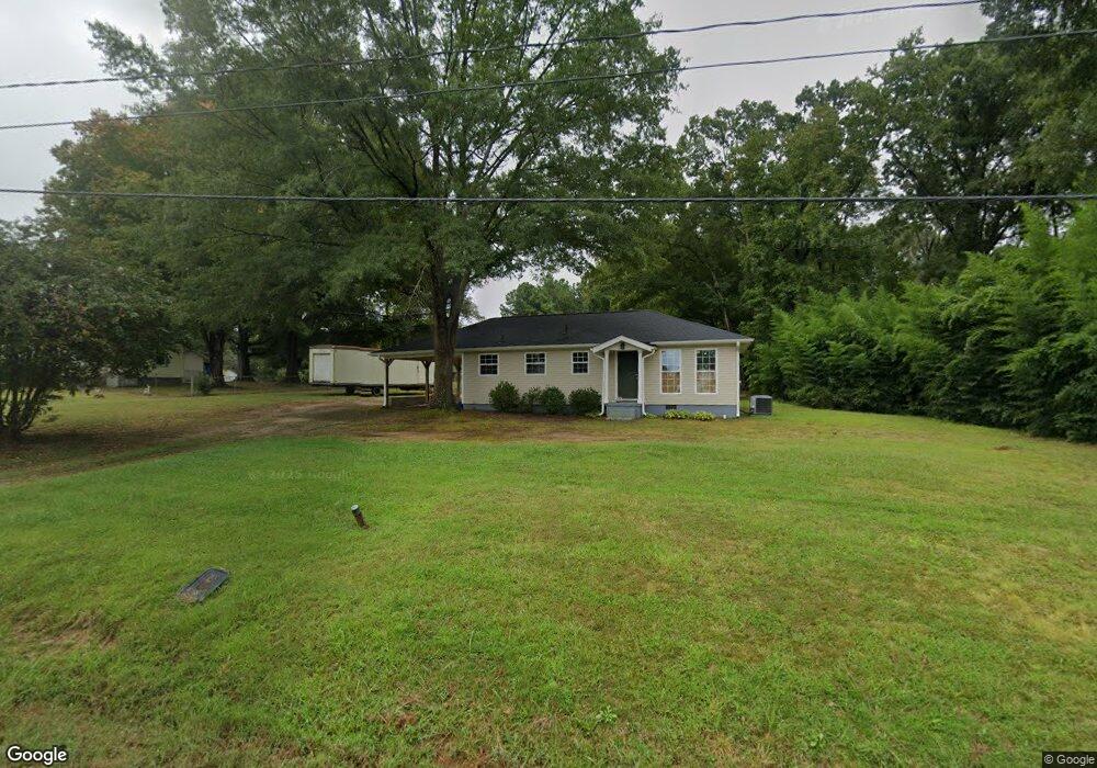
1211 Pennock Rd Durham, NC 27703
Eastern Durham NeighborhoodEstimated Value: $340,156 - $425,000
3
Beds
1
Bath
1,050
Sq Ft
$356/Sq Ft
Est. Value
About This Home
This home is located at 1211 Pennock Rd, Durham, NC 27703 and is currently estimated at $373,289, approximately $355 per square foot. 1211 Pennock Rd is a home located in Durham County with nearby schools including Spring Valley Elementary School, John W Neal Middle School, and Southern School of Energy & Sustainability.
Ownership History
Date
Name
Owned For
Owner Type
Purchase Details
Closed on
May 23, 2017
Sold by
Watlins Robin and Bendt Katherine
Bought by
Bendt Katharine
Current Estimated Value
Purchase Details
Closed on
Jun 4, 2007
Sold by
Chavez Erick O and Ordonez Gloria
Bought by
Watkins Robin and Bendt Katharine
Home Financials for this Owner
Home Financials are based on the most recent Mortgage that was taken out on this home.
Original Mortgage
$76,000
Outstanding Balance
$46,327
Interest Rate
6.12%
Mortgage Type
New Conventional
Estimated Equity
$326,962
Create a Home Valuation Report for This Property
The Home Valuation Report is an in-depth analysis detailing your home's value as well as a comparison with similar homes in the area
Home Values in the Area
Average Home Value in this Area
Purchase History
| Date | Buyer | Sale Price | Title Company |
|---|---|---|---|
| Bendt Katharine | -- | None Available | |
| Watkins Robin | $80,000 | None Available |
Source: Public Records
Mortgage History
| Date | Status | Borrower | Loan Amount |
|---|---|---|---|
| Open | Watkins Robin | $76,000 |
Source: Public Records
Tax History Compared to Growth
Tax History
| Year | Tax Paid | Tax Assessment Tax Assessment Total Assessment is a certain percentage of the fair market value that is determined by local assessors to be the total taxable value of land and additions on the property. | Land | Improvement |
|---|---|---|---|---|
| 2025 | $3,019 | $430,357 | $151,496 | $278,861 |
| 2024 | $1,941 | $182,119 | $57,143 | $124,976 |
| 2023 | $1,867 | $182,119 | $57,143 | $124,976 |
| 2022 | $1,810 | $182,119 | $57,143 | $124,976 |
| 2021 | $1,597 | $182,119 | $57,143 | $124,976 |
| 2020 | $1,561 | $182,119 | $57,143 | $124,976 |
| 2019 | $1,543 | $182,119 | $57,143 | $124,976 |
| 2018 | $1,074 | $116,355 | $36,251 | $80,104 |
| 2017 | $920 | $102,996 | $36,251 | $66,745 |
| 2016 | $891 | $102,996 | $36,251 | $66,745 |
| 2015 | $922 | $84,813 | $23,836 | $60,977 |
| 2014 | $926 | $84,813 | $23,836 | $60,977 |
Source: Public Records
Map
Nearby Homes
- 610 Sherron Rd
- 622 Sherron Rd
- 16 Vestrial Ln
- 1100 Constellation Cir
- 1104 Constellation Cir
- 1062 Constellation Cir
- 1010 Constellation Cir
- 1107 High Fox Dr
- 1017 Constellation Cir
- 148 Daneborg Rd
- Landrum III Plan at Stella View - Summit Collection
- Mayflower III Plan at Stella View - Summit Collection
- Coleman Plan at Stella View - Ardmore Collection
- Tryon III Plan at Stella View - Summit Collection
- 715 Southshore Pkwy
- 1307 Cosmic Dr
- 144 Daneborg Rd
- 1312 Cosmic Dr
- 615 Southshore Pkwy
- 1106 Constellation Cir
- 504 Broach Rd
- 512 Broach Rd
- 1217 Pennock Rd
- 516 Broach Rd
- 418 Broach Rd
- 1301 Pennock Rd
- 503 Broach Rd
- 513 Broach Rd
- 423 Broach Rd
- 1307 Pennock Rd
- 521 Broach Rd
- 604 Broach Rd
- 1112 Pennock Rd
- 603 Broach Rd
- 409 Broach Rd
- 1213 Mockingbird Ln
- 1312 Pennock Rd
- 608 Broach Rd
- 1221 Mockingbird Ln
- 1117 Mockingbird Ln