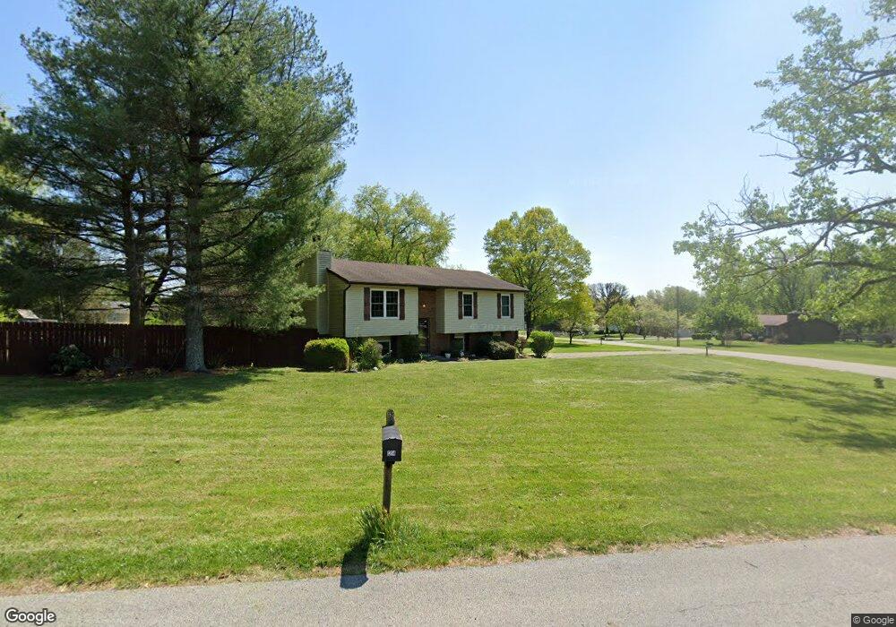
1212 Dant Dr Georgetown, IN 47122
Estimated Value: $294,000 - $313,000
3
Beds
3
Baths
2,086
Sq Ft
$146/Sq Ft
Est. Value
About This Home
This home is located at 1212 Dant Dr, Georgetown, IN 47122 and is currently estimated at $303,750, approximately $145 per square foot. 1212 Dant Dr is a home located in Floyd County with nearby schools including Georgetown Elementary School, Highland Hills Middle School, and Floyd Central High School.
Ownership History
Date
Name
Owned For
Owner Type
Purchase Details
Closed on
Aug 27, 2020
Sold by
Roman Elias and Roman Enrique
Bought by
Day John G and Day Heather L
Current Estimated Value
Home Financials for this Owner
Home Financials are based on the most recent Mortgage that was taken out on this home.
Original Mortgage
$145,000
Outstanding Balance
$128,678
Interest Rate
2.9%
Mortgage Type
New Conventional
Estimated Equity
$175,072
Purchase Details
Closed on
Mar 20, 2006
Sold by
Drake Roy D and Drake Karen D
Bought by
Roman Elias and Roman Enrique
Home Financials for this Owner
Home Financials are based on the most recent Mortgage that was taken out on this home.
Original Mortgage
$143,509
Interest Rate
6.38%
Mortgage Type
FHA
Create a Home Valuation Report for This Property
The Home Valuation Report is an in-depth analysis detailing your home's value as well as a comparison with similar homes in the area
Home Values in the Area
Average Home Value in this Area
Purchase History
| Date | Buyer | Sale Price | Title Company |
|---|---|---|---|
| Day John G | -- | None Available | |
| Roman Elias | -- | None Available |
Source: Public Records
Mortgage History
| Date | Status | Borrower | Loan Amount |
|---|---|---|---|
| Open | Day John G | $145,000 | |
| Previous Owner | Roman Elias | $143,509 |
Source: Public Records
Tax History
| Year | Tax Paid | Tax Assessment Tax Assessment Total Assessment is a certain percentage of the fair market value that is determined by local assessors to be the total taxable value of land and additions on the property. | Land | Improvement |
|---|---|---|---|---|
| 2024 | $1,146 | $150,800 | $25,100 | $125,700 |
| 2023 | $1,229 | $160,700 | $25,100 | $135,600 |
| 2022 | $1,326 | $162,500 | $25,100 | $137,400 |
| 2021 | $2,893 | $152,500 | $25,100 | $127,400 |
| 2020 | $960 | $129,000 | $25,100 | $103,900 |
| 2019 | $936 | $129,000 | $25,100 | $103,900 |
| 2018 | $979 | $136,700 | $25,100 | $111,600 |
| 2017 | $926 | $127,000 | $25,100 | $101,900 |
| 2016 | $853 | $125,800 | $25,100 | $100,700 |
| 2014 | $1,088 | $133,200 | $25,100 | $108,100 |
| 2013 | -- | $132,600 | $25,100 | $107,500 |
Source: Public Records
Map
Nearby Homes
- 2004 Peach Tree Ln
- 7014 Dylan Cir Unit Lot 406
- 1034 Brookstone Ct
- 1034 Oskin Dr Unit 204
- 8031 Hudson Ln
- 1040 Oskin Dr Unit 201
- 4046 Oakstone Dr
- 8026 Hudson Ln
- 1010 Brookstone Ct
- 3006 Zachary Trail
- 2022 Brookstone Way
- 8164- LOT 932 Zelpha Blvd
- 5006 Oakhill Ln
- 1213 Oakes Way
- 3074 Alonzo Smith Rd
- 3995 Edwardsville Galena Rd
- 6602 Iron Ct
- 6009 Springcrest Dr
- 7001 - LOT 971 Mitsch Ln
- 6614 State Road 64 Vacant Land
Your Personal Tour Guide
Ask me questions while you tour the home.