Estimated Value: $2,434,000 - $5,748,000
4
Beds
4
Baths
3,197
Sq Ft
$1,210/Sq Ft
Est. Value
About This Home
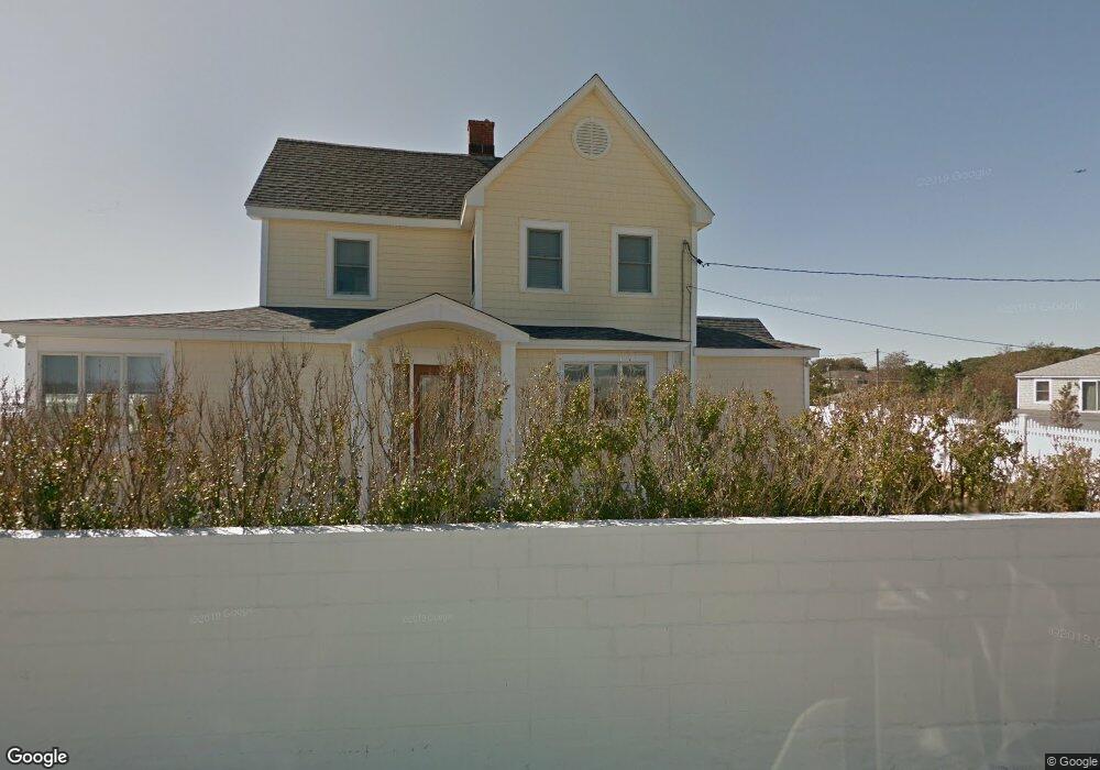
This home is located at 1212 Ocean Blvd, Rye, NH 03870 and is currently estimated at $3,869,175, approximately $1,210 per square foot. 1212 Ocean Blvd is a home located in Rockingham County with nearby schools including Rye Elementary School and Rye Junior High School.
Ownership History
Date
Name
Owned For
Owner Type
Purchase Details
Closed on
Feb 25, 2015
Sold by
Sharma Deepak
Bought by
Sharma Rockingham Rt and Sharma
Current Estimated Value
Purchase Details
Closed on
Jul 10, 2008
Sold by
Hamilton Michael S
Bought by
Sharma Deepak
Home Financials for this Owner
Home Financials are based on the most recent Mortgage that was taken out on this home.
Original Mortgage
$1,347,000
Interest Rate
6.13%
Mortgage Type
Purchase Money Mortgage
Create a Home Valuation Report for This Property
The Home Valuation Report is an in-depth analysis detailing your home's value as well as a comparison with similar homes in the area
Home Values in the Area
Average Home Value in this Area
Purchase History
| Date | Buyer | Sale Price | Title Company |
|---|---|---|---|
| Sharma Rockingham Rt | -- | -- | |
| Sharma Deepak | $1,550,000 | -- | |
| Sharma Rockingham Rt | -- | -- | |
| Sharma Deepak | $1,550,000 | -- |
Source: Public Records
Mortgage History
| Date | Status | Borrower | Loan Amount |
|---|---|---|---|
| Previous Owner | Sharma Deepak | $1,239,500 | |
| Previous Owner | Sharma Deepak | $1,347,000 |
Source: Public Records
Tax History
| Year | Tax Paid | Tax Assessment Tax Assessment Total Assessment is a certain percentage of the fair market value that is determined by local assessors to be the total taxable value of land and additions on the property. | Land | Improvement |
|---|---|---|---|---|
| 2024 | $30,037 | $3,468,500 | $2,829,000 | $639,500 |
| 2023 | $27,852 | $3,468,500 | $2,829,000 | $639,500 |
| 2022 | $24,210 | $3,468,500 | $2,829,000 | $639,500 |
| 2021 | $22,862 | $2,237,000 | $1,747,300 | $489,700 |
| 2020 | $22,862 | $2,237,000 | $1,747,300 | $489,700 |
| 2019 | $22,855 | $2,236,300 | $1,747,300 | $489,000 |
| 2018 | $22,609 | $2,236,300 | $1,747,300 | $489,000 |
| 2017 | $22,609 | $2,236,300 | $1,747,300 | $489,000 |
| 2016 | $20,292 | $1,900,000 | $1,411,900 | $488,100 |
| 2013 | $19,205 | $1,750,700 | $1,341,200 | $409,500 |
Source: Public Records
Map
Nearby Homes
- 1215 Ocean Blvd Unit 5
- 1193 Ocean Blvd
- 1191 - 1193 Ocean Blvd
- 137 Clark Rd
- 1591 Ocean Blvd
- 389 Sagamore Rd
- 46 Fowler Dr
- 763 Ocean Blvd
- 1643 Ocean Blvd
- 236 Sagamore Rd
- 267 Pioneer Rd
- 665 Wallis Rd Unit 2
- 14 Sagamore Rd Unit 3
- 4 Sagamore Rd
- 104 Odiorne Point Rd
- 239 Gosport Rd
- 1155 Sagamore Ave Unit 2
- 1155 Sagamore Ave Unit 3
- 1 Pheasant Ln
- 414 Springbrook Cir
- 1228 Ocean Blvd
- 1226 Ocean Blvd
- 1218 Ocean Blvd
- 1216 Ocean Blvd Unit 1216
- 1218 Ocean Blvd Unit 1218
- 1220 Ocean Blvd
- 1214 Ocean Blvd
- 1214 Ocean Blvd Unit 3
- 1220 Ocean Blvd Unit 2
- 1230 Ocean Blvd
- 1196 Ocean Blvd
- 1196 Ocean Blvd Unit 2
- 1232 Ocean Blvd
- 1200 Ocean Blvd
- 1210 Ocean Blvd
- 1210 Ocean Blvd Unit 3
- 1234 Ocean Blvd
- 1236 Ocean Blvd
- 1215 Ocean Blvd Unit 2
- 1215 Ocean Blvd Unit 4
Your Personal Tour Guide
Ask me questions while you tour the home.