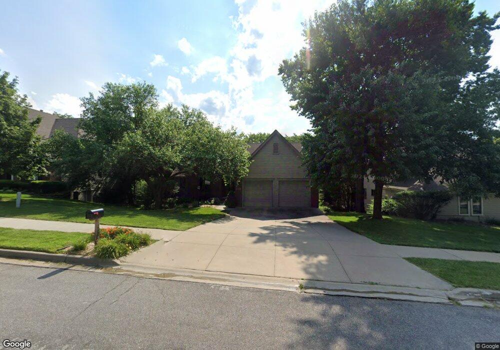
1212 Parkside Rd Lawrence, KS 66049
Perry Park NeighborhoodEstimated Value: $492,000 - $607,156
5
Beds
3
Baths
2,898
Sq Ft
$196/Sq Ft
Est. Value
About This Home
This home is located at 1212 Parkside Rd, Lawrence, KS 66049 and is currently estimated at $568,539, approximately $196 per square foot. 1212 Parkside Rd is a home located in Douglas County with nearby schools including Sunset Hill Elementary School, West Middle School, and Lawrence Free State High School.
Ownership History
Date
Name
Owned For
Owner Type
Purchase Details
Closed on
May 6, 2009
Sold by
Khosh Mehdi L and Yamakawa Tomomi
Bought by
Oakley Berl R and Oakley Christine E
Current Estimated Value
Purchase Details
Closed on
Jul 28, 2003
Sold by
Denning Santee Construction Co
Bought by
Khosh Mehdi L and Yamakawa Tomomi
Home Financials for this Owner
Home Financials are based on the most recent Mortgage that was taken out on this home.
Original Mortgage
$307,700
Interest Rate
5.19%
Mortgage Type
Purchase Money Mortgage
Create a Home Valuation Report for This Property
The Home Valuation Report is an in-depth analysis detailing your home's value as well as a comparison with similar homes in the area
Home Values in the Area
Average Home Value in this Area
Purchase History
| Date | Buyer | Sale Price | Title Company |
|---|---|---|---|
| Oakley Berl R | -- | Commerce Title | |
| Khosh Mehdi L | -- | Commerce Title |
Source: Public Records
Mortgage History
| Date | Status | Borrower | Loan Amount |
|---|---|---|---|
| Previous Owner | Khosh Mehdi L | $307,700 |
Source: Public Records
Tax History
| Year | Tax Paid | Tax Assessment Tax Assessment Total Assessment is a certain percentage of the fair market value that is determined by local assessors to be the total taxable value of land and additions on the property. | Land | Improvement |
|---|---|---|---|---|
| 2025 | $8,609 | $68,483 | $8,625 | $59,858 |
| 2024 | $8,019 | $63,848 | $7,475 | $56,373 |
| 2023 | $7,766 | $59,961 | $7,475 | $52,486 |
| 2022 | $7,083 | $54,361 | $7,475 | $46,886 |
| 2021 | $6,635 | $49,473 | $6,334 | $43,139 |
| 2020 | $6,402 | $47,989 | $6,334 | $41,655 |
| 2019 | $6,333 | $47,518 | $6,334 | $41,184 |
| 2018 | $6,343 | $47,248 | $6,334 | $40,914 |
| 2017 | $6,203 | $45,694 | $6,334 | $39,360 |
| 2016 | $5,932 | $45,643 | $5,753 | $39,890 |
| 2015 | $2,927 | $45,045 | $5,753 | $39,292 |
| 2014 | $2,892 | $44,942 | $5,753 | $39,189 |
Source: Public Records
Map
Nearby Homes
- 1039 Lakecrest Rd
- 3421 W 10th Place
- 1011 Lakecrest Rd
- 1215 Hacienda Ln
- 1405 Lawrence Ave Unit C
- 3916 Monterey Ct
- 904 Joseph Dr
- 916 Christie Ct
- 1503 Crossgate Dr
- 4013 Vintage Ct
- 904 Christie Ct
- 1628 Gleneagle St
- 1617 Alvamar Dr
- 912 Chalk Hill Ct
- 1300 Westbrooke St
- 709 Joseph Dr
- 1323 Westbrooke St
- 3902 Willshire Dr
- 1029 Eldridge St
- 3008 Westdale Place
- 1216 Parkside Rd
- 1208 Parkside Rd
- 1204 Parkside Rd
- 1220 Parkside Rd
- 1224 Parkside Rd
- 1164 Parkside Cir
- 1160 Parkside Cir
- 1309 Randall Rd
- 1156 Parkside Cir
- 1301 Randall Rd
- 1211 Randall Rd
- 1209 Randall Rd
- 1205 Randall Rd
- 1152 Parkside Cir
- 1126 Parkside Rd
- 1129 Parkside Cir
- 1201 Randall Rd
- 1304 Randall Rd
- 1148 Parkside Cir
- 1139 Randall Rd
Your Personal Tour Guide
Ask me questions while you tour the home.