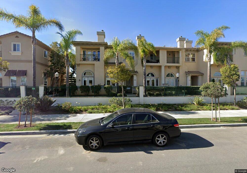
1213 Bayside Cir Oxnard, CA 93035
Channel Islands NeighborhoodEstimated Value: $750,000 - $909,000
3
Beds
2
Baths
1,844
Sq Ft
$449/Sq Ft
Est. Value
About This Home
This home is located at 1213 Bayside Cir, Oxnard, CA 93035 and is currently estimated at $828,190, approximately $449 per square foot. 1213 Bayside Cir is a home located in Ventura County with nearby schools including Christa Mcauliffe Elementary School and Oxnard High School.
Ownership History
Date
Name
Owned For
Owner Type
Purchase Details
Closed on
Jun 5, 2013
Sold by
Gastouniotis Constantine S and Gastouniotis Georgia
Bought by
Kimball Richard Doss and Madigan Kimball Patricia
Current Estimated Value
Purchase Details
Closed on
Nov 4, 2004
Sold by
Gastouniotis Constantine S and Gastouniotis Georgia
Bought by
Gastouniotis Constantine S and Gastouniotis Georgia
Purchase Details
Closed on
Sep 9, 2003
Sold by
Beazer Homes Holdings Corp
Bought by
Gastouniotis Constantine S and Gastouniotis Georgia
Home Financials for this Owner
Home Financials are based on the most recent Mortgage that was taken out on this home.
Original Mortgage
$322,700
Interest Rate
4.87%
Mortgage Type
Purchase Money Mortgage
Create a Home Valuation Report for This Property
The Home Valuation Report is an in-depth analysis detailing your home's value as well as a comparison with similar homes in the area
Home Values in the Area
Average Home Value in this Area
Purchase History
| Date | Buyer | Sale Price | Title Company |
|---|---|---|---|
| Kimball Richard Doss | $429,000 | Chicago Title Company | |
| Gastouniotis Constantine S | -- | -- | |
| Gastouniotis Constantine S | $458,000 | Fidelity National Title Co |
Source: Public Records
Mortgage History
| Date | Status | Borrower | Loan Amount |
|---|---|---|---|
| Previous Owner | Gastouniotis Constantine S | $322,700 |
Source: Public Records
Tax History
| Year | Tax Paid | Tax Assessment Tax Assessment Total Assessment is a certain percentage of the fair market value that is determined by local assessors to be the total taxable value of land and additions on the property. | Land | Improvement |
|---|---|---|---|---|
| 2025 | $8,773 | $512,710 | $128,168 | $384,542 |
| 2024 | $8,773 | $502,657 | $125,655 | $377,002 |
| 2023 | $8,478 | $492,801 | $123,191 | $369,610 |
| 2022 | $8,406 | $483,139 | $120,776 | $362,363 |
| 2021 | $8,289 | $473,666 | $118,408 | $355,258 |
| 2020 | $7,757 | $468,811 | $117,195 | $351,616 |
| 2019 | $8,307 | $459,620 | $114,898 | $344,722 |
| 2018 | $8,201 | $450,609 | $112,646 | $337,963 |
| 2017 | $7,983 | $441,775 | $110,438 | $331,337 |
| 2016 | $6,762 | $433,114 | $108,273 | $324,841 |
| 2015 | $7,400 | $426,610 | $106,648 | $319,962 |
| 2014 | $7,305 | $418,256 | $104,560 | $313,696 |
Source: Public Records
Map
Nearby Homes
- 4344 Tradewinds Dr
- 4312 Waterside Ln
- 1520 Viewpoint Dr
- 4234 Tradewinds Dr
- 1464 Twin Tides Place
- 1365 Donegal Way
- 1085 Canal St
- 1095 Canal St
- 4906 Dunes St
- 1423 Caspian Way
- 1729 Emerald Isle Way
- 1758 Emerald Isle Way
- 4114 Caribbean St
- 5003 Island View St
- 4901 Catamaran St
- 4625 Falkirk Bay
- 4060 Tradewinds Dr
- 4229 Harbour Island Ln
- 5040 Island View St
- 5120 Terramar Way
- 1215 Bayside Cir
- 1217 Bayside Cir
- 1217 Bayside Cir Unit 13
- 1211 Bayside Cir
- 1230 Bayside Cir
- 1239 Bayside Ln
- 1214 Bayside Cir
- 1216 Bayside Cir Unit 5
- 1210 Bayside Cir
- 1249 Bayside Ln
- 1234 Bayside Cir
- 1212 Bayside Cir
- 1259 Bayside Ln
- 1236 Bayside Cir
- 1206 Bayside Cir
- 1230 Bayside Ln
- 1225 Bayside Cir
- 1227 Bayside Cir
- 1231 Bayside Cir
- 1240 Bayside Cir
Your Personal Tour Guide
Ask me questions while you tour the home.