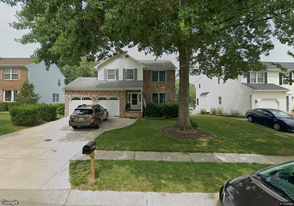
1213 Viking Dr N Arnold, MD 21012
Estimated Value: $661,000 - $742,000
--
Bed
3
Baths
1,994
Sq Ft
$351/Sq Ft
Est. Value
About This Home
This home is located at 1213 Viking Dr N, Arnold, MD 21012 and is currently estimated at $699,363, approximately $350 per square foot. 1213 Viking Dr N is a home located in Anne Arundel County with nearby schools including Broadneck Elementary School, Magothy River Middle School, and Broadneck High School.
Ownership History
Date
Name
Owned For
Owner Type
Purchase Details
Closed on
Feb 4, 2004
Sold by
Kvichak Thomas A
Bought by
Strayer Daryl J and Strayer Laura A
Current Estimated Value
Purchase Details
Closed on
May 12, 1994
Sold by
Foxmoor Associates Lp
Bought by
Kvichak Thomas A
Home Financials for this Owner
Home Financials are based on the most recent Mortgage that was taken out on this home.
Original Mortgage
$203,150
Interest Rate
7.93%
Create a Home Valuation Report for This Property
The Home Valuation Report is an in-depth analysis detailing your home's value as well as a comparison with similar homes in the area
Home Values in the Area
Average Home Value in this Area
Purchase History
| Date | Buyer | Sale Price | Title Company |
|---|---|---|---|
| Strayer Daryl J | $350,000 | -- | |
| Kvichak Thomas A | $218,024 | -- |
Source: Public Records
Mortgage History
| Date | Status | Borrower | Loan Amount |
|---|---|---|---|
| Previous Owner | Kvichak Thomas A | $203,150 | |
| Closed | Strayer Daryl J | -- |
Source: Public Records
Tax History Compared to Growth
Tax History
| Year | Tax Paid | Tax Assessment Tax Assessment Total Assessment is a certain percentage of the fair market value that is determined by local assessors to be the total taxable value of land and additions on the property. | Land | Improvement |
|---|---|---|---|---|
| 2025 | $4,603 | $507,167 | -- | -- |
| 2024 | $4,603 | $477,300 | $267,400 | $209,900 |
| 2023 | $4,016 | $474,033 | $0 | $0 |
| 2022 | $4,210 | $470,767 | $0 | $0 |
| 2021 | $8,286 | $467,500 | $267,400 | $200,100 |
| 2020 | $4,025 | $453,067 | $0 | $0 |
| 2019 | $3,950 | $438,633 | $0 | $0 |
| 2018 | $4,301 | $424,200 | $227,400 | $196,800 |
| 2017 | $3,718 | $420,667 | $0 | $0 |
| 2016 | -- | $417,133 | $0 | $0 |
| 2015 | -- | $413,600 | $0 | $0 |
| 2014 | -- | $411,000 | $0 | $0 |
Source: Public Records
Map
Nearby Homes
- 1256 Crowell Ct
- 400 Colonial Ridge Ln
- 1205 Farley Ct N
- 516 Norton Ln
- 1217 Springwood Ct
- 1215 Driftwood Ct
- 493 Colonial Ridge Ln
- 349 Candle Ridge Ct
- 515 Bay Hills Dr
- 478 Bay Green Dr
- 249 Overleaf Dr
- 618 Andrew Hill Rd
- 633 Andrew Hill Rd
- 507 Greenblades Ct
- 1180 Mosswood Ct
- 1182 Palmwood Ct
- 303 Ternwing Dr
- 33 Sheridan Rd
- 332 Carronade Way
- 1512 Winterberry Dr
- 1211 Viking Dr N
- 1217 Viking Dr N
- 1219 Viking Dr N
- 1209 Viking Dr N
- 1207 Viking Dr N
- 550 Norton Ln
- 548 Norton Ln
- 1215 Viking Dr N
- 552 Norton Ln
- 546 Norton Ln
- 546 Norton Ln Unit CORNER LOT
- 1205 Viking Dr N
- 1240 Viking Dr N
- 542 Norton Ln
- 1203 Viking Dr N
- 1208 Viking Dr N
- 1220 Viking Dr N
- 1218 Viking Dr N
- 1206 Viking Dr N
- 1210 Viking Dr N