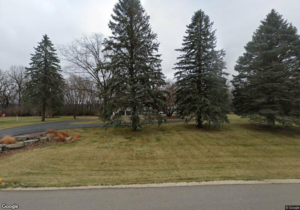
1214 E Weatherhill Dr SW Rochester, MN 55902
Estimated Value: $1,079,691 - $1,609,000
5
Beds
5
Baths
4,522
Sq Ft
$287/Sq Ft
Est. Value
About This Home
This home is located at 1214 E Weatherhill Dr SW, Rochester, MN 55902 and is currently estimated at $1,299,564, approximately $287 per square foot. 1214 E Weatherhill Dr SW is a home located in Olmsted County with nearby schools including Bamber Valley Elementary School, John Adams Middle School, and Mayo Senior High School.
Ownership History
Date
Name
Owned For
Owner Type
Purchase Details
Closed on
May 3, 2021
Sold by
Tabatabai Abbas
Bought by
Breen James P and Breen Linda K
Current Estimated Value
Home Financials for this Owner
Home Financials are based on the most recent Mortgage that was taken out on this home.
Original Mortgage
$60,000
Outstanding Balance
$45,425
Interest Rate
3.1%
Mortgage Type
New Conventional
Estimated Equity
$1,254,139
Purchase Details
Closed on
Jun 5, 2015
Sold by
Rose Steve H and Elliott Beth Ann
Bought by
Klaas James P and Klaas Kelsey M
Home Financials for this Owner
Home Financials are based on the most recent Mortgage that was taken out on this home.
Original Mortgage
$573,300
Interest Rate
3.82%
Mortgage Type
New Conventional
Create a Home Valuation Report for This Property
The Home Valuation Report is an in-depth analysis detailing your home's value as well as a comparison with similar homes in the area
Home Values in the Area
Average Home Value in this Area
Purchase History
| Date | Buyer | Sale Price | Title Company |
|---|---|---|---|
| Breen James P | $460,079 | Edina Realty Title Inc | |
| Klaas James P | $637,000 | Rochester Title |
Source: Public Records
Mortgage History
| Date | Status | Borrower | Loan Amount |
|---|---|---|---|
| Open | Breen James P | $60,000 | |
| Previous Owner | Klaas James P | $573,300 |
Source: Public Records
Tax History Compared to Growth
Tax History
| Year | Tax Paid | Tax Assessment Tax Assessment Total Assessment is a certain percentage of the fair market value that is determined by local assessors to be the total taxable value of land and additions on the property. | Land | Improvement |
|---|---|---|---|---|
| 2024 | $11,122 | $960,900 | $200,000 | $760,900 |
| 2023 | $9,892 | $934,700 | $200,000 | $734,700 |
| 2022 | $8,748 | $808,900 | $150,000 | $658,900 |
| 2021 | $8,342 | $750,800 | $150,000 | $600,800 |
| 2020 | $8,402 | $726,500 | $150,000 | $576,500 |
| 2019 | $7,652 | $693,900 | $125,000 | $568,900 |
| 2018 | $7,565 | $667,600 | $120,000 | $547,600 |
| 2017 | $7,662 | $635,000 | $120,000 | $515,000 |
| 2016 | $7,566 | $635,000 | $120,000 | $515,000 |
| 2015 | $7,190 | $618,700 | $120,000 | $498,700 |
| 2014 | $6,958 | $624,500 | $120,000 | $504,500 |
| 2012 | -- | $613,400 | $120,000 | $493,400 |
Source: Public Records
Map
Nearby Homes
- 1246 Meadowlark Ct SW
- 1500 Weatherhill Ridge Ct SW
- 1409 Weatherhill Ct SW
- 3942 Autumn Lake Ct SW
- 4063 Autumn Lake Ct SW
- 5240 8th St SW
- 4921 8th St SW
- 5192 8th St SW
- 5215 8th St SW
- 5185 8th St SW
- 1846 Mayowood Rd SW
- 795 Irvin Ln SW
- 5249 8th St SW
- 1822 Mayowood Rd SW
- 1835 Mayowood Rd SW
- 1851 Mayowood Ct SW
- 1798 Mayowood Rd SW
- 1787 Mayowood Rd SW
- 1782 Mayowood Ct SW
- 5650 Weatherhill Rd SW
- 1258 E Weatherhill Dr SW
- 1176 E Weatherhill Dr SW
- 1359 Westhill Dr SW
- 1393 Westhill Dr SW
- 1135 E Weatherhill Dr SW
- 1402 Weatherhill Ridge Ct SW
- 1315 Westhill Dr SW
- 1441 Westhill Dr SW
- 1277 Westhill Dr SW
- 1169 E Weatherhill Dr SW
- 1092 E Weatherhill Dr SW
- 1412 Weatherhill Ridge Ct SW
- 1249 Westhill Dr SW
- 1403 Weatherhill Ridge Ct SW
- 1358 Westhill Dr SW
- 4415 Valley Ct SW
- 1314 Westhill Dr SW
- 1440 Westhill Dr SW
- 4432 Oak Ct SW
- 1407 Weatherhill Ridge Ct SW
