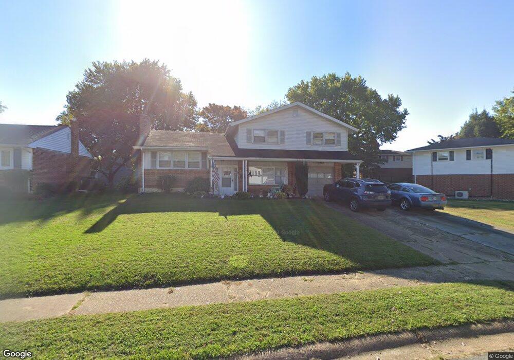
1214 Pecksniff Rd Wilmington, DE 19808
Marshallton NeighborhoodEstimated Value: $357,000 - $441,000
4
Beds
2
Baths
1,304
Sq Ft
$317/Sq Ft
Est. Value
About This Home
This home is located at 1214 Pecksniff Rd, Wilmington, DE 19808 and is currently estimated at $413,759, approximately $317 per square foot. 1214 Pecksniff Rd is a home located in New Castle County with nearby schools including Heritage Elementary School, Skyline Middle School, and Thomas McKean High School.
Ownership History
Date
Name
Owned For
Owner Type
Purchase Details
Closed on
Sep 14, 2022
Sold by
Jeanette Kubler-Ross
Bought by
Stapleton Norma Ann
Current Estimated Value
Home Financials for this Owner
Home Financials are based on the most recent Mortgage that was taken out on this home.
Original Mortgage
$284,747
Outstanding Balance
$271,779
Interest Rate
5.13%
Mortgage Type
FHA
Estimated Equity
$141,980
Purchase Details
Closed on
Jul 31, 2009
Sold by
Lex Stephen
Bought by
Lex Jeanette and Kubler Ross Jeanette
Create a Home Valuation Report for This Property
The Home Valuation Report is an in-depth analysis detailing your home's value as well as a comparison with similar homes in the area
Home Values in the Area
Average Home Value in this Area
Purchase History
| Date | Buyer | Sale Price | Title Company |
|---|---|---|---|
| Stapleton Norma Ann | -- | -- | |
| Lex Jeanette | -- | None Available |
Source: Public Records
Mortgage History
| Date | Status | Borrower | Loan Amount |
|---|---|---|---|
| Open | Stapleton Norma Ann | $284,747 |
Source: Public Records
Tax History
| Year | Tax Paid | Tax Assessment Tax Assessment Total Assessment is a certain percentage of the fair market value that is determined by local assessors to be the total taxable value of land and additions on the property. | Land | Improvement |
|---|---|---|---|---|
| 2024 | $2,693 | $70,300 | $12,200 | $58,100 |
| 2023 | $2,389 | $70,300 | $12,200 | $58,100 |
| 2022 | $2,402 | $70,300 | $12,200 | $58,100 |
| 2021 | $2,399 | $70,300 | $12,200 | $58,100 |
| 2020 | $2,400 | $70,300 | $12,200 | $58,100 |
| 2019 | $2,551 | $70,300 | $12,200 | $58,100 |
| 2018 | $2,358 | $70,300 | $12,200 | $58,100 |
| 2017 | $2,330 | $70,300 | $12,200 | $58,100 |
| 2016 | $2,216 | $70,300 | $12,200 | $58,100 |
| 2015 | $2,083 | $70,300 | $12,200 | $58,100 |
| 2014 | $1,935 | $70,300 | $12,200 | $58,100 |
Source: Public Records
Map
Nearby Homes
- 1215 Milltown Rd
- 2623 Bardell Dr
- 2430 Nicholby Dr
- 1 Kenleigh Ct
- 2407 Mccawber Dr
- 2406 Limestone Rd
- 2413 Darnay Ln
- 2308 Belford Dr
- 222 Barberry Dr
- 2109 Nicholby Dr
- 618 Dandenog Dr
- 703 Sweetleaf Dr
- 2621 Stephenson Dr
- 5008 E Woodmill Dr
- 14 Whitekirk Dr
- 2503A Duncan Rd
- 5073 E Woodmill Dr
- 2738 Barnsley Rd
- 233 Cayman Ct
- 19 Whitekirk Dr
- 1212 Pecksniff Rd
- 1216 Pecksniff Rd
- 2721 Westlock Dr
- 1210 Pecksniff Rd
- 1215 Highgate Rd
- 1217 Highgate Rd
- 1213 Highgate Rd
- 1215 Pecksniff Rd
- 1208 Pecksniff Rd
- 1219 Highgate Rd
- 1213 Pecksniff Rd
- 1217 Pecksniff Rd
- 1211 Highgate Rd
- 1211 Pecksniff Rd
- 1219 Pecksniff Rd
- 1206 Pecksniff Rd
- 1209 Highgate Rd
- 1218 Pecksniff Rd
- 1209 Pecksniff Rd
- 1221 Pecksniff Rd
Your Personal Tour Guide
Ask me questions while you tour the home.