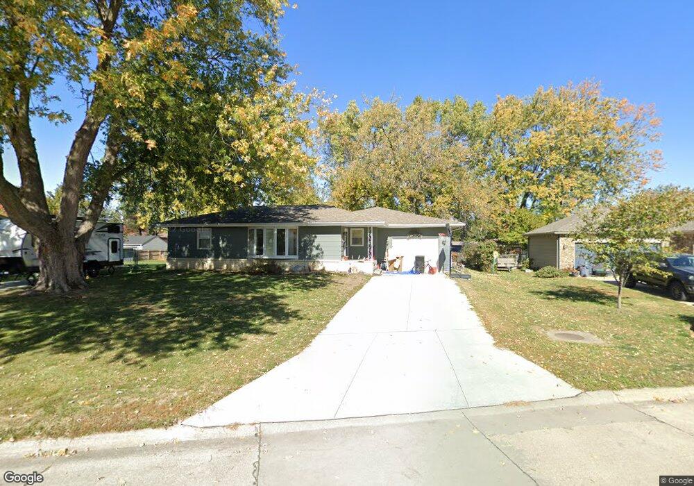
1214 S 10th Ave E Newton, IA 50208
Estimated Value: $208,000 - $227,000
3
Beds
4
Baths
1,206
Sq Ft
$178/Sq Ft
Est. Value
About This Home
This home is located at 1214 S 10th Ave E, Newton, IA 50208 and is currently estimated at $214,660, approximately $177 per square foot. 1214 S 10th Ave E is a home located in Jasper County with nearby schools including Berg Middle School, Newton Senior High School, and Newton Christian School.
Ownership History
Date
Name
Owned For
Owner Type
Purchase Details
Closed on
Jul 20, 2023
Sold by
Johnson David Wayne
Bought by
Johnson Kayla Renee Dougla
Current Estimated Value
Purchase Details
Closed on
Jan 3, 2019
Sold by
Muir Betty A
Bought by
Muir James S
Home Financials for this Owner
Home Financials are based on the most recent Mortgage that was taken out on this home.
Original Mortgage
$68,732
Interest Rate
5.25%
Mortgage Type
FHA
Create a Home Valuation Report for This Property
The Home Valuation Report is an in-depth analysis detailing your home's value as well as a comparison with similar homes in the area
Home Values in the Area
Average Home Value in this Area
Purchase History
| Date | Buyer | Sale Price | Title Company |
|---|---|---|---|
| Johnson Kayla Renee Dougla | -- | None Listed On Document | |
| Muir James S | -- | -- |
Source: Public Records
Mortgage History
| Date | Status | Borrower | Loan Amount |
|---|---|---|---|
| Previous Owner | Muir James S | $68,732 |
Source: Public Records
Tax History
| Year | Tax Paid | Tax Assessment Tax Assessment Total Assessment is a certain percentage of the fair market value that is determined by local assessors to be the total taxable value of land and additions on the property. | Land | Improvement |
|---|---|---|---|---|
| 2025 | $3,228 | $188,600 | $36,300 | $152,300 |
| 2024 | $3,228 | $170,380 | $36,300 | $134,080 |
| 2023 | $3,012 | $170,380 | $36,300 | $134,080 |
| 2022 | $2,850 | $147,420 | $36,300 | $111,120 |
| 2021 | $2,448 | $137,050 | $36,300 | $100,750 |
| 2020 | $2,448 | $113,000 | $30,260 | $82,740 |
| 2019 | $2,434 | $112,580 | $0 | $0 |
| 2018 | $2,434 | $112,580 | $0 | $0 |
| 2017 | $2,436 | $112,580 | $0 | $0 |
| 2016 | $2,436 | $112,580 | $0 | $0 |
| 2015 | $2,372 | $112,580 | $0 | $0 |
| 2014 | $2,282 | $112,580 | $0 | $0 |
Source: Public Records
Map
Nearby Homes
- 824 & 820 E 12th St S
- 903 E 14th St S
- 904 E 14th St S
- 808 E 14th St S
- 502 E 12th St S
- 940 E 8th St S
- 709 E 9th St S
- 606 E 9th St S
- 1609 S 12th Ave E
- 416 E 12th St S
- 601 E 9th St S
- 400 E 10th St S
- 717 S 5th Ave E
- 309 E 10th St S
- 1306 E 6th St S
- 512 E 19th St S
- 321 E 8th St S
- 724 S 4th Ave E
- 1220 1st Ave E
- 431 S 6th Ave E
- 1210 S 10th Ave E
- 1220 S 10th Ave E
- 1204 S 10th Ave E
- 1229 S 9th Ave E
- 1225 S 9th Ave E
- 1301 S 10th Ave E
- 1235 S 9th Ave E
- 1217 S 10th Ave E
- 1303 S 9th Ave E
- 1306 S 10th Ave E
- 900 E 12th St S
- 1311 S 9th Ave E
- 1305 S 10th Ave E
- 1315 S 9th Ave E
- 1310 S 10th Ave E
- 1309 S 10th Ave E
- 1218 S 11th Ave E
- 1234 S 9th Ave E
- 1000 E 12th St S
- 1319 S 9th Ave E
Your Personal Tour Guide
Ask me questions while you tour the home.