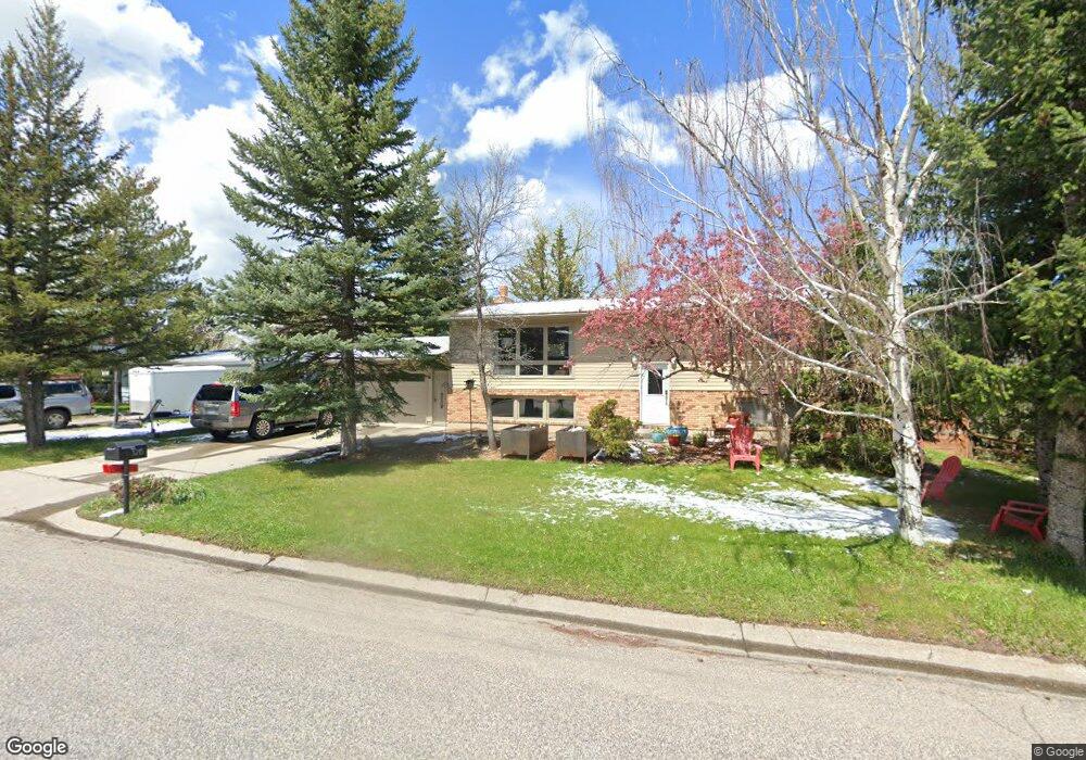
1215 Cherry Dr Bozeman, MT 59715
East Bozeman NeighborhoodEstimated Value: $770,371 - $813,000
4
Beds
2
Baths
1,118
Sq Ft
$710/Sq Ft
Est. Value
About This Home
This home is located at 1215 Cherry Dr, Bozeman, MT 59715 and is currently estimated at $793,343, approximately $709 per square foot. 1215 Cherry Dr is a home located in Gallatin County with nearby schools including Longfellow School, Sacajawea Middle School, and Bozeman High School.
Ownership History
Date
Name
Owned For
Owner Type
Purchase Details
Closed on
Oct 29, 2010
Sold by
Roughton Jane T and Racster Marc
Bought by
Rolland Steven and Rolland Kara L
Current Estimated Value
Home Financials for this Owner
Home Financials are based on the most recent Mortgage that was taken out on this home.
Original Mortgage
$207,056
Outstanding Balance
$136,473
Interest Rate
4.25%
Mortgage Type
FHA
Estimated Equity
$656,870
Create a Home Valuation Report for This Property
The Home Valuation Report is an in-depth analysis detailing your home's value as well as a comparison with similar homes in the area
Home Values in the Area
Average Home Value in this Area
Purchase History
| Date | Buyer | Sale Price | Title Company |
|---|---|---|---|
| Rolland Steven | -- | Security Title Company |
Source: Public Records
Mortgage History
| Date | Status | Borrower | Loan Amount |
|---|---|---|---|
| Open | Rolland Steven | $207,056 |
Source: Public Records
Tax History
| Year | Tax Paid | Tax Assessment Tax Assessment Total Assessment is a certain percentage of the fair market value that is determined by local assessors to be the total taxable value of land and additions on the property. | Land | Improvement |
|---|---|---|---|---|
| 2025 | $3,542 | $758,000 | $0 | $0 |
| 2024 | $4,239 | $636,800 | $0 | $0 |
| 2023 | $4,097 | $636,800 | $0 | $0 |
| 2022 | $3,593 | $468,600 | $0 | $0 |
| 2021 | $3,965 | $468,600 | $0 | $0 |
| 2020 | $3,352 | $392,800 | $0 | $0 |
| 2019 | $3,365 | $385,500 | $0 | $0 |
| 2018 | $3,102 | $329,300 | $0 | $0 |
| 2017 | $3,070 | $329,300 | $0 | $0 |
| 2016 | $2,468 | $261,800 | $0 | $0 |
| 2015 | $2,471 | $261,800 | $0 | $0 |
| 2014 | $2,485 | $154,972 | $0 | $0 |
Source: Public Records
Map
Nearby Homes
- 1103 S Pinecrest Dr
- 1109 E Kagy Blvd
- TBD - Lot 18 Boreal Way
- 131 Erik Dr
- 102 Hoffman Dr Unit 1
- 1918 Spring Creek Dr
- 1918 & TBD Spring Creek Dr
- 1914 Spring Creek Dr
- TBD Spring Creek Dr
- 125 Blossom Way
- 101 Painted Ridge Rd
- TBD Lot 17 Boreal Way
- 101 Painted Ridge
- 145 Blossom Way
- 1964 Little Cottage Ln
- 2516 Spring Creek Dr
- 815 Alpine Way
- 405 Ice Pond Rd
- 719 S Church Ave
- 3751 Sourdough Rd
- 1209 Cherry Dr
- 1221 Cherry Dr
- 1203 Cherry Dr
- 1227 Cherry Dr
- 1220 Cherry Dr
- 1214 Cherry Dr
- 1210 Cherry Dr
- 1222 Cherry Dr
- 1204 S Spruce Dr
- 1202 S Spruce Dr
- 1303 Cherry Dr
- 1204 Cherry Dr
- 1145 Cherry Dr
- 1206 S Spruce Dr
- 1146 S Spruce Dr
- 1146 Cherry Dr
- 1208 S Spruce Dr
- 1209 E Kagy Blvd
- 1139 Cherry Dr
- 1307 Cherry Dr
Your Personal Tour Guide
Ask me questions while you tour the home.