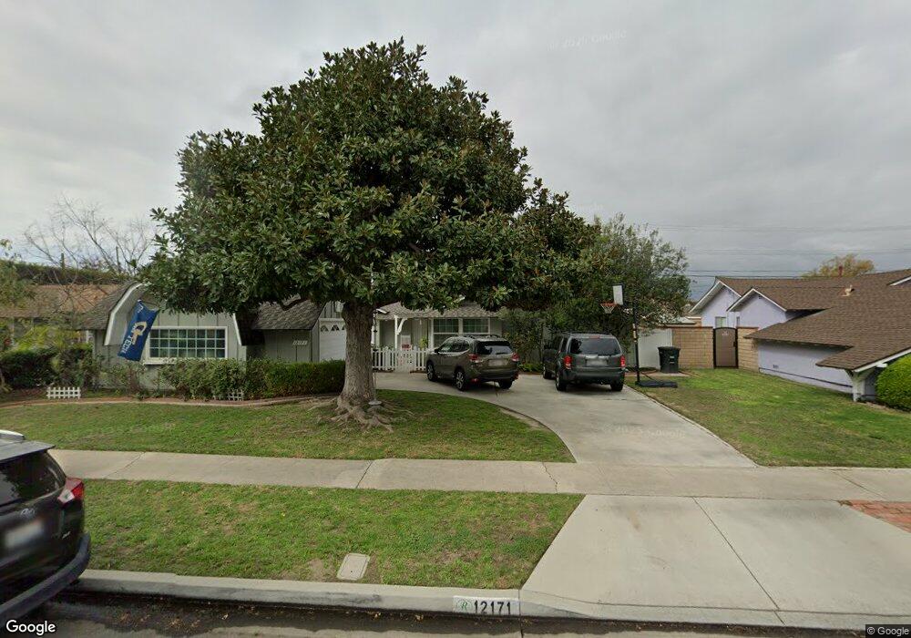
12171 Foster Rd Los Alamitos, CA 90720
Rossmoor NeighborhoodEstimated Value: $1,343,625 - $1,542,000
3
Beds
2
Baths
1,622
Sq Ft
$900/Sq Ft
Est. Value
About This Home
This home is located at 12171 Foster Rd, Los Alamitos, CA 90720 and is currently estimated at $1,459,906, approximately $900 per square foot. 12171 Foster Rd is a home located in Orange County with nearby schools including Jack L. Weaver Elementary School, Richard Henry Lee Elementary School, and Oak Middle School.
Ownership History
Date
Name
Owned For
Owner Type
Purchase Details
Closed on
Nov 9, 1993
Sold by
Sullivan John L and Sullivan Teresa R
Bought by
Sullivan John L and Sullivan Teresa R
Current Estimated Value
Home Financials for this Owner
Home Financials are based on the most recent Mortgage that was taken out on this home.
Original Mortgage
$146,000
Interest Rate
6.88%
Purchase Details
Closed on
Nov 5, 1993
Sold by
Sullivan John L and Sullivan Teresa R
Bought by
Sullivan John L and Sullivan Teresa R
Home Financials for this Owner
Home Financials are based on the most recent Mortgage that was taken out on this home.
Original Mortgage
$146,000
Interest Rate
6.88%
Create a Home Valuation Report for This Property
The Home Valuation Report is an in-depth analysis detailing your home's value as well as a comparison with similar homes in the area
Home Values in the Area
Average Home Value in this Area
Purchase History
| Date | Buyer | Sale Price | Title Company |
|---|---|---|---|
| Sullivan John L | -- | South Coast Title Company | |
| Sullivan John L | -- | South Coast Title Company |
Source: Public Records
Mortgage History
| Date | Status | Borrower | Loan Amount |
|---|---|---|---|
| Previous Owner | Sullivan John L | $146,000 |
Source: Public Records
Tax History Compared to Growth
Tax History
| Year | Tax Paid | Tax Assessment Tax Assessment Total Assessment is a certain percentage of the fair market value that is determined by local assessors to be the total taxable value of land and additions on the property. | Land | Improvement |
|---|---|---|---|---|
| 2025 | $4,498 | $355,320 | $242,921 | $112,399 |
| 2024 | $4,498 | $348,353 | $238,157 | $110,196 |
| 2023 | $4,390 | $341,523 | $233,487 | $108,036 |
| 2022 | $4,363 | $334,827 | $228,909 | $105,918 |
| 2021 | $4,268 | $328,262 | $224,420 | $103,842 |
| 2020 | $4,273 | $324,897 | $222,119 | $102,778 |
| 2019 | $4,191 | $318,527 | $217,764 | $100,763 |
| 2018 | $4,037 | $312,282 | $213,494 | $98,788 |
| 2017 | $3,953 | $306,159 | $209,308 | $96,851 |
| 2016 | $3,878 | $300,156 | $205,204 | $94,952 |
| 2015 | $3,856 | $295,648 | $202,122 | $93,526 |
| 2014 | $3,728 | $289,857 | $198,163 | $91,694 |
Source: Public Records
Map
Nearby Homes
- 2872 Aceca Dr
- 2762 Engel Dr
- 12452 Martha Ann Dr
- 12300 Montecito Rd Unit 13
- 12200 Montecito Rd Unit K201
- 12200 Montecito Rd
- 12200 Montecito Rd Unit A205
- 12200 Montecito Rd Unit C103
- 12100 Montecito Rd Unit 49
- 12400 Montecito Rd Unit 417
- 12400 Montecito Rd Unit 222
- 3232 Brimhall Dr
- 12584 Montecito Rd Unit 5
- 3272 Saint Albans Dr
- 7100 E Atherton Dr
- 12725 Martha Ann Dr
- 5006 Belmont Ln
- 3342 Bradbury Rd Unit 34
- 6038 Derby Ln
- 3362 Saint Albans Dr
- 12181 Foster Rd
- 12152 Argyle Dr
- 2792 Woodstock Rd
- 12141 Foster Rd
- 12201 Foster Rd
- 2801 Kempton Dr
- 12172 Foster Rd
- 12142 Argyle Dr
- 12182 Foster Rd
- 12152 Foster Rd
- 2791 Kempton Dr
- 12131 Foster Rd
- 12142 Foster Rd
- 12202 Foster Rd
- 12132 Argyle Dr
- 2781 Kempton Dr
- 12132 Foster Rd
- 12171 Christy Ln
- 12121 Foster Rd
- 12181 Christy Ln