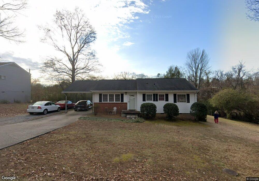
1218 Echo Dr Hixson, TN 37343
Dupont NeighborhoodEstimated Value: $237,000 - $274,000
Studio
1
Bath
1,336
Sq Ft
$192/Sq Ft
Est. Value
About This Home
This home is located at 1218 Echo Dr, Hixson, TN 37343 and is currently estimated at $257,029, approximately $192 per square foot. 1218 Echo Dr is a home located in Hamilton County with nearby schools including DuPont Elementary School, Hixson Middle School, and Hixson High School.
Ownership History
Date
Name
Owned For
Owner Type
Purchase Details
Closed on
Oct 27, 2003
Sold by
Card Dan E and Card Linda G
Bought by
Griffin Cheryl Diane
Current Estimated Value
Home Financials for this Owner
Home Financials are based on the most recent Mortgage that was taken out on this home.
Original Mortgage
$85,350
Outstanding Balance
$38,385
Interest Rate
6.03%
Mortgage Type
Purchase Money Mortgage
Estimated Equity
$218,644
Purchase Details
Closed on
Feb 3, 1999
Sold by
Card Dan E Tr
Bought by
Card Dan E and Card Linda G
Create a Home Valuation Report for This Property
The Home Valuation Report is an in-depth analysis detailing your home's value as well as a comparison with similar homes in the area
Home Values in the Area
Average Home Value in this Area
Purchase History
| Date | Buyer | Sale Price | Title Company |
|---|---|---|---|
| Griffin Cheryl Diane | $88,000 | -- | |
| Card Dan E | -- | -- |
Source: Public Records
Mortgage History
| Date | Status | Borrower | Loan Amount |
|---|---|---|---|
| Open | Griffin Cheryl Diane | $85,350 |
Source: Public Records
Tax History
| Year | Tax Paid | Tax Assessment Tax Assessment Total Assessment is a certain percentage of the fair market value that is determined by local assessors to be the total taxable value of land and additions on the property. | Land | Improvement |
|---|---|---|---|---|
| 2025 | $1,084 | $71,500 | $0 | $0 |
| 2024 | $728 | $32,525 | $0 | $0 |
| 2023 | $728 | $32,525 | $0 | $0 |
| 2022 | $728 | $32,525 | $0 | $0 |
| 2021 | $728 | $32,525 | $0 | $0 |
| 2020 | $774 | $27,975 | $0 | $0 |
| 2019 | $774 | $27,975 | $0 | $0 |
| 2018 | $763 | $27,975 | $0 | $0 |
| 2017 | $774 | $27,975 | $0 | $0 |
| 2016 | $758 | $0 | $0 | $0 |
| 2015 | $1,506 | $27,400 | $0 | $0 |
| 2014 | $1,506 | $0 | $0 | $0 |
Source: Public Records
Map
Nearby Homes
- 1218 Cranbrook Dr
- 1512 Ely Rd
- 1415 Highland Way
- 1416 Highland Way
- 1315 Northgate Cir
- 4326 Comet Trail
- 4703 Clover Ln
- 4705 Clover Ln
- 1705 Bagwell Ave
- 1636 Green Hill Dr
- 1313 Michael Ln
- 961 Ashland Terrace
- 4607 Cloverdale Loop
- 4609 Plaza Hills Ln
- 936 Sherry Cir
- 810 Forest Dale Ln
- 3914 Memphis Dr
- 3956 Fairfax Dr
- 3944 Azalean Dr
- 3609 Forest Highland Dr
Your Personal Tour Guide
Ask me questions while you tour the home.