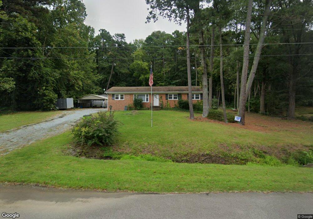
1218 Horseshoe Rd Durham, NC 27703
Eastern Durham NeighborhoodEstimated Value: $270,723 - $333,000
3
Beds
1
Bath
1,382
Sq Ft
$220/Sq Ft
Est. Value
About This Home
This home is located at 1218 Horseshoe Rd, Durham, NC 27703 and is currently estimated at $303,431, approximately $219 per square foot. 1218 Horseshoe Rd is a home located in Durham County with nearby schools including Bethesda Elementary School, John W Neal Middle School, and Southern School of Energy & Sustainability.
Ownership History
Date
Name
Owned For
Owner Type
Purchase Details
Closed on
May 24, 2007
Sold by
Edwards Marsha T
Bought by
Edwards William Eugene
Current Estimated Value
Home Financials for this Owner
Home Financials are based on the most recent Mortgage that was taken out on this home.
Original Mortgage
$132,000
Outstanding Balance
$80,248
Interest Rate
6.16%
Mortgage Type
Purchase Money Mortgage
Estimated Equity
$223,183
Create a Home Valuation Report for This Property
The Home Valuation Report is an in-depth analysis detailing your home's value as well as a comparison with similar homes in the area
Home Values in the Area
Average Home Value in this Area
Purchase History
| Date | Buyer | Sale Price | Title Company |
|---|---|---|---|
| Edwards William Eugene | -- | None Available |
Source: Public Records
Mortgage History
| Date | Status | Borrower | Loan Amount |
|---|---|---|---|
| Open | Edwards William Eugene | $132,000 |
Source: Public Records
Tax History Compared to Growth
Tax History
| Year | Tax Paid | Tax Assessment Tax Assessment Total Assessment is a certain percentage of the fair market value that is determined by local assessors to be the total taxable value of land and additions on the property. | Land | Improvement |
|---|---|---|---|---|
| 2025 | $2,509 | $335,307 | $116,200 | $219,107 |
| 2024 | $1,691 | $146,555 | $33,260 | $113,295 |
| 2023 | $1,612 | $146,555 | $33,260 | $113,295 |
| 2022 | $1,546 | $146,555 | $33,260 | $113,295 |
| 2021 | $1,285 | $146,555 | $33,260 | $113,295 |
| 2020 | $1,256 | $146,555 | $33,260 | $113,295 |
| 2019 | $1,241 | $146,555 | $33,260 | $113,295 |
| 2018 | $1,206 | $130,701 | $33,260 | $97,441 |
| 2017 | $1,167 | $130,701 | $33,260 | $97,441 |
| 2016 | $1,131 | $130,701 | $33,260 | $97,441 |
| 2015 | $1,304 | $126,233 | $23,325 | $102,908 |
| 2014 | $1,311 | $126,233 | $23,325 | $102,908 |
Source: Public Records
Map
Nearby Homes
- 335 Pleasant Dr
- 1218 Kendall Dr
- 806 Kendall Dr
- 1030 Thoughtful Spot Ln
- 1006 Spacious Skies Ln
- 519 Pleasant Dr
- 2072 Tanners Mill Dr
- 2036 October Dr
- 3211 Ivey Wood Ln
- 1015 Sora Way
- 1525 S Mineral Springs Rd
- 3459 Delmar Dr
- 3308 Opal Dr
- 3302 Opal Dr
- 3533 Gibson Rd
- 3309 Delmar Dr
- 3313 Delmar Dr
- 3457 Delmar Dr
- 2213 Mica Ridge Ln
- 3317 Delmar Dr
- 1216 Horseshoe Rd
- 231 Pleasant Dr
- 0 Horseshoe Rd
- LOT 52 Horseshoe Rd
- 301 Pleasant Dr
- 1221 Horseshoe Rd
- 1221 Horseshoe Rd
- 1214 Horseshoe Rd
- 1214 Horseshoe Rd
- 305 Pleasant Dr
- 225 Pleasant Dr
- 1217 Horseshoe Rd
- 1120 Horseshoe Rd
- 1210 Horseshoe Rd
- 306 Pleasant Dr
- 1126 Horseshoe Rd
- 234 Pleasant Dr
- 1204 Horseshoe Rd
- 226 Pleasant Dr
- 1204 Horseshoe Rd