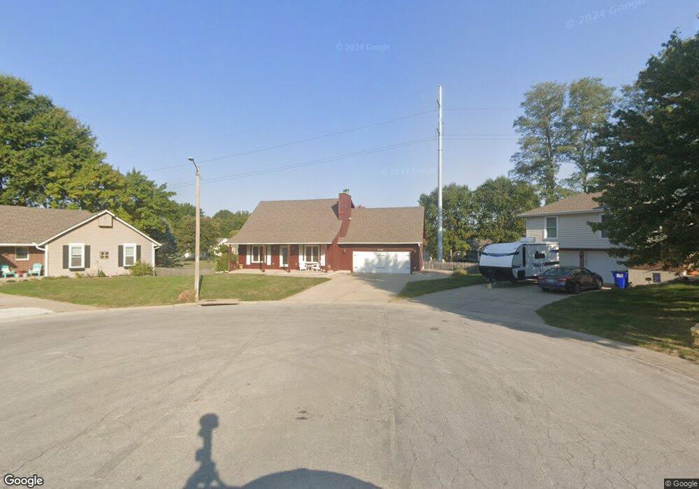
1219 NE Banner Ct Lees Summit, MO 64086
Estimated Value: $326,000 - $357,000
4
Beds
3
Baths
1,632
Sq Ft
$208/Sq Ft
Est. Value
About This Home
This home is located at 1219 NE Banner Ct, Lees Summit, MO 64086 and is currently estimated at $339,534, approximately $208 per square foot. 1219 NE Banner Ct is a home located in Jackson County with nearby schools including Underwood Elementary School, Bernard C. Campbell Middle School, and Lee's Summit North High School.
Ownership History
Date
Name
Owned For
Owner Type
Purchase Details
Closed on
Jul 1, 2024
Sold by
Iseman Ralph J and Iseman Julie L
Bought by
Iseman Andrew James
Current Estimated Value
Home Financials for this Owner
Home Financials are based on the most recent Mortgage that was taken out on this home.
Original Mortgage
$176,000
Outstanding Balance
$173,878
Interest Rate
6.94%
Mortgage Type
New Conventional
Estimated Equity
$165,656
Create a Home Valuation Report for This Property
The Home Valuation Report is an in-depth analysis detailing your home's value as well as a comparison with similar homes in the area
Home Values in the Area
Average Home Value in this Area
Purchase History
| Date | Buyer | Sale Price | Title Company |
|---|---|---|---|
| Iseman Andrew James | -- | Prestige Land Title Llc |
Source: Public Records
Mortgage History
| Date | Status | Borrower | Loan Amount |
|---|---|---|---|
| Open | Iseman Andrew James | $176,000 |
Source: Public Records
Tax History
| Year | Tax Paid | Tax Assessment Tax Assessment Total Assessment is a certain percentage of the fair market value that is determined by local assessors to be the total taxable value of land and additions on the property. | Land | Improvement |
|---|---|---|---|---|
| 2025 | $3,342 | $47,741 | $7,174 | $40,567 |
| 2024 | $3,318 | $46,284 | $7,182 | $39,102 |
| 2023 | $3,318 | $46,284 | $7,406 | $38,878 |
| 2022 | $2,914 | $36,100 | $6,631 | $29,469 |
| 2021 | $2,975 | $36,100 | $6,631 | $29,469 |
| 2020 | $2,806 | $33,729 | $6,631 | $27,098 |
| 2019 | $2,730 | $33,729 | $6,631 | $27,098 |
| 2018 | $986,694 | $31,688 | $4,634 | $27,054 |
| 2017 | $2,764 | $31,688 | $4,634 | $27,054 |
| 2016 | $2,722 | $30,894 | $4,826 | $26,068 |
Source: Public Records
Map
Nearby Homes
- 1118 NE Deerbrook Terrace
- 1213 NE Ball Dr
- 1141 NE Hunters Ridge
- 1133 NE Mulberry St
- 1401 NE Ernest Way
- 1541 NE Neawanna Dr
- 1104 NE Country Ln
- 812 NE Mulberry St
- 1490 NE Independence Ave
- 809 NE Cedar St
- 717 NE Mulberry St
- 718 NE Mulberry St
- 1108 NE Colleen Dr
- 1300 NE Browning Ln
- 905 NE Country Ln
- 1345 NE Foxwood Dr
- 1708 NE Balboa St
- 816 NE Pollard St
- 1700 NE Bluff St
- 1708 NE Bluff St
- 1218 NE Banner Ct
- 1215 NE Banner Ct
- 1211 NE Banner Ct
- 1214 NE Banner Ct
- 1207 NE Banner Ct
- 1113 NE Hunters Ridge
- 1105 NE Hunters Ridge
- 1101 NE Hunters Ridge
- 1109 NE Hunters Ridge
- 1211 NE Richardson Place
- 1034 NE Deerbrook Terrace
- 1100 NE Deerbrook Terrace
- 1207 NE Richardson Place
- 1117 NE Hunters Ridge
- 1030 NE Deerbrook Terrace
- 1039 NE Hunters Ridge
- 1215 NE Richardson Place
- 1316 NE Ball Dr
- 1312 NE Ball Dr
- 1308 NE Ball Dr
Your Personal Tour Guide
Ask me questions while you tour the home.