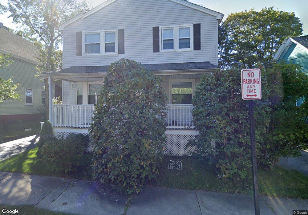
122 Adams Ave Saugus, MA 01906
Pleasant Hills NeighborhoodEstimated Value: $683,807 - $744,000
3
Beds
2
Baths
1,792
Sq Ft
$394/Sq Ft
Est. Value
About This Home
This home is located at 122 Adams Ave, Saugus, MA 01906 and is currently estimated at $705,202, approximately $393 per square foot. 122 Adams Ave is a home located in Essex County with nearby schools including Saugus High School, Pioneer Charter School Of Science II, and Melrose Montessori School.
Ownership History
Date
Name
Owned For
Owner Type
Purchase Details
Closed on
May 17, 2024
Sold by
Barker Jean M and Barker Michael
Bought by
Jean & Michael Barker Ret and Barker
Current Estimated Value
Purchase Details
Closed on
Sep 29, 2000
Sold by
Blanton Edna M
Bought by
Barker Michael and Barker Jean M
Purchase Details
Closed on
Sep 1, 1999
Sold by
Thompson Imelda A Est and Lombard Marietta A
Bought by
Blanton Edna M
Create a Home Valuation Report for This Property
The Home Valuation Report is an in-depth analysis detailing your home's value as well as a comparison with similar homes in the area
Home Values in the Area
Average Home Value in this Area
Purchase History
| Date | Buyer | Sale Price | Title Company |
|---|---|---|---|
| Jean & Michael Barker Ret | -- | None Available | |
| Jean & Michael Barker Ret | -- | None Available | |
| Barker Michael | $253,000 | -- | |
| Blanton Edna M | $130,000 | -- | |
| Barker Michael | $253,000 | -- | |
| Blanton Edna M | $130,000 | -- |
Source: Public Records
Mortgage History
| Date | Status | Borrower | Loan Amount |
|---|---|---|---|
| Previous Owner | Blanton Edna M | $146,000 | |
| Previous Owner | Blanton Edna M | $175,000 |
Source: Public Records
Tax History Compared to Growth
Tax History
| Year | Tax Paid | Tax Assessment Tax Assessment Total Assessment is a certain percentage of the fair market value that is determined by local assessors to be the total taxable value of land and additions on the property. | Land | Improvement |
|---|---|---|---|---|
| 2025 | $6,092 | $570,400 | $297,500 | $272,900 |
| 2024 | $5,843 | $548,600 | $280,500 | $268,100 |
| 2023 | $5,633 | $500,300 | $246,500 | $253,800 |
| 2022 | $5,366 | $446,800 | $226,100 | $220,700 |
| 2021 | $5,147 | $417,100 | $196,400 | $220,700 |
| 2020 | $4,758 | $399,200 | $187,000 | $212,200 |
| 2019 | $4,527 | $371,700 | $170,000 | $201,700 |
| 2018 | $4,210 | $363,600 | $164,900 | $198,700 |
| 2017 | $4,055 | $336,500 | $153,900 | $182,600 |
| 2016 | $3,422 | $280,500 | $153,600 | $126,900 |
| 2015 | $3,209 | $267,000 | $146,200 | $120,800 |
| 2014 | $3,455 | $297,600 | $146,200 | $151,400 |
Source: Public Records
Map
Nearby Homes