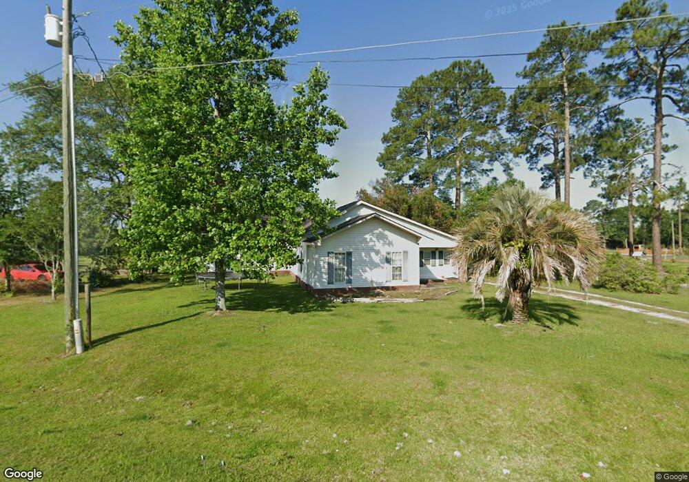
122 Briar Rd Moultrie, GA 31788
Estimated Value: $143,000 - $174,000
--
Bed
1
Bath
1,854
Sq Ft
$86/Sq Ft
Est. Value
About This Home
This home is located at 122 Briar Rd, Moultrie, GA 31788 and is currently estimated at $159,431, approximately $85 per square foot. 122 Briar Rd is a home located in Colquitt County with nearby schools including Odom Elementary School, Willie J. Williams Middle School, and C.A. Gray Junior High School.
Ownership History
Date
Name
Owned For
Owner Type
Purchase Details
Closed on
Aug 23, 2020
Sold by
Waters Property Group Llc
Bought by
Waters James Alexander and Sunara Waters Adriana
Current Estimated Value
Purchase Details
Closed on
May 18, 2018
Sold by
J Waters Inc
Bought by
Waters Property Grp Llc
Purchase Details
Closed on
Mar 6, 2018
Sold by
Purvis Ricky R
Bought by
J Waters Inc
Purchase Details
Closed on
Mar 9, 1995
Bought by
Purvis Ricky R
Create a Home Valuation Report for This Property
The Home Valuation Report is an in-depth analysis detailing your home's value as well as a comparison with similar homes in the area
Home Values in the Area
Average Home Value in this Area
Purchase History
| Date | Buyer | Sale Price | Title Company |
|---|---|---|---|
| Waters James Alexander | -- | -- | |
| Waters Property Grp Llc | -- | -- | |
| J Waters Inc | $20,206 | -- | |
| Purvis Ricky R | $10,300 | -- |
Source: Public Records
Tax History Compared to Growth
Tax History
| Year | Tax Paid | Tax Assessment Tax Assessment Total Assessment is a certain percentage of the fair market value that is determined by local assessors to be the total taxable value of land and additions on the property. | Land | Improvement |
|---|---|---|---|---|
| 2024 | $833 | $41,484 | $1,600 | $39,884 |
| 2023 | $875 | $25,827 | $1,600 | $24,227 |
| 2022 | $593 | $24,902 | $1,600 | $23,302 |
| 2021 | $683 | $28,146 | $1,600 | $26,546 |
| 2020 | $662 | $26,785 | $1,600 | $25,185 |
| 2019 | $743 | $27,012 | $1,600 | $25,412 |
| 2018 | $569 | $22,235 | $1,600 | $20,635 |
| 2017 | $551 | $22,235 | $1,600 | $20,635 |
| 2016 | $558 | $22,235 | $1,600 | $20,635 |
| 2015 | $563 | $22,235 | $1,600 | $20,635 |
| 2014 | $553 | $22,235 | $1,600 | $20,635 |
| 2013 | -- | $20,866 | $800 | $20,066 |
Source: Public Records
Map
Nearby Homes
- 0 Sardis Church Rd
- 182 Horseshoe Dr
- 124 Flint Dr
- 2262 Sardis Church Rd
- 132 Tallokas Trail
- 270 Old Timey Trail
- 410 Indian Trail
- 1113 Georgia 133
- 0 Old Timey Trail
- 31 31st Ave SE
- 0 Upper Trail Unit 913421
- 0 Upper Trail Unit 913422
- 292 Robin Ln
- 125 Inner Cir
- 4 Baldwin Place SE
- 16 Francine Way SE
- 65 Packer Pride Dr SE
- 48 Packer Pride Dr SE
- 331 Cobblestone Blvd SE
- 85 Cobblestone Blvd SE
- 227 Dean Matthews Rd
- 136 Briar Rd
- 205 Dean Matthews Rd
- 141 Briar Rd
- 218 Dean Matthews Rd
- 273 Dean Matthews Rd
- 166 Briar Rd
- 185 Dean Matthews Rd
- 206 Dean Matthews Rd
- 280 Dean Matthews Rd
- 180 Dean Matthews Rd
- 146 Roy Price Rd
- 127 Ortiz Ln
- 173 Dean Matthews Rd
- 302 Dean Matthews Rd
- 158 Roy Price Rd
- 163 Dean Matthews Rd
- 220 Hawthorne Dr
- 178 Hawthorne Dr
- 166 Dean Matthews Rd