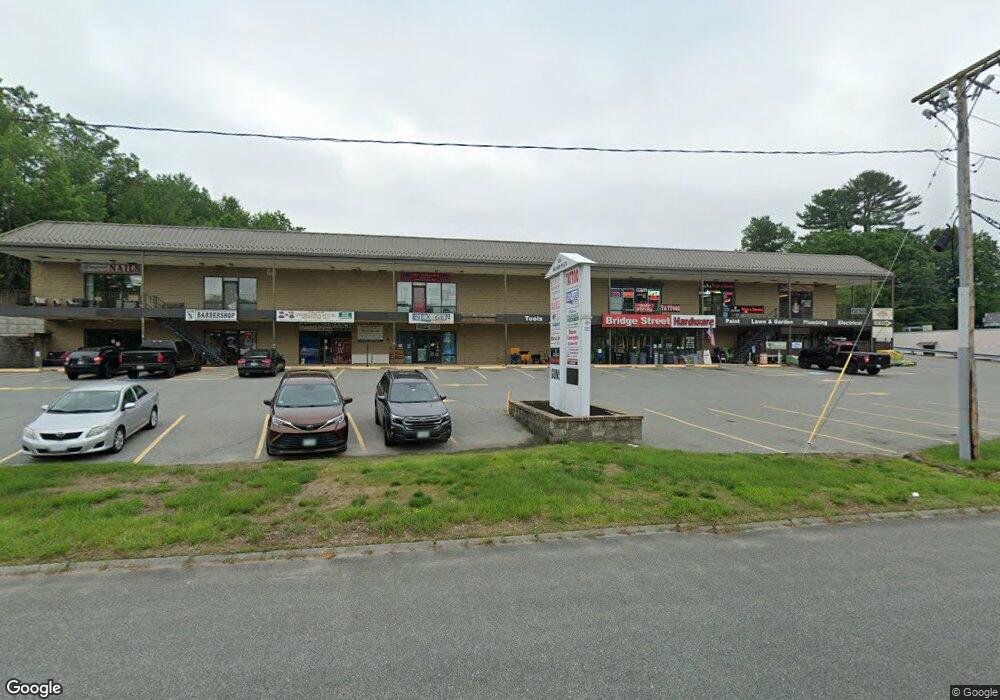
122 Bridge St Pelham, NH 03076
Estimated Value: $4,009,794
Studio
--
Bath
--
Sq Ft
185,566
Sq Ft Lot
About This Home
This home is located at 122 Bridge St, Pelham, NH 03076 and is currently estimated at $4,009,794. 122 Bridge St is a home located in Hillsborough County with nearby schools including Pelham Elementary School, Pelham Memorial School, and Pelham High School.
Ownership History
Date
Name
Owned For
Owner Type
Purchase Details
Closed on
Jul 18, 2002
Sold by
F & L Real Est Assoc
Bought by
Reno James Realty Llc
Current Estimated Value
Home Financials for this Owner
Home Financials are based on the most recent Mortgage that was taken out on this home.
Original Mortgage
$1,350,000
Outstanding Balance
$573,104
Interest Rate
6.73%
Mortgage Type
Commercial
Estimated Equity
$3,436,690
Create a Home Valuation Report for This Property
The Home Valuation Report is an in-depth analysis detailing your home's value as well as a comparison with similar homes in the area
Home Values in the Area
Average Home Value in this Area
Purchase History
| Date | Buyer | Sale Price | Title Company |
|---|---|---|---|
| Reno James Realty Llc | $1,500,000 | -- |
Source: Public Records
Mortgage History
| Date | Status | Borrower | Loan Amount |
|---|---|---|---|
| Open | Reno James Realty Llc | $505,000 | |
| Closed | Reno James Realty Llc | $100,000 | |
| Closed | Reno James Realty Llc | $80,000 | |
| Open | Reno James Realty Llc | $1,350,000 |
Source: Public Records
Tax History
| Year | Tax Paid | Tax Assessment Tax Assessment Total Assessment is a certain percentage of the fair market value that is determined by local assessors to be the total taxable value of land and additions on the property. | Land | Improvement |
|---|---|---|---|---|
| 2024 | $44,053 | $2,402,000 | $601,400 | $1,800,600 |
| 2023 | $43,692 | $2,402,000 | $601,400 | $1,800,600 |
| 2022 | $41,843 | $2,402,000 | $601,400 | $1,800,600 |
| 2021 | $38,266 | $2,397,600 | $601,400 | $1,796,200 |
| 2020 | $48,472 | $2,399,600 | $681,800 | $1,717,800 |
| 2019 | $46,552 | $2,399,600 | $681,800 | $1,717,800 |
| 2018 | $44,892 | $2,091,900 | $681,800 | $1,410,100 |
| 2017 | $44,871 | $2,091,900 | $681,800 | $1,410,100 |
| 2016 | $43,825 | $2,091,900 | $681,800 | $1,410,100 |
| 2015 | $42,212 | $1,814,800 | $681,800 | $1,133,000 |
| 2014 | $41,504 | $1,814,800 | $681,800 | $1,133,000 |
| 2013 | $41,504 | $1,814,800 | $681,800 | $1,133,000 |
Source: Public Records
Map
Nearby Homes
- 4 Haystack Cir
- 6 David Dr
- 4 Wilshire Ln Unit 4
- 4 Wilshire Ln
- 6 Wilshire Ln Unit 6
- 2 S Shore Dr
- 6 Hemlock Dr
- 10 Oakland Ridge Rd Unit 11
- 94 Tanager Cir Unit 94
- 40 Westfall Rd
- 9 Cornstalk Ln
- 28 Bridal Path Rd
- 29 Saddle Rd
- 7 Little Island Park
- Lot 4 Canterbury Rd Unit 4
- 12 Old Pasture Rd
- 19 Esther Way Unit Lot 10
- 11 Wellesley Dr
- 170 E Richardson Rd
- 979 Hildreth St
- 122 Bridge St Unit 8
- 122 Bridge St
- 116 Bridge St
- 13 Highland Ave
- 80 Thistlewood Dr Unit 10-351-34
- 90 Thistlewood Dr Unit 1-351-30
- 94 Thistlewood Dr Unit 29
- 88 Thistlewood Dr Unit 31
- 58 Thistlewood Dr
- 15 Highland Ave
- 125 Bridge St
- 4 Cornstalk Ln
- 12 Highland Ave
- 15 Livingston Rd
- Lot Currier Rd
- 17 Livingston Rd
- 1 Loretta Ave
- 10 Garland Woods Subdivision
- 16 Garland Woods Subdivision
- 11 Livingston Rd
Your Personal Tour Guide
Ask me questions while you tour the home.