Estimated Value: $143,962 - $205,000
--
Bed
2
Baths
1,579
Sq Ft
$110/Sq Ft
Est. Value
About This Home
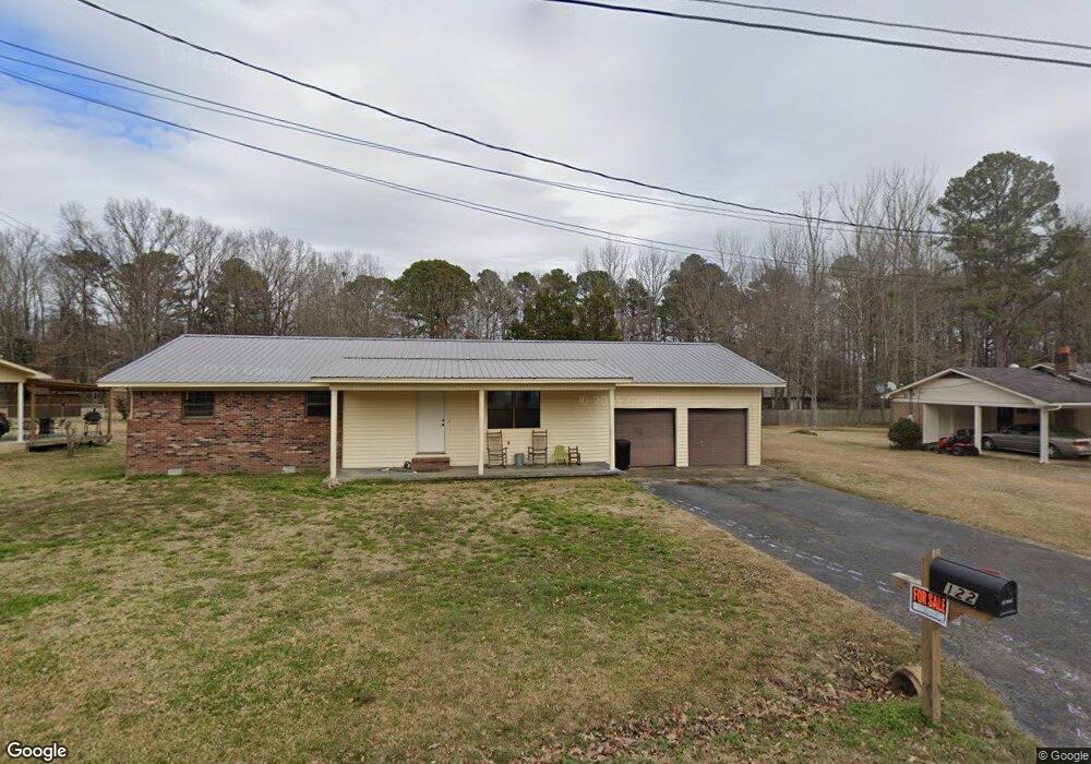
This home is located at 122 Robin Ln Unit 52, Iuka, MS 38852 and is currently estimated at $174,241, approximately $110 per square foot. 122 Robin Ln Unit 52 is a home located in Tishomingo County.
Ownership History
Date
Name
Owned For
Owner Type
Purchase Details
Closed on
Jul 16, 2020
Sold by
Spears Crystal
Bought by
Quick Channing and Quick Kensley
Current Estimated Value
Purchase Details
Closed on
Dec 2, 2019
Sold by
Spears Johnnie
Bought by
Spears Crystal
Purchase Details
Closed on
Oct 4, 2019
Sold by
S And S Properties Llc
Bought by
Spears Johnnie
Purchase Details
Closed on
Sep 12, 2019
Sold by
Barnett Nona
Bought by
S And S Properties Llc
Purchase Details
Closed on
Sep 3, 2019
Sold by
Knickerbocker Michelle
Bought by
Spears Johnnie L
Purchase Details
Closed on
Oct 5, 2016
Sold by
Knickerbocker Michele
Bought by
Knickerbocker Michelle and Burns Benjamin
Create a Home Valuation Report for This Property
The Home Valuation Report is an in-depth analysis detailing your home's value as well as a comparison with similar homes in the area
Home Values in the Area
Average Home Value in this Area
Purchase History
| Date | Buyer | Sale Price | Title Company |
|---|---|---|---|
| Quick Channing | -- | None Available | |
| Spears Crystal | -- | None Available | |
| Spears Johnnie | -- | None Available | |
| S And S Properties Llc | -- | None Available | |
| Spears Johnnie L | -- | None Available | |
| Knickerbocker Michelle | -- | -- | |
| Knickerbocker Michele | -- | -- |
Source: Public Records
Tax History Compared to Growth
Tax History
| Year | Tax Paid | Tax Assessment Tax Assessment Total Assessment is a certain percentage of the fair market value that is determined by local assessors to be the total taxable value of land and additions on the property. | Land | Improvement |
|---|---|---|---|---|
| 2024 | $383 | $6,473 | $0 | $0 |
| 2023 | $383 | $6,473 | $0 | $0 |
| 2022 | $388 | $6,520 | $0 | $0 |
| 2021 | $381 | $6,520 | $0 | $0 |
| 2020 | $118 | $1,200 | $0 | $0 |
| 2019 | $1,075 | $10,973 | $0 | $0 |
| 2018 | $1,075 | $10,973 | $0 | $0 |
| 2017 | $1,042 | $10,973 | $0 | $0 |
| 2016 | $1,026 | $10,797 | $0 | $0 |
| 2015 | -- | $7,198 | $0 | $0 |
| 2014 | -- | $7,198 | $0 | $0 |
Source: Public Records
Map
Nearby Homes
- 0 County Road 321
- 1108 S Pearl St
- 1104 S Pearl St
- 101 Bettydale Cir
- 0 Battleground Dr
- 204 Graham Rd
- 114 S Stone St
- ALL LOTS Graham Ridge Rd
- LOT 9 Graham Ridge Rd
- LOT 12 Graham Ridge Rd
- LOT 10 Graham Ridge Rd
- LOT 7 Graham Ridge Rd
- 14B & West Part of 16a Cr 488 Extension
- 0 Cr 321
- 13 Cr 456
- 106 Cr 323
- 302 W 5th St
- 47.3 ac Mississippi 25
- 800 E Quitman St
- 0 Spring St
- 124 Robin Ln Unit 51
- 609 Hubbard Branch Rd
- 120 Robin Ln Unit 53
- 609 Hubbard Branch Rd Unit 47
- 701 Gann St
- 611 Hubbard Branch Rd Unit 48
- 615 Gann St Unit 50
- 118 Robin Ln Unit 54
- 613 Hubbard Branch Rd
- 703 Gann St
- 702 Gann St Unit 87
- 704 Gann St Unit 86
- 116 Robin Ln Unit 55
- 755 Gann St
- 114 Robin Ln Unit 56
- 706 Gann St Unit 8285
- 109 Robin Ln Unit 6869
- 109 Robin Ln Unit 65
- 112 Robin Ln Unit 57
- 803 Gann St Unit 74