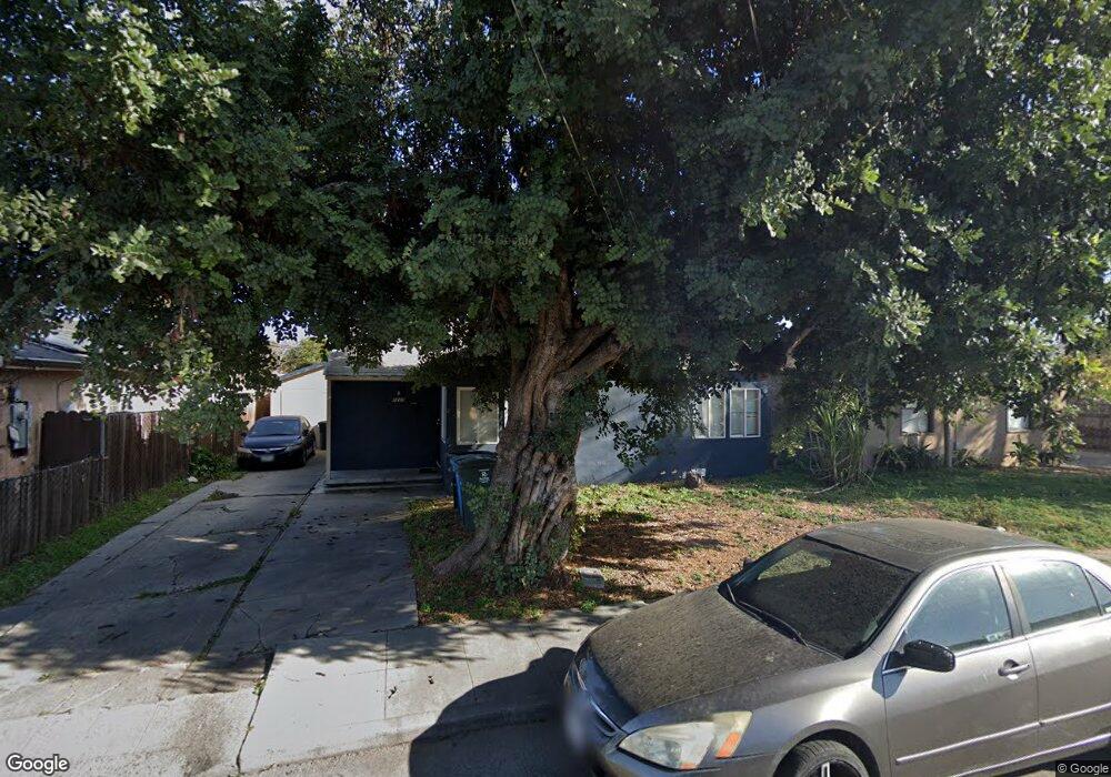
1220 Jervis Ave East Palo Alto, CA 94303
Estimated Value: $809,343 - $1,217,000
3
Beds
1
Bath
960
Sq Ft
$981/Sq Ft
Est. Value
About This Home
This home is located at 1220 Jervis Ave, East Palo Alto, CA 94303 and is currently estimated at $941,586, approximately $980 per square foot. 1220 Jervis Ave is a home located in San Mateo County with nearby schools including Belle Haven Elementary School, Menlo-Atherton High School, and KIPP Valiant Community Prep.
Ownership History
Date
Name
Owned For
Owner Type
Purchase Details
Closed on
Dec 23, 2013
Sold by
Laurel Street Church Of Christ
Bought by
Laurel Avenue Church Of Christ
Current Estimated Value
Purchase Details
Closed on
Jun 22, 2004
Sold by
Laurel Street Church Of Christ
Bought by
Laurel Street Church Of Christ
Home Financials for this Owner
Home Financials are based on the most recent Mortgage that was taken out on this home.
Original Mortgage
$150,000
Interest Rate
6.29%
Mortgage Type
Purchase Money Mortgage
Create a Home Valuation Report for This Property
The Home Valuation Report is an in-depth analysis detailing your home's value as well as a comparison with similar homes in the area
Home Values in the Area
Average Home Value in this Area
Purchase History
| Date | Buyer | Sale Price | Title Company |
|---|---|---|---|
| Laurel Avenue Church Of Christ | -- | None Available | |
| Laurel Street Church Of Christ | -- | Chicago Title Insurance Comp |
Source: Public Records
Mortgage History
| Date | Status | Borrower | Loan Amount |
|---|---|---|---|
| Previous Owner | Laurel Street Church Of Christ | $150,000 |
Source: Public Records
Tax History Compared to Growth
Tax History
| Year | Tax Paid | Tax Assessment Tax Assessment Total Assessment is a certain percentage of the fair market value that is determined by local assessors to be the total taxable value of land and additions on the property. | Land | Improvement |
|---|---|---|---|---|
| 2025 | $2,892 | $43,190 | $10,966 | $32,224 |
| 2023 | $2,892 | $41,515 | $10,541 | $30,974 |
| 2022 | $2,647 | $40,702 | $10,335 | $30,367 |
| 2021 | $2,577 | $39,905 | $10,133 | $29,772 |
| 2020 | $2,497 | $39,497 | $10,030 | $29,467 |
| 2019 | $2,448 | $38,724 | $9,834 | $28,890 |
| 2018 | $2,367 | $37,966 | $9,642 | $28,324 |
| 2017 | $2,260 | $37,222 | $9,453 | $27,769 |
| 2016 | $2,261 | $36,493 | $9,268 | $27,225 |
| 2015 | $2,196 | $35,946 | $9,129 | $26,817 |
| 2014 | $2,108 | $35,243 | $8,951 | $26,292 |
Source: Public Records
Map
Nearby Homes
- 1007 Newbridge St
- 1257 Laurel Ave
- 1221 Westminster Ave
- 1133 Jervis Ave
- 1002 Alberni St
- 1120 Alberni St
- 1024 Laurel Ave
- 2210 Menalto Ave
- 1127 Madera Ave
- 315 Haight St
- 813 Bay Rd
- 1127 Hollyburne Ave
- 2148 Ralmar Ave
- 128 Grace Ave
- 903 Laurel Ave
- 2396 Glen Way
- 2118 Addison Ave
- 505 Runnymede St Unit C
- 1037 Windermere Ave
- 1523 Ursula Way
- 1226 Jervis Ave
- 1214 Jervis Ave
- 1230 Jervis Ave
- 1234 Jervis Ave
- 1227 Laurel Ave
- 1003 Newbridge St
- 1238 Jervis Ave
- 1233 Laurel Ave
- 1011 Newbridge St
- 1213 Jervis Ave
- 1235 Jervis Ave
- 1239 Laurel Ave
- 1239 Jervis Ave
- 1205 Laurel Ave
- 1244 Jervis Ave
- 1245 Jervis Ave
- 1245 Laurel Ave
- 1250 Jervis Ave
- 1249 Jervis Ave
- 965 Newbridge St