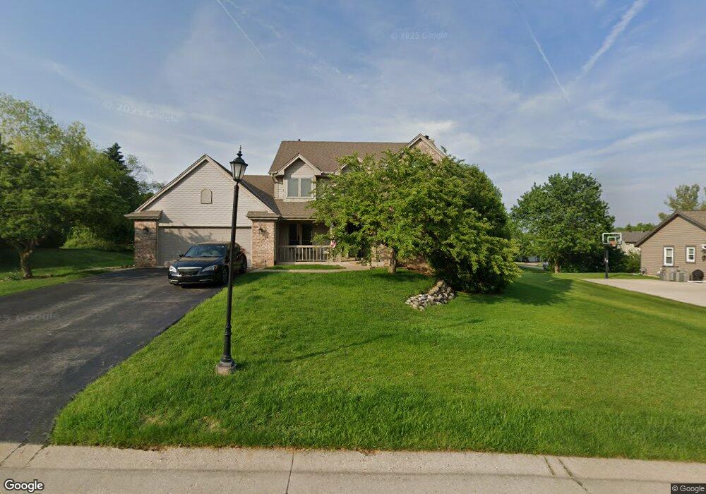
1220 Ridge Rd Waukesha, WI 53186
Brookfield Town NeighborhoodEstimated Value: $536,626 - $616,000
--
Bed
--
Bath
--
Sq Ft
0.35
Acres
About This Home
This home is located at 1220 Ridge Rd, Waukesha, WI 53186 and is currently estimated at $576,157. 1220 Ridge Rd is a home located in Waukesha County with nearby schools including Hillcrest Elementary School, Horning Middle School, and South High School.
Ownership History
Date
Name
Owned For
Owner Type
Purchase Details
Closed on
Jun 22, 2015
Sold by
Brodhead Robert and Brodhead Tracy
Bought by
Sobierajski Monika and Sobierajski Lidia
Current Estimated Value
Home Financials for this Owner
Home Financials are based on the most recent Mortgage that was taken out on this home.
Original Mortgage
$276,000
Outstanding Balance
$214,302
Interest Rate
3.82%
Mortgage Type
New Conventional
Estimated Equity
$361,855
Purchase Details
Closed on
May 17, 2013
Sold by
Hussinger Tod A and Hussinger Denise E
Bought by
Brodhead Robert and Brodhead Tracy
Home Financials for this Owner
Home Financials are based on the most recent Mortgage that was taken out on this home.
Original Mortgage
$319,113
Interest Rate
3.52%
Mortgage Type
FHA
Purchase Details
Closed on
Mar 25, 2009
Sold by
Hussinger Tod A and Husseinger Denise E
Bought by
Hussinger Tod A and Hussinger Denise E
Purchase Details
Closed on
Jan 9, 2009
Sold by
Hussinger Tod A and Hussinger Denise E
Bought by
Hussinger Tod A and Hussinger Denise E
Purchase Details
Closed on
Jul 9, 2005
Sold by
Hussinger Tod A and Hussinger Denise E
Bought by
Hussinger Tod A and Hussinger Denise E
Purchase Details
Closed on
Dec 15, 2004
Sold by
Hussinger Tod A and Hussinger Denise E
Bought by
Hussinger Tod A and Hussinger Denise E
Purchase Details
Closed on
Mar 23, 2002
Sold by
Hussinger Tod A and Hussinger Denise E
Bought by
Hussinger Tod A and Hussinger Denise E
Purchase Details
Closed on
Nov 28, 2001
Sold by
Hussinger Tod A and Hussinger Denise E
Bought by
Hussinger Tod A and Hussinger Denise E
Home Financials for this Owner
Home Financials are based on the most recent Mortgage that was taken out on this home.
Original Mortgage
$95,000
Interest Rate
6.6%
Mortgage Type
Purchase Money Mortgage
Purchase Details
Closed on
Oct 23, 1997
Sold by
Hussinger Tod A and Hussinger Denise E
Bought by
Hussinger Tod A and Hussinger Denise E
Home Financials for this Owner
Home Financials are based on the most recent Mortgage that was taken out on this home.
Original Mortgage
$96,500
Interest Rate
7.42%
Mortgage Type
Purchase Money Mortgage
Create a Home Valuation Report for This Property
The Home Valuation Report is an in-depth analysis detailing your home's value as well as a comparison with similar homes in the area
Home Values in the Area
Average Home Value in this Area
Purchase History
| Date | Buyer | Sale Price | Title Company |
|---|---|---|---|
| Sobierajski Monika | $345,000 | Priority Title Corp | |
| Brodhead Robert | $325,000 | None Available | |
| Hussinger Tod A | -- | None Available | |
| Hussinger Tod A | -- | None Available | |
| Hussinger Tod A | -- | -- | |
| Hussinger Tod A | -- | -- | |
| Hussinger Tod A | -- | -- | |
| Hussinger Tod A | -- | -- | |
| Hussinger Tod A | -- | -- | |
| Hussinger Tod A | -- | -- |
Source: Public Records
Mortgage History
| Date | Status | Borrower | Loan Amount |
|---|---|---|---|
| Open | Sobierajski Monika | $276,000 | |
| Previous Owner | Brodhead Robert | $319,113 | |
| Previous Owner | Hussinger Tod A | $95,000 | |
| Previous Owner | Hussinger Tod A | $96,500 |
Source: Public Records
Tax History Compared to Growth
Tax History
| Year | Tax Paid | Tax Assessment Tax Assessment Total Assessment is a certain percentage of the fair market value that is determined by local assessors to be the total taxable value of land and additions on the property. | Land | Improvement |
|---|---|---|---|---|
| 2024 | $4,257 | $444,800 | $93,000 | $351,800 |
| 2023 | $4,294 | $444,800 | $93,000 | $351,800 |
| 2022 | $4,526 | $444,800 | $93,000 | $351,800 |
| 2021 | $4,907 | $397,200 | $77,500 | $319,700 |
| 2020 | $5,048 | $397,200 | $77,500 | $319,700 |
| 2019 | $5,140 | $397,200 | $77,500 | $319,700 |
| 2018 | $4,397 | $343,600 | $77,000 | $266,600 |
| 2017 | $4,397 | $343,600 | $77,000 | $266,600 |
| 2016 | $4,534 | $334,600 | $77,000 | $257,600 |
| 2015 | $4,585 | $334,600 | $77,000 | $257,600 |
| 2014 | -- | $334,600 | $77,000 | $257,600 |
| 2013 | -- | $324,800 | $77,000 | $247,800 |
Source: Public Records
Map
Nearby Homes
- 21525 Belgren Rd
- 1825 Paramount Dr Unit F
- 1823 Paramount Dr Unit D
- 745 Hi Ridge Ave
- 1715 Stardust Dr Unit A
- S17W22650 Lincoln Ave
- Lt2 Downie Rd
- 2215 Avalon Dr
- 1701 S Lilly Ln
- 2423 Kossow Rd
- 1333 Niagara St
- 1349 Rose Ct Unit 62
- 1219 National Ave
- 930 Harding Ave
- 1920 Cardinal Dr
- 918 Niagara St
- Lt1 Davidson Rd
- 936 Perkins Ave
- 1471 Cleveland Ave
- 2119 E Broadway Unit C
- 1240 Ridge Rd
- 1190 Ridge Rd
- 1215 Ridge Rd
- 1255 Ridge Rd
- 1260 Ridge Rd
- 1155 S Springdale Rd
- 1185 S Springdale Rd
- 1140 S Springdale Rd
- 1170 S Springdale Rd
- 1125 S Springdale Rd
- 1130 Ridge Rd
- 1165 Ridge Rd
- 1160 Ridge Rd
- 1215 S Springdale Rd
- 1200 S Springdale Rd
- 1195 Ridge Rd
- 1105 S Springdale Rd
- 1275 Ridge Rd
- 1280 Ridge Rd
- 1230 S Springdale Rd