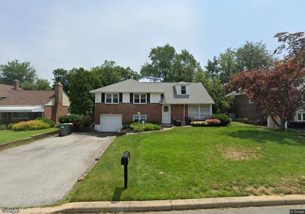
1220 Wilson Rd Wilmington, DE 19803
Carrcroft NeighborhoodEstimated Value: $417,000 - $470,000
4
Beds
3
Baths
1,215
Sq Ft
$372/Sq Ft
Est. Value
About This Home
This home is located at 1220 Wilson Rd, Wilmington, DE 19803 and is currently estimated at $451,744, approximately $371 per square foot. 1220 Wilson Rd is a home located in New Castle County with nearby schools including Carrcroft Elementary School, Springer Middle School, and Mount Pleasant High School.
Ownership History
Date
Name
Owned For
Owner Type
Purchase Details
Closed on
Apr 27, 2001
Sold by
Lugar Scott and Lugar Eliza
Bought by
Feeley Denise M
Current Estimated Value
Home Financials for this Owner
Home Financials are based on the most recent Mortgage that was taken out on this home.
Original Mortgage
$158,100
Outstanding Balance
$58,247
Interest Rate
6.85%
Mortgage Type
FHA
Estimated Equity
$393,497
Create a Home Valuation Report for This Property
The Home Valuation Report is an in-depth analysis detailing your home's value as well as a comparison with similar homes in the area
Home Values in the Area
Average Home Value in this Area
Purchase History
| Date | Buyer | Sale Price | Title Company |
|---|---|---|---|
| Feeley Denise M | $159,900 | -- |
Source: Public Records
Mortgage History
| Date | Status | Borrower | Loan Amount |
|---|---|---|---|
| Open | Feeley Denise M | $158,100 |
Source: Public Records
Tax History Compared to Growth
Tax History
| Year | Tax Paid | Tax Assessment Tax Assessment Total Assessment is a certain percentage of the fair market value that is determined by local assessors to be the total taxable value of land and additions on the property. | Land | Improvement |
|---|---|---|---|---|
| 2024 | $2,382 | $62,600 | $16,500 | $46,100 |
| 2023 | $2,177 | $62,600 | $16,500 | $46,100 |
| 2022 | $2,214 | $62,600 | $16,500 | $46,100 |
| 2021 | $2,214 | $62,600 | $16,500 | $46,100 |
| 2020 | $2,215 | $62,600 | $16,500 | $46,100 |
| 2019 | $2,482 | $62,600 | $16,500 | $46,100 |
| 2018 | $2,117 | $62,600 | $16,500 | $46,100 |
| 2017 | $2,084 | $62,600 | $16,500 | $46,100 |
| 2016 | $2,082 | $62,600 | $16,500 | $46,100 |
| 2015 | $1,916 | $62,600 | $16,500 | $46,100 |
| 2014 | $1,915 | $62,600 | $16,500 | $46,100 |
Source: Public Records
Map
Nearby Homes
- 1218 Winstead Rd
- 133 Marcella Rd
- 2247 Silverside Rd
- 1224 Grinnell Rd
- 1108 Graylyn Rd
- 1900 Beechwood Dr
- 1300 Hillside Blvd
- 1607 Silverside Rd
- 1425 Bucknell Rd
- 1902 Longcome Dr
- 820 Montico Rd
- 502 Ivydale Rd
- 1820 Foulk Rd
- 2010 Kynwyd Rd
- 1822 Foulk Rd
- 200 Churchill Dr
- 816 Wilson Rd
- 1400 Carson Rd
- 9 Penarth Dr
- 13 Newark Union Public Rd
- 1222 Wilson Rd
- 1218 Wilson Rd
- 1219 Mayfield Rd
- 1224 Wilson Rd
- 1217 Mayfield Rd
- 1216 Wilson Rd
- 1221 Mayfield Rd
- 1215 Mayfield Rd
- 1214 Wilson Rd
- 1226 Wilson Rd
- 1223 Mayfield Rd
- 1213 Mayfield Rd
- 1212 Wilson Rd
- 1217 Winstead Rd
- 1225 Mayfield Rd
- 1211 Mayfield Rd
- 1213 Wilson Rd
- 1212 Mayfield Rd
- 1210 Wilson Rd
- 1228 Winstead Rd