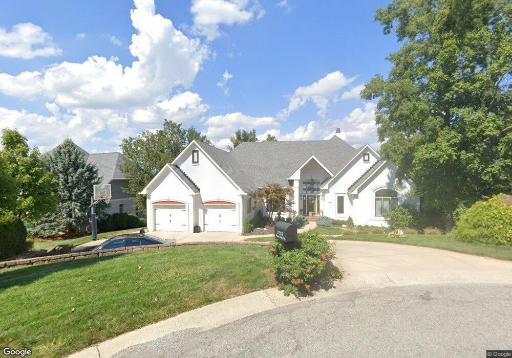
12208 Admirals Pointe Cir Indianapolis, IN 46236
Geist NeighborhoodEstimated Value: $624,000 - $968,000
--
Bed
3
Baths
2,333
Sq Ft
$354/Sq Ft
Est. Value
About This Home
This home is located at 12208 Admirals Pointe Cir, Indianapolis, IN 46236 and is currently estimated at $824,822, approximately $353 per square foot. 12208 Admirals Pointe Cir is a home located in Marion County with nearby schools including Amy Beverland Elementary School, Belzer Middle School, and Lawrence Central High School.
Ownership History
Date
Name
Owned For
Owner Type
Purchase Details
Closed on
Aug 31, 2017
Sold by
Donell Eldred H Mac
Bought by
Dubois Dustin S and Dubois Tonya W
Current Estimated Value
Home Financials for this Owner
Home Financials are based on the most recent Mortgage that was taken out on this home.
Original Mortgage
$864,000
Outstanding Balance
$722,082
Interest Rate
3.93%
Mortgage Type
Adjustable Rate Mortgage/ARM
Estimated Equity
$102,740
Create a Home Valuation Report for This Property
The Home Valuation Report is an in-depth analysis detailing your home's value as well as a comparison with similar homes in the area
Home Values in the Area
Average Home Value in this Area
Purchase History
| Date | Buyer | Sale Price | Title Company |
|---|---|---|---|
| Dubois Dustin S | $960,000 | -- | |
| Dubois Dustin S | $960,000 | Mid-America Title Co. |
Source: Public Records
Mortgage History
| Date | Status | Borrower | Loan Amount |
|---|---|---|---|
| Open | Dubois Dustin S | $864,000 |
Source: Public Records
Tax History Compared to Growth
Tax History
| Year | Tax Paid | Tax Assessment Tax Assessment Total Assessment is a certain percentage of the fair market value that is determined by local assessors to be the total taxable value of land and additions on the property. | Land | Improvement |
|---|---|---|---|---|
| 2024 | $9,563 | $852,400 | $238,400 | $614,000 |
| 2023 | $9,563 | $852,400 | $238,400 | $614,000 |
| 2022 | $8,689 | $760,800 | $238,400 | $522,400 |
| 2021 | $8,323 | $718,400 | $238,400 | $480,000 |
| 2020 | $8,120 | $693,100 | $238,400 | $454,700 |
| 2019 | $7,455 | $731,000 | $238,400 | $492,600 |
| 2018 | $7,422 | $728,100 | $238,400 | $489,700 |
| 2017 | $6,297 | $616,000 | $238,400 | $377,600 |
| 2016 | $6,208 | $607,500 | $238,400 | $369,100 |
| 2014 | $5,909 | $590,900 | $238,400 | $352,500 |
| 2013 | $5,909 | $590,900 | $238,400 | $352,500 |
Source: Public Records
Map
Nearby Homes
- 12348 Seaway Cir
- 12082 Old Stone Dr
- 12335 Old Stone Dr
- 9224 Bluestone Cir
- 11845 Discovery Cir
- 12650 Shorevista Dr
- 12040 Kingfisher Cir
- 11691 Diamond Pointe Ct
- 9727 Marina Village Dr
- 6203 Hampton Cove Ln
- 6217 Hampton Cove Ln
- 8458 Admirals Landing Way
- 11943 Glen Cove Ct
- 8515 Brittany Ct N
- 11505 Hampton Cove Ln
- 8635 Sturgen Bay Ln
- 11715 Landings Dr
- 12214 Ridgeside Rd
- 8845 Otter Cove Cir
- 8338 Glen Highlands Dr
- 12160 Admirals Pointe Cir
- 12218 Admirals Pointe Cir
- 12209 Admirals Pointe Cir
- 9149 Admirals Pointe Ct
- 12150 Admirals Pointe Cir
- 12161 Admirals Pointe Cir
- 12151 Admirals Pointe Cir
- 9158 Admirals Pointe Ct
- 9135 Admirals Pointe Ct
- 12141 Admirals Pointe Cir
- 9115 Admirals Pointe Ct
- 9138 Admirals Pointe Ct
- 12131 Admirals Pointe Cir
- 12305 Thunder Bay Ct
- 12306 Thunder Bay Ct
- 9128 Admirals Pointe Ct
- 12107 Silver Shore Ct
- 12162 Pearl Bay Ridge
- 12152 Pearl Bay Ridge
- 9118 Admirals Pointe Ct