Estimated Value: $1,607,899
Studio
--
Bath
35,200
Sq Ft
$46/Sq Ft
Est. Value
About This Home
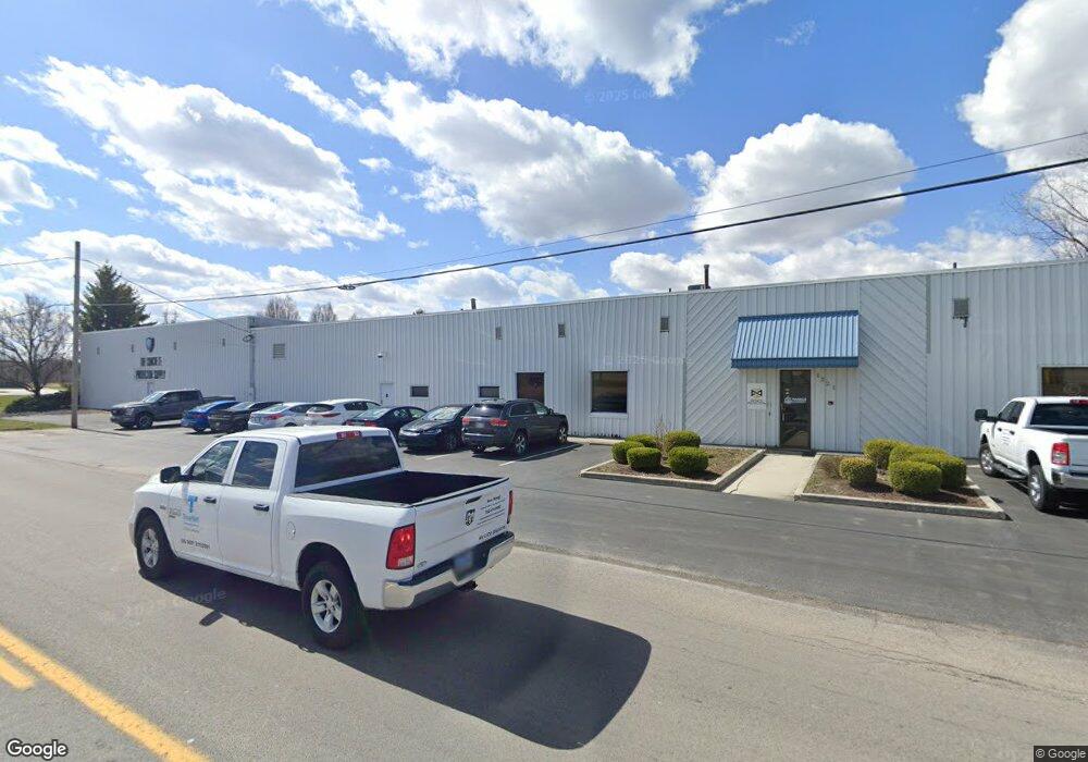
This home is located at 1221 Stewart Rd, Lima, OH 45801 and is currently estimated at $1,607,899, approximately $45 per square foot. 1221 Stewart Rd is a home located in Allen County with nearby schools including Bath Elementary School, Bath Middle School, and Bath High School.
Ownership History
Date
Name
Owned For
Owner Type
Purchase Details
Closed on
May 15, 2023
Sold by
Richard M Toth Living Trust
Bought by
Quickest Storage Ltd
Current Estimated Value
Home Financials for this Owner
Home Financials are based on the most recent Mortgage that was taken out on this home.
Original Mortgage
$1,080,000
Outstanding Balance
$1,006,765
Interest Rate
6.28%
Mortgage Type
New Conventional
Estimated Equity
$601,134
Purchase Details
Closed on
Dec 14, 2005
Sold by
Toth Richard M and Toth Cathi A
Bought by
Greto Corporation
Purchase Details
Closed on
May 31, 1990
Bought by
Toth Richard M
Create a Home Valuation Report for This Property
The Home Valuation Report is an in-depth analysis detailing your home's value as well as a comparison with similar homes in the area
Purchase History
We collect this data history from publicly available records. To have your information removed, we recommend requesting removal directly through your county’s website.
| Date | Buyer | Sale Price | Title Company |
|---|---|---|---|
| Quickest Storage Ltd | $1,350,000 | None Listed On Document | |
| Greto Corporation | -- | None Available | |
| Toth Richard M | $200,000 | -- |
Source: Public Records
Mortgage History
We collect this data history from publicly available records. To have your information removed, we recommend requesting removal directly through your county’s website.
| Date | Status | Borrower | Loan Amount |
|---|---|---|---|
| Open | Quickest Storage Ltd | $1,080,000 |
Source: Public Records
Tax History
| Year | Tax Paid | Tax Assessment Tax Assessment Total Assessment is a certain percentage of the fair market value that is determined by local assessors to be the total taxable value of land and additions on the property. | Land | Improvement |
|---|---|---|---|---|
| 2025 | $19,321 | $350,000 | $15,750 | $334,250 |
| 2024 | $19,398 | $350,000 | $15,750 | $334,250 |
| 2023 | $17,754 | $318,190 | $14,320 | $303,870 |
| 2022 | $18,118 | $318,190 | $14,320 | $303,870 |
| 2021 | $6,451 | $114,140 | $14,320 | $99,820 |
| 2020 | $6,265 | $102,200 | $14,070 | $88,130 |
| 2019 | $6,265 | $102,200 | $14,070 | $88,130 |
| 2018 | $3,606 | $102,200 | $14,070 | $88,130 |
| 2017 | $6,510 | $102,200 | $14,070 | $88,130 |
| 2016 | $6,477 | $102,200 | $14,070 | $88,130 |
| 2015 | $7,721 | $102,200 | $14,070 | $88,130 |
| 2014 | $7,721 | $120,300 | $14,070 | $106,230 |
| 2013 | $7,730 | $120,300 | $14,070 | $106,230 |
Source: Public Records
Map
Nearby Homes
- 2145 N Dixie Hwy Unit 80
- 2145 N Dixie Hwy Unit 103
- 2145 N Dixie Hwy Unit 113
- 2145 N Dixie Hwy Unit 101
- 1615 N Sugar St
- 911 Kingswood Dr
- 1800 Reservoir Rd Unit Lot 51
- 2230 N Dixie Hwy
- 780 Kingswood Dr
- 820 Yorkshire Dr
- 712 Taylor Ave
- 124 S Collins Ave
- 124 N Perry St
- 1125 E Market St
- 1210 E Market St
- 115 Barnsbury Dr
- 501 W O'Connor Ave
- 922 N Jefferson St
- 1376 Fetter Rd
- 1416 N Central Ave
Your Personal Tour Guide
Ask me questions while you tour the home.