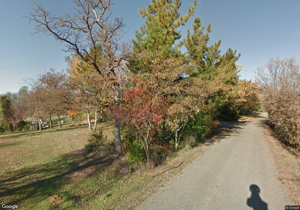
12210 Carol Ann Ln Redding, CA 96003
Estimated Value: $393,000 - $490,000
2
Beds
2
Baths
1,822
Sq Ft
$248/Sq Ft
Est. Value
About This Home
This home is located at 12210 Carol Ann Ln, Redding, CA 96003 and is currently estimated at $452,652, approximately $248 per square foot. 12210 Carol Ann Ln is a home located in Shasta County with nearby schools including Columbia Elementary School, Mountain View Middle School, and Foothill High School.
Ownership History
Date
Name
Owned For
Owner Type
Purchase Details
Closed on
Jul 26, 2022
Sold by
Evans Jane A
Bought by
Jane Evans Living Trust and Evans
Current Estimated Value
Purchase Details
Closed on
Nov 22, 2017
Sold by
Rcp Investments Llc
Bought by
Mccarthy Brad
Home Financials for this Owner
Home Financials are based on the most recent Mortgage that was taken out on this home.
Original Mortgage
$233,689
Interest Rate
3.88%
Mortgage Type
FHA
Create a Home Valuation Report for This Property
The Home Valuation Report is an in-depth analysis detailing your home's value as well as a comparison with similar homes in the area
Home Values in the Area
Average Home Value in this Area
Purchase History
| Date | Buyer | Sale Price | Title Company |
|---|---|---|---|
| Jane Evans Living Trust | -- | None Listed On Document | |
| Mccarthy Brad | $238,000 | First American Title Co |
Source: Public Records
Mortgage History
| Date | Status | Borrower | Loan Amount |
|---|---|---|---|
| Previous Owner | Mccarthy Brad | $233,689 |
Source: Public Records
Tax History Compared to Growth
Tax History
| Year | Tax Paid | Tax Assessment Tax Assessment Total Assessment is a certain percentage of the fair market value that is determined by local assessors to be the total taxable value of land and additions on the property. | Land | Improvement |
|---|---|---|---|---|
| 2025 | $3,600 | $327,100 | $84,859 | $242,241 |
| 2024 | $3,609 | $320,688 | $83,196 | $237,492 |
| 2023 | $3,609 | $314,401 | $81,565 | $232,836 |
| 2022 | $3,476 | $308,237 | $79,966 | $228,271 |
| 2021 | $3,478 | $302,195 | $78,399 | $223,796 |
| 2020 | $3,434 | $299,098 | $77,596 | $221,502 |
| 2019 | $3,354 | $293,234 | $76,075 | $217,159 |
| 2018 | $3,395 | $287,485 | $74,584 | $212,901 |
| 2017 | $3,431 | $281,849 | $73,122 | $208,727 |
| 2016 | $3,217 | $276,324 | $71,689 | $204,635 |
| 2015 | $3,167 | $272,175 | $70,613 | $201,562 |
| 2014 | $3,080 | $266,844 | $69,230 | $197,614 |
Source: Public Records
Map
Nearby Homes
- 2662 Brooklyn Ln
- 2169 Hope Ln
- 6298 Oasis Rd
- 12723 Old Oregon Trail
- 1779 Player Ct
- 6260 Carmel Dr
- 12680 Akrich St
- 19935 Paso Robles Ave
- 1633 Wee Burn Ct
- 6173 Brassie Way
- 6038 Gleneagles Ct
- 1575 Saint Andrews Dr
- 11632 Ridgewood Rd
- 19862 Paso Robles Ave
- 1102 Hope Ln
- 1533 Spanish Bay Dr
- 12910 Old Oregon Trail
- 13323 Alicia Pkwy
- 6040 Constitution Way
- 12832 Los Osos St
- 12239 Carol Ann Ln
- 12175 Carol Ann Ln
- 12175 Carol Ann Ln3 5% Unit 1
- 12166 Carol Ann Ln
- 12249 Manzanoaks Dr
- 12180 Old Oregon Trail
- 12277 Manzanoaks Dr
- 19622 Wallers Way
- 19603 Wallers Way
- 12232 Manzanoaks Dr
- 19640 Wallers Way
- 19621 Wallers Way
- 074250061 Manzanoaks Dr
- 43 Manzanoaks Dr
- 12339 Manzanoaks Dr
- 0 Manzanoaks Dr
- 19415 Cool Breeze Way
- 19649 Wallers Way
- 19393 Cool Breeze Way
- 12150 Old Oregon Trail
