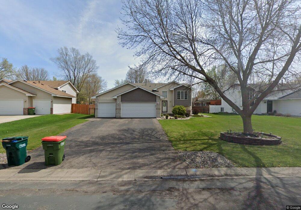
12219 Quinn St NW Coon Rapids, MN 55448
Estimated Value: $361,000 - $395,000
2
Beds
2
Baths
1,028
Sq Ft
$372/Sq Ft
Est. Value
About This Home
This home is located at 12219 Quinn St NW, Coon Rapids, MN 55448 and is currently estimated at $382,028, approximately $371 per square foot. 12219 Quinn St NW is a home located in Anoka County with nearby schools including Lucile Bruner Elementary School, Hoover Elementary School, and Laughlin Junior/Senior High School.
Ownership History
Date
Name
Owned For
Owner Type
Purchase Details
Closed on
Sep 4, 1998
Sold by
Shade Tree Construction Inc
Bought by
Albrecht Shawn A and Albrecht Shari L
Current Estimated Value
Purchase Details
Closed on
May 8, 1998
Sold by
Tsm Development Inc
Bought by
Shade Tree Construction Inc
Create a Home Valuation Report for This Property
The Home Valuation Report is an in-depth analysis detailing your home's value as well as a comparison with similar homes in the area
Home Values in the Area
Average Home Value in this Area
Purchase History
| Date | Buyer | Sale Price | Title Company |
|---|---|---|---|
| Albrecht Shawn A | $119,748 | -- | |
| Shade Tree Construction Inc | $169,500 | -- |
Source: Public Records
Tax History Compared to Growth
Tax History
| Year | Tax Paid | Tax Assessment Tax Assessment Total Assessment is a certain percentage of the fair market value that is determined by local assessors to be the total taxable value of land and additions on the property. | Land | Improvement |
|---|---|---|---|---|
| 2025 | $3,678 | $352,800 | $86,000 | $266,800 |
| 2024 | $3,678 | $350,900 | $95,000 | $255,900 |
| 2023 | $3,401 | $350,000 | $82,000 | $268,000 |
| 2022 | $2,986 | $347,100 | $70,000 | $277,100 |
| 2021 | $2,914 | $274,500 | $59,000 | $215,500 |
| 2020 | $3,036 | $262,500 | $63,000 | $199,500 |
| 2019 | $2,886 | $261,700 | $67,000 | $194,700 |
| 2018 | $2,670 | $243,000 | $0 | $0 |
| 2017 | $2,391 | $220,000 | $0 | $0 |
| 2016 | $2,398 | $193,100 | $0 | $0 |
| 2015 | $2,633 | $193,100 | $51,000 | $142,100 |
| 2014 | -- | $176,400 | $50,300 | $126,100 |
Source: Public Records
Map
Nearby Homes
- 2068 124th Ln NW
- 2147 125th Ln NW
- 12365 Jay St NW
- 1727 121st Ln NW
- 12760 Raven St NW
- 1930 127th Cir NW
- 12019 Zion St NW
- 12554 Grouse St NW
- 2675 128th Ave NW
- 12010 Eagle St NW
- 12463 Drake St NW
- 12888 Nightingale St NW
- 1593 126th Ln NW
- 12759 Ibis St NW
- 1449 119th Ln NW
- 11749 Crooked Lake Blvd NW
- 1660 Northdale Blvd NW
- 1450 126th Ln NW
- 11444 Hanson Blvd NW
- 11424 Hanson Blvd NW
- 12205 Quinn St NW
- 12233 Quinn St NW
- 12230 Partridge St NW
- 12228 Partridge St NW
- 12232 Partridge St NW
- 12203 Quinn St NW
- 12236 Partridge St NW
- 12247 Quinn St NW
- 12210 Quinn St NW
- 12230 Quinn St NW
- 12200 Quinn St NW
- 12191 Quinn St NW
- 12240 Partridge St NW
- 12244 Quinn St NW
- 12196 Partridge St NW
- 12261 Quinn St NW
- 12248 Partridge St NW
- 12192 Quinn St NW
- 12185 Quinn St NW
- 2096 122nd Ln NW