
Seller's Agent in 2025
Tom Wawczak
Century 21 Coleman-Hornsby
(815) 735-2868
286 Total Sales
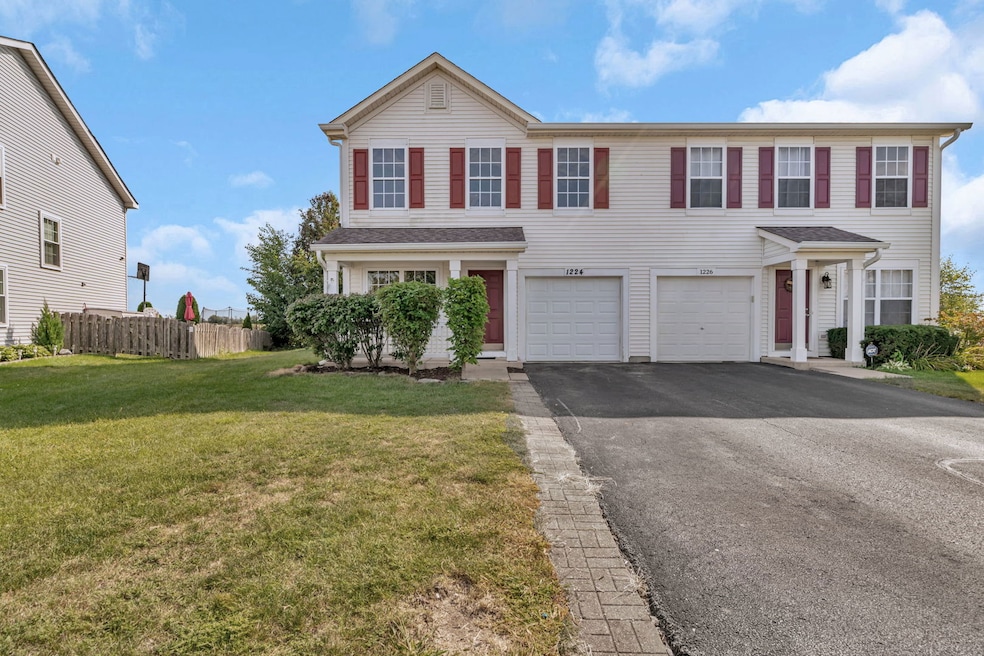
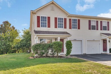
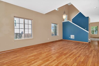


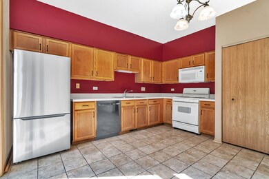
Welcome to this spacious 3-bedroom, 2.5-bath duplex - the largest model available! Featuring a newer roof (2017) and siding (2017), this home is move-in ready and loaded with value. Inside, you'll find a generous master suite with a private bath and oversized bedroom, plus two additional bedrooms that offer plenty of space. In addition, laundry is conveniently located on the second floor. The bright kitchen and open layout flow seamlessly into the living areas, making it perfect for entertaining or everyday living. Located in a highly desirable subdivision with a clubhouse and pool, this home is within walking distance to elementary schools, parks, ponds, and more! Don't wait - schedule your private showing today!
Last Agent to Sell the Property
Century 21 Coleman-Hornsby License #471022849 Listed on: 09/20/2025
| Date | Type | Sale Price | Title Company |
|---|---|---|---|
| Warranty Deed | $255,000 | Fidelity National Title | |
| Interfamily Deed Transfer | -- | None Available | |
| Deed | $154,500 | Fidelity National Title |
| Date | Status | Loan Amount | Loan Type |
|---|---|---|---|
| Previous Owner | $147,958 | FHA | |
| Previous Owner | $151,308 | FHA |
| Date | Event | Price | List to Sale | Price per Sq Ft |
|---|---|---|---|---|
| 10/09/2025 10/09/25 | Sold | $255,000 | -3.8% | $150 / Sq Ft |
| 09/25/2025 09/25/25 | Pending | -- | -- | -- |
| 09/20/2025 09/20/25 | For Sale | $265,000 | -- | $156 / Sq Ft |
| Year | Tax Paid | Tax Assessment Tax Assessment Total Assessment is a certain percentage of the fair market value that is determined by local assessors to be the total taxable value of land and additions on the property. | Land | Improvement |
|---|---|---|---|---|
| 2024 | $5,144 | $64,131 | $8,184 | $55,947 |
| 2023 | $4,689 | $58,455 | $7,460 | $50,995 |
| 2022 | $3,878 | $54,351 | $6,936 | $47,415 |
| 2021 | $3,702 | $51,450 | $6,566 | $44,884 |
| 2020 | $3,602 | $49,217 | $6,281 | $42,936 |
| 2019 | $3,384 | $45,572 | $5,816 | $39,756 |
| 2018 | $3,339 | $44,104 | $5,751 | $38,353 |
| 2017 | $3,231 | $42,116 | $5,492 | $36,624 |
| 2016 | $3,003 | $39,534 | $5,155 | $34,379 |
| 2015 | $2,829 | $35,937 | $4,686 | $31,251 |
| 2014 | $2,864 | $40,642 | $5,575 | $35,067 |
| 2013 | $3,448 | $41,190 | $5,650 | $35,540 |
Seller's Agent in 2025
Tom Wawczak
Century 21 Coleman-Hornsby
(815) 735-2868
286 Total Sales
Seller Co-Listing Agent in 2025
Kelly Pina
Century 21 Coleman-Hornsby
(815) 823-6147
24 Total Sales
Buyer's Agent in 2025
Gilda Eboli-Hayden
Goggin Real Estate LLC
(815) 603-1774
60 Total Sales
Source: Midwest Real Estate Data (MRED)
MLS Number: 12472149
APN: 03-14-103-043
Disclaimer: Certain information contained herein is derived from information provided by parties other than Homes.com. All information provided is deemed reliable, but is not guaranteed to be accurate and should be independently verified.
![]() Based on information submitted to the MLS GRID. All data is obtained from various sources and may not have been verified by broker or MLS GRID. Supplied Open House Information is subject to change without notice. All information should be independently reviewed and verified for accuracy. Properties may or may not be listed by the office/agent presenting the information. Some IDX listings have been excluded from this website.
Based on information submitted to the MLS GRID. All data is obtained from various sources and may not have been verified by broker or MLS GRID. Supplied Open House Information is subject to change without notice. All information should be independently reviewed and verified for accuracy. Properties may or may not be listed by the office/agent presenting the information. Some IDX listings have been excluded from this website.
Based on information submitted to the MLS GRID
Ask me questions while you tour the home.