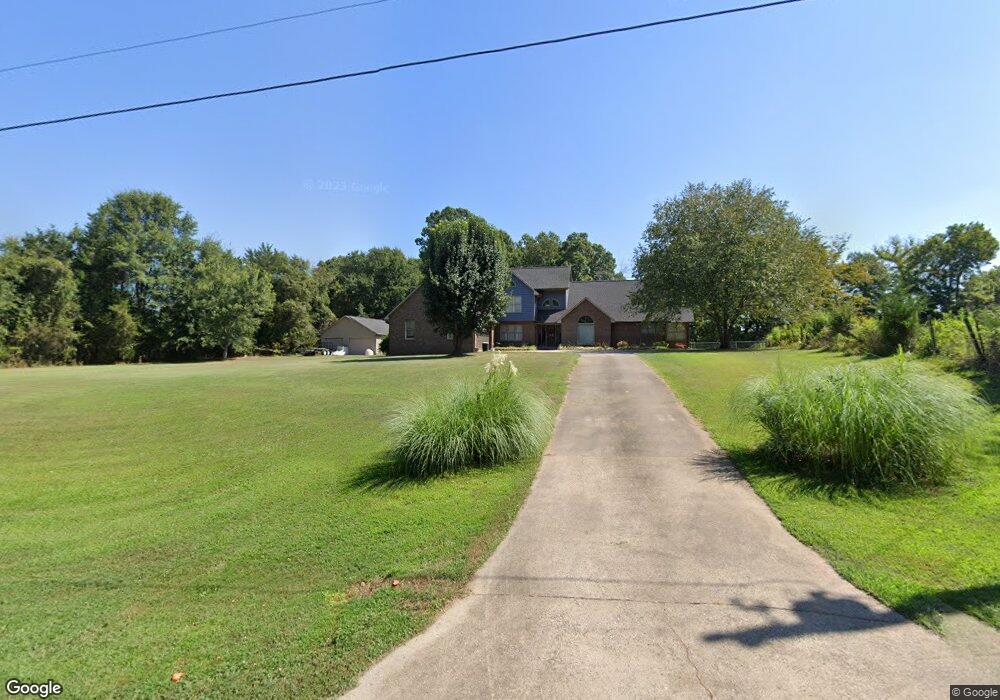
1224 Davis Rd Lincolnton, NC 28092
Estimated Value: $575,000 - $791,000
3
Beds
4
Baths
3,431
Sq Ft
$190/Sq Ft
Est. Value
About This Home
This home is located at 1224 Davis Rd, Lincolnton, NC 28092 and is currently estimated at $651,122, approximately $189 per square foot. 1224 Davis Rd is a home located in Lincoln County with nearby schools including Norris S. Childers Elementary School, West Lincoln Middle, and West Lincoln High School.
Ownership History
Date
Name
Owned For
Owner Type
Purchase Details
Closed on
Sep 30, 2021
Sold by
Mccorkle Robert Dennis and Mccorkle Paula Morrison
Bought by
Mccorkle Robert Dennis and Mccorkle Paula Morrison
Current Estimated Value
Purchase Details
Closed on
Jan 30, 2015
Sold by
Mccorkle Robert Dennis and Mccorkle Paula M
Bought by
Mccorkle Robert Dennis
Create a Home Valuation Report for This Property
The Home Valuation Report is an in-depth analysis detailing your home's value as well as a comparison with similar homes in the area
Home Values in the Area
Average Home Value in this Area
Purchase History
| Date | Buyer | Sale Price | Title Company |
|---|---|---|---|
| Mccorkle Robert Dennis | -- | None Available | |
| Mccorkle Robert Dennis | -- | None Available | |
| Reynolds Mary Ross | -- | None Available |
Source: Public Records
Tax History Compared to Growth
Tax History
| Year | Tax Paid | Tax Assessment Tax Assessment Total Assessment is a certain percentage of the fair market value that is determined by local assessors to be the total taxable value of land and additions on the property. | Land | Improvement |
|---|---|---|---|---|
| 2025 | $3,916 | $595,049 | $30,564 | $564,485 |
| 2024 | $3,896 | $595,049 | $30,564 | $564,485 |
| 2023 | $3,891 | $595,049 | $30,564 | $564,485 |
| 2022 | $2,501 | $316,249 | $24,851 | $291,398 |
| 2021 | $2,501 | $316,249 | $24,851 | $291,398 |
| 2020 | $2,323 | $316,249 | $24,851 | $291,398 |
| 2019 | $2,323 | $316,249 | $24,851 | $291,398 |
| 2018 | $2,035 | $263,761 | $23,173 | $240,588 |
| 2017 | $1,934 | $263,761 | $23,173 | $240,588 |
| 2016 | $1,934 | $263,761 | $23,173 | $240,588 |
| 2015 | $1,843 | $0 | $0 | $226,247 |
| 2014 | $2,200 | $301,232 | $20,749 | $280,483 |
Source: Public Records
Map
Nearby Homes
- 0 N Carolina 182 Unit CAR4246688
- 1070 N Carolina 182
- 1338 Pell Dr
- 743 Lore Rd
- 536 Lincolnview Rd
- 1231 Better Brook Ln
- 000 Better Brook Ln
- 668 Riverside Dr
- 524 Bonview Ave
- #168 Rolling Rd
- 000 Blossom Hill Rd Unit 138
- 801 N Grove St
- 502 Forney Ave
- 217 Blossom Hill Rd
- 515 Willow St
- 411 W Sycamore St
- 627 W Main St
- 327 Bonview Ave
- 697 S Grove St
- 689 S Grove St
- 1515 Midtown Dr
- 1507 Midtown Dr
- 1507 Midtown Dr Unit 10
- 1170 Davis Rd
- 1244 Davis Rd
- 1261 Davis Rd
- 178 Bob Burgin Rd
- 380 Viewmont Rd
- 1282 Davis Rd
- 1289 Davis Rd
- 11 acres Bob Burgin Rd
- 1303 Davis Rd
- 1304 Davis Rd
- 1290 Davis Rd
- 1329 Davis Rd
- 198 Bob Burgin Rd
- 1339 Davis Rd
- 1086 Davis Rd
- 242 Bob Burgin Rd
- 1353 Davis Rd