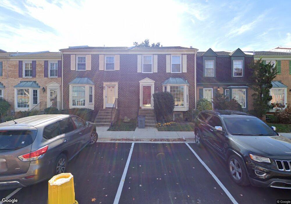
1225 Brunswick Ct Unit 83 Arnold, MD 21012
Estimated Value: $447,669 - $461,000
3
Beds
4
Baths
1,454
Sq Ft
$312/Sq Ft
Est. Value
About This Home
This home is located at 1225 Brunswick Ct Unit 83, Arnold, MD 21012 and is currently estimated at $453,167, approximately $311 per square foot. 1225 Brunswick Ct Unit 83 is a home located in Anne Arundel County with nearby schools including Broadneck Elementary School, Magothy River Middle School, and Broadneck High School.
Ownership History
Date
Name
Owned For
Owner Type
Purchase Details
Closed on
Jul 22, 2024
Sold by
Roop William and Roop Kathleen
Bought by
Harpoon Md-1225 Llc
Current Estimated Value
Purchase Details
Closed on
Mar 5, 2021
Sold by
Roop William
Bought by
Roop William and Roop Kathleen
Purchase Details
Closed on
Apr 6, 2020
Sold by
Hadsell Amy Swan
Bought by
Roop William
Purchase Details
Closed on
Aug 1, 2006
Sold by
Marshall Frank B
Bought by
Hadsell Amy S
Purchase Details
Closed on
Jul 17, 2006
Sold by
Marshall Frank B
Bought by
Hadsell Amy S
Purchase Details
Closed on
Sep 29, 1987
Sold by
Ross John J
Bought by
Marshall Frank B
Create a Home Valuation Report for This Property
The Home Valuation Report is an in-depth analysis detailing your home's value as well as a comparison with similar homes in the area
Home Values in the Area
Average Home Value in this Area
Purchase History
| Date | Buyer | Sale Price | Title Company |
|---|---|---|---|
| Harpoon Md-1225 Llc | $420,000 | Cc Title | |
| Harpoon Md-1225 Llc | $420,000 | Cc Title | |
| Roop William | -- | Abode Settlement Group Llc | |
| Roop William | $248,500 | Mid Atlantic Setmnt Svcs Llc | |
| Hadsell Amy S | -- | -- | |
| Hadsell Amy S | -- | -- | |
| Marshall Frank B | $104,500 | -- |
Source: Public Records
Tax History Compared to Growth
Tax History
| Year | Tax Paid | Tax Assessment Tax Assessment Total Assessment is a certain percentage of the fair market value that is determined by local assessors to be the total taxable value of land and additions on the property. | Land | Improvement |
|---|---|---|---|---|
| 2025 | $3,888 | $349,033 | -- | -- |
| 2024 | $3,888 | $315,400 | $150,000 | $165,400 |
| 2023 | $3,391 | $310,533 | $0 | $0 |
| 2022 | $3,563 | $305,667 | $0 | $0 |
| 2021 | $3,512 | $300,800 | $150,000 | $150,800 |
| 2020 | $3,368 | $290,767 | $0 | $0 |
| 2019 | $3,265 | $280,733 | $0 | $0 |
| 2018 | $2,745 | $270,700 | $100,000 | $170,700 |
| 2017 | $2,959 | $263,233 | $0 | $0 |
| 2016 | -- | $255,767 | $0 | $0 |
| 2015 | -- | $248,300 | $0 | $0 |
| 2014 | -- | $248,300 | $0 | $0 |
Source: Public Records
Map
Nearby Homes
- 400 Colonial Ridge Ln
- 478 Bay Green Dr
- 349 Candle Ridge Ct
- 340 Candle Ridge Dr
- 618 Andrew Hill Rd
- 515 Bay Hills Dr
- 633 Andrew Hill Rd
- 1256 Crowell Ct
- 533 Bay Green Dr
- 537 Bay Green Dr
- 1512 Winterberry Dr
- 543 Bay Green Dr
- 1231 Summerwood Ct
- 553 Bay Green Dr
- 1553 Star Pine Dr
- 1217 Springwood Ct
- 1249 Birchcrest Ct
- 1180 Mosswood Ct
- 1583 Star Pine Dr
- 1116 Riverboat Ct
- 1225 Brunswick Ct
- 1223 Brunswick Ct
- 1227 Brunswick Ct
- 1221 Brunswick Ct
- 1229 Brunswick Ct
- 1217 Brunswick Ct
- 1219 Brunswick Ct
- 1231 Brunswick Ct
- 470 Colonial Ridge Ln
- 470 Colonial Ridge Ln Unit 93
- 468 Colonial Ridge Ln
- 466 Colonial Ridge Ln
- 472 Colonial Ridge Ln
- 464 Colonial Ridge Ln
- 462 Colonial Ridge Ln
- 462 Colonial Ridge Ln Unit 89
- 1213 Brunswick Ct Unit 78
- 460 Colonial Ridge Ln
- 1211 Brunswick Ct
- 1211 Brunswick Ct Unit 77