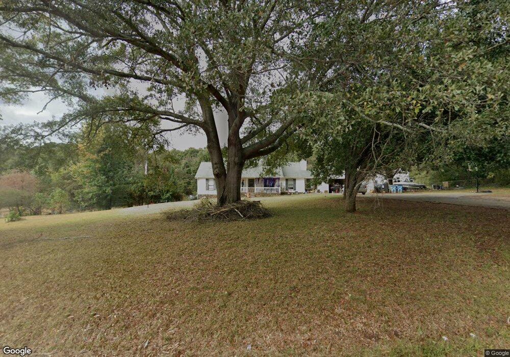
1225 Highway 138 E Stockbridge, GA 30281
Estimated Value: $275,692 - $306,000
3
Beds
2
Baths
1,716
Sq Ft
$171/Sq Ft
Est. Value
About This Home
This home is located at 1225 Highway 138 E, Stockbridge, GA 30281 and is currently estimated at $293,673, approximately $171 per square foot. 1225 Highway 138 E is a home located in Henry County with nearby schools including Woodland Elementary School, Woodland Middle School, and Woodland High School.
Ownership History
Date
Name
Owned For
Owner Type
Purchase Details
Closed on
Feb 3, 2012
Sold by
Secretary Of Housing And U
Bought by
Ali Mohammed
Current Estimated Value
Purchase Details
Closed on
Apr 5, 2011
Sold by
Everhome Mtg Co
Bought by
Hud-Housing Of Urban Dev
Purchase Details
Closed on
Apr 3, 2003
Sold by
Do Right Homebuilders Inc
Bought by
Dobbins Richard
Home Financials for this Owner
Home Financials are based on the most recent Mortgage that was taken out on this home.
Original Mortgage
$185,320
Interest Rate
8.2%
Mortgage Type
New Conventional
Create a Home Valuation Report for This Property
The Home Valuation Report is an in-depth analysis detailing your home's value as well as a comparison with similar homes in the area
Home Values in the Area
Average Home Value in this Area
Purchase History
| Date | Buyer | Sale Price | Title Company |
|---|---|---|---|
| Ali Mohammed | $55,000 | -- | |
| Hud-Housing Of Urban Dev | -- | -- | |
| Everbank | $210,809 | -- | |
| Dobbins Richard | -- | -- |
Source: Public Records
Mortgage History
| Date | Status | Borrower | Loan Amount |
|---|---|---|---|
| Previous Owner | Dobbins Richard | $185,320 |
Source: Public Records
Tax History Compared to Growth
Tax History
| Year | Tax Paid | Tax Assessment Tax Assessment Total Assessment is a certain percentage of the fair market value that is determined by local assessors to be the total taxable value of land and additions on the property. | Land | Improvement |
|---|---|---|---|---|
| 2025 | $5,096 | $127,908 | $12,000 | $115,908 |
| 2024 | $5,096 | $113,360 | $12,000 | $101,360 |
| 2023 | $4,083 | $105,400 | $12,000 | $93,400 |
| 2022 | $3,434 | $88,480 | $12,000 | $76,480 |
| 2021 | $2,845 | $73,120 | $10,800 | $62,320 |
| 2020 | $2,579 | $66,200 | $10,800 | $55,400 |
| 2019 | $2,435 | $62,440 | $10,800 | $51,640 |
| 2018 | $2,398 | $61,480 | $8,000 | $53,480 |
| 2016 | $1,935 | $49,400 | $7,200 | $42,200 |
| 2015 | -- | $43,600 | $7,200 | $36,400 |
| 2014 | $1,625 | $39,600 | $7,200 | $32,400 |
Source: Public Records
Map
Nearby Homes
- 100 Kim Trail
- 405 Tatum Terrace
- 1548 Harlequin Way
- 116 Way Point Dr
- 551 Hood Rd
- 1493 Harlequin Way
- 1009 Moseley Rd
- 1001 Moseley Rd
- 164 Mckenzie Ct
- 608 Mckenzie Cir
- 825 Bufflehead Ct
- 242 Summerford Place
- 564 Mckenzie Ave
- 0 Mckenzie Ave Unit 10593345
- 120 Montgomery Dr
- 104 Montgomery Dr
- 1720 Highway 138 E
- 0 W Hemphill Rd Unit 10295429
- 0 W Hemphill Rd Unit 10536232
- 2581 Union Church Rd SW
- 1225 Georgia 138
- 420 W Hemphill Rd
- 1245 Highway 138 E
- 1205 Highway 138 E
- 560 Aerial Ave
- 384 W Hemphill Rd Unit 1
- 384 W Hemphill Rd
- 97 Kim Trail
- 561 Aerial Ave Unit LOT 9
- 561 Aerial Ave
- 1181 Highway 138 E
- 105 Kim Trail
- 20 Lynn Ct
- 447 W Hemphill Rd
- 557 Aerial Ave Unit LOT 8
- 557 Aerial Ave
- 30 Lynn Ct
- 766 Aerial Ave
- 757 Aerial Ave
- 556 Ariel Ave Unit LOT 11