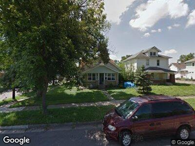
1225 Joe Nuxhall Blvd Hamilton, OH 45011
East Hamilton NeighborhoodEstimated Value: $112,455 - $134,000
4
Beds
1
Bath
1,478
Sq Ft
$85/Sq Ft
Est. Value
About This Home
This home is located at 1225 Joe Nuxhall Blvd, Hamilton, OH 45011 and is currently estimated at $125,364, approximately $84 per square foot. 1225 Joe Nuxhall Blvd is a home located in Butler County with nearby schools including Fairwood Elementary School, Garfield Middle School, and Hamilton Freshman School.
Ownership History
Date
Name
Owned For
Owner Type
Purchase Details
Closed on
Jan 16, 1998
Sold by
Emc Mortgage Corp
Bought by
Heichelbech Donald and Beers Mark
Current Estimated Value
Home Financials for this Owner
Home Financials are based on the most recent Mortgage that was taken out on this home.
Original Mortgage
$48,000
Interest Rate
7.24%
Mortgage Type
Purchase Money Mortgage
Purchase Details
Closed on
Oct 29, 1997
Sold by
Shrf Michael Sharp Pr
Bought by
Emc Mortgage Corp
Purchase Details
Closed on
May 1, 1989
Create a Home Valuation Report for This Property
The Home Valuation Report is an in-depth analysis detailing your home's value as well as a comparison with similar homes in the area
Home Values in the Area
Average Home Value in this Area
Purchase History
| Date | Buyer | Sale Price | Title Company |
|---|---|---|---|
| Heichelbech Donald | $47,000 | -- | |
| Emc Mortgage Corp | $40,000 | -- | |
| -- | $35,000 | -- |
Source: Public Records
Mortgage History
| Date | Status | Borrower | Loan Amount |
|---|---|---|---|
| Closed | Heichelbech Donald | $48,000 |
Source: Public Records
Tax History Compared to Growth
Tax History
| Year | Tax Paid | Tax Assessment Tax Assessment Total Assessment is a certain percentage of the fair market value that is determined by local assessors to be the total taxable value of land and additions on the property. | Land | Improvement |
|---|---|---|---|---|
| 2024 | $1,250 | $25,130 | $3,690 | $21,440 |
| 2023 | $1,192 | $25,130 | $3,690 | $21,440 |
| 2022 | $1,160 | $20,530 | $3,690 | $16,840 |
| 2021 | $1,029 | $19,810 | $3,690 | $16,120 |
| 2020 | $1,067 | $19,810 | $3,690 | $16,120 |
| 2019 | $1,203 | $16,430 | $3,670 | $12,760 |
| 2018 | $893 | $16,430 | $3,670 | $12,760 |
| 2017 | $900 | $16,430 | $3,670 | $12,760 |
| 2016 | $933 | $16,310 | $3,670 | $12,640 |
| 2015 | $821 | $16,310 | $3,670 | $12,640 |
| 2014 | $925 | $16,310 | $3,670 | $12,640 |
| 2013 | $925 | $17,290 | $3,670 | $13,620 |
Source: Public Records
Map
Nearby Homes
- 1216 Vine St
- 555 Linn St
- 1161 Heaton St
- 1798 Fairgrove Ave
- 324 N 9th St
- 1718 Greenwood Ave
- 308 N 9th St
- 307 N 8th St
- 416 N 3rd St
- 390 Campbell Dr
- 3879 Piper Ln Unit D
- 3883 Piper Ln
- 1213 Vanderveer Ave
- 113 Starr Ave
- 919 Summer St
- 1311 Vanderveer Ave
- 2308 Mossy Grove
- 220 S 13th St
- 5014 S Castle Ct
- 413 N C St